- Home
- Project Apri sottomenù
- UPLAND ARCHAEOLOGY WORKSHOP Apri sottomenù
-
Abstracts
Apri sottomenù
- Wieke de Neef (Ghent University / Otto-Friedrich University Bamberg)
- Francesco Carrer (School of History, Classics and Archaeology, Newcastle University (UK))
- Umberto Tecchiati (University of Milan)
- Tesse Stek (KNIR - Royal Netherlands Institute in Rome)
- Riccardo Rao (University of Bergamo)
- Fabio Saggioro, Nicola Mancassola (University of Verona)
- Roberto Maggi, LASA (Laboratorio di Archeologia e Storia Ambientale), University of Genova
- Andrea Cardarelli, Andrea Conte (University of Rome "La Sapienza")
- Federico Zoni (University of Bergamo)
-
Short presentations
Apri sottomenù
- SHORT PRESENTATIONS PROGRAMME
- Putzolu et al., The 2nd Millennium BC in the northern Apennines
- Giorgi et al., New insights into the upland landscape of ancient Epirus, Southern Albania
- Carra, Subsistence economy in the Bronze Age in the northern Apennines upland
- Gaucci et al., Mapping mobility in the Apennines: The Reno Valley between the 6th-4th century BCE and the contemporary period
- Cirelli et al., Insediamenti di altura nell’Appennino Romagnolo e Toscano nel medioevo
- Betori et al., Amatrice: da castello a città
- Del Fattore, Upland landscapes and settlements strategies in the Central-Southern Apennines (1000 BC-2023 AD)
- Conversi et al., The site of Albareto cà Nova
- Bottazzi et al., Attorno al Monte Titano (739 m s.l.m.). Ricerche archeologiche e paleoambientali in Repubblica di San Marino
- Conversi et al., Il sito tardoatico – medievale d’altura della Piana di S. Martino , Pianello Val Tidone (PC)
- Cortesi et al., Archeologia dei paesaggi in una vallata appenninica: il progetto “Val Fantella” (Premilcuore, FC)
- Barbariol, Farms abandonment in Iceland
- Garattoni, Doss Penede (Nago, TN): progettare e costruire un insediamento minore nell’Alto Garda in epoca romana
- Santandrea, Detecting and Mapping Hilltop Sites between the Cesano, Misa, and Nevola River-Valleys
- Bonazzi et al., “Media Valle del Cedrino”: a region between uplands and plateaus
- Zanotti, Back to Monte della Croce
- Monticone et al., Un approccio di archeologia museale al ri-studio del sito neolitico di Chiomonte-La Maddalena (Piemonte, Italia). Revisione ed aggiornamento dei dati dal 1988 al 2023.
- Facciani et al., Exploring the funerary landscape of the Samarkand piedmont area
- Kaur and Poddar, Colonial Churches of Shimla: Public Archaeology as a Tool for Engagement and Outreach
- Datta, Upland Buddhist Monastic Complexes and the Pala Kingdom: Reviewing the Highland-Lowland Relationships in Ancient Bengal
- Staff
- Contacts
- Events calendar
- Seminars Apri sottomenù
- NEWS Apri sottomenù
Giorgi et al., New insights into the upland landscape of ancient Epirus, Southern Albania
Enrico Giorgi, Federica Carbotti, Veronica Castignani, Giacomo Sigismondo
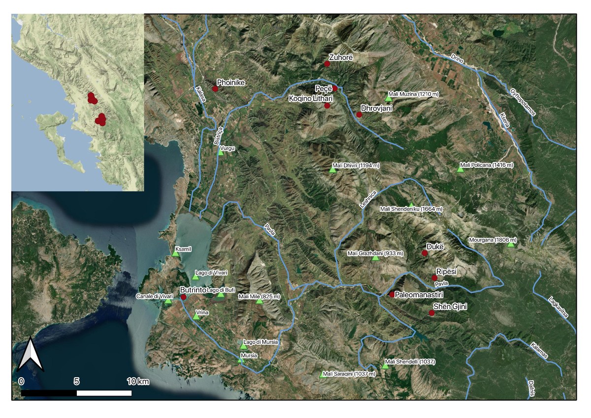
Figure 1. Sites mentioned in the text
The new research in Southern Albania, led by the University of Bologna and the Albanian
Institute of Archaeology as a part of the Butrint Project, has resumed the study of Albanian
landscape in the areas around the sites of Butrint and Phoinike, in ancient Chaonia. After
almost 20 years from the SITARC Project[1], the current and ongoing field surveys of the
Butrint Project are focused on the Region of Vlorë, mainly in the Municipalities of Sarandë
along the coast, Finiqi further inland and Konispoli close to the Greek administrative border.
The aim of the research is a new reading of ancient landscape in a diachronic perspective and
through interpretative approaches to properly define settlement patterns, land use and
economic structure of the region in ancient times.
Geographical context
Ancient Epirus, comprised between the Acroceraunian mountains to the North, the Pindus
range to the East and the Ambracian gulf to the South, has a predominantly mountainous
morphology characterised by high rocky ridges subparallel to the coastline and divided by
narrow valleys, which have conditioned communication routes, settlement patterns, and the
management and exploitation of resources. Valleys are incised by perennial rivers and
seasonal streams which facilitate connections between landing places, coastal floodplains and
inland mountainous regions. Upland settlement became preferential since the main
hydrographic basins rarely form large alluvial plains and these latter are often subjected to
swamping phenomena[2]. Mountain morphology in ancient Epirus has different appearances
depending on orogeny and surface processes. As a result, the southernmost part of the Vlorë
Region displays both rugged rocky reliefs rising steeply from narrow valleys, as in the upper
and middle Pavllë River valley, and hilly landscapes of lower elevation and more gradual
slope, as along the Ksamil peninsula. In a high mountain environment, ancient sites are often
located on summit paleosurfaces, on narrow hillside plateaus or directly on a steep spur of
rock. In a hilly and piedmont environment, sites are placed on modest summit or hillside
plateaus, or on river terraces closer to the valley floor. The mountain and hill slopes are often
characterised by large areas of pastureland and forest cover.
As a consequence, ancient Epirus was characterised mainly by a mixed agro-pastoral
economy, which exploited valleys for agriculture and required mobility, albeit over short
distances, for livestock grazing in mountain pastures. This implies not only the exploitation
of animal-derived secondary products but of uncultivated landscape resources as well, which
often were essential for the production of those same derived products. Timber harvesting,
rock salt exploitation, resources gathered in coastal marshland, mining activities, they all
become pull factors in defining transhumance routes and economic exploitation of the
territory, as well as, consequently, for settlement choice and territorial organisation as a
whole.
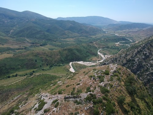
Figura 2. Paleomanastiri (Karroqi, Finiqi)
The Butrint Project: methodological issues and new approaches
The Butrint Project research has focused particularly on the so-called fortified storehouses
and farmsteads and some of the fortified hilltop sites in the Bistricë and Pavllë rivers valleys.
In ancient times, these regions represented natural access to the Delvinë district, the Vurgu
plain and the coastal area around Butrint, as well as a borderland between coastal Chaonia
and the inland regions inhabited by Thesprotes and Molossi. The Project intends to update the
topographic documentation, integrate archaeological data, and make new considerations on
these sites and surrounding landscape from a diachronic perspective. A geo-database in a GIS
platform was created in order to obtain a multi-thematic basemap useful to collect, visualise,
manage, and integrate the documentation available from the Albanian ASIG Geoportal, from
IGMI topographic map, historical aerial photography provided by IGMI and RAF flights, and
dataset from the newest fieldworks.
Peculiarities of mountain environment, which comprises uneven surfaces at high altitudes,
narrow and deep valley incisions, generally steep slopes, imply natural factors that affect
preservation and visibility on the ground of the archaeological record. Intensive erosion due
to atmospheric agents and a relatively scarce vegetation coverage increase the probability that
archaeological deposits are subjected to processes of dispersion and scattering of artefacts,
which even when collected only yield generic chronological indications[3]. These practical
problems are compounded by difficulties in the interpretation of the surveyed sites, unknown
in literary and epigraphic sources and whose dating is rarely provided even when
stratigraphically investigated. In addition, in many cases circuit walls were erected directly on
the natural bedrock, so the possibility of finding material related to the foundation moment is
rare, and chronological sequences based on stylistic comparisons with other Epirote
fortifications may not be very fruitful either[4].
Thus, reconstructing ancient occupation patterns is challenging and a combined approach is
required. Targeted fieldwalking and topographical survey using terrestrial and drone
photogrammetric survey, laser scanning recording and GNSS instruments are used according
to the specifics of each site. Dataset is combined with geological and land-use maps, as well
as with information on the exploitation of upland and marshlands available from historical
and ethnographic sources. The aim is to correctly interpret them in relation to their
topographical and historical background and assess how dynamics and forms of settlement
and resource exploitation have interacted with each other over time.
The sites of Zuhorë, Peçë, Koqino Lithari and Dhrovjani (Finiqi) are located near the Muzinë
pass, a natural communication route between the Delvinë district and the Drino valley. They
are known from literature for rubble wall circuits which could be possibly dated around the
late Bronze Age and early Iron Age and for Late Antique and Medieval phases of
frequentation. Our survey on the hill of Dhrovjani located modern structures and detected
part of the circuit in rubble wall, however materials collected during fieldwalking were few
and inconclusive for dating its occupation. Beyond the chronological framework, the location
of these sites speaks for a longer occupation in time given the importance of the control of
this crossing point, which gave inland communities access to coastplains. The relevance of
the Bistriçë valley in the mobility of livestock and people could also be linked to the
exploitation of the extensive rock salt mines in Dhrovjani, as salt plays a key role in the dairy
process and as a constituent of livestock diet. If we also consider the coverage of forest and
natural grassland, which is still visible today, and the presence of natural springs and shelters
along the slopes of Mali i Gjerë, hilltop sites in the Bistriçë valley could have also served as
places for the shelter of livestock and production and exploitation of their secondary
products.
Fieldworks faced some practical issues related to the morphology of the upland landscape, as
intensive fieldwalking strategies cannot be implemented for most hilltop sites. Shën Gjini and
Paleomanastiri (Karroqi, Finiqi) are located on hardly accessible spurs of rocks or on high
rocky plateaus, which prevented us from surveying the whole wall circuit on foot or
identifying clear features of rooms and terrace walls on the ground. The aerial view provided
by drone survey is helpful in this sense, and in the case of Ripësi (Zmineci, Finiqi) we were
able to entirely document the wall circuit not otherwise visible. However, except during the
end-summer dry season, the areas of interest are particularly overgrown and the ground
visibility is low in any case: a survey was carried out in Dukë (Zmineci, Finiqi) in two
different moments of the year, but the dense shrub coverage prevented the detection of further
structures and surface collection. The lack of archaeological material is closely related to the
morphology of the sites, as they are located on plateaus where soil deposit is extremely
limited, thus ceramic materials were often washed down the slopes and barely preserved on
the ground. Despite the absence of reliable archaeological data, the construction of these
fortified hilltop sites can be dated to the Hellenistic period mainly on historical and
topographical considerations. They lay along the Pavllë River valley, a border region between
Chaonia and the inland Epirus of Molossians. The arrangement of a strategic network, in
which every fortification is a node visually interacting with others to efficiently control the
access to Chaonia, presupposes a central organisation that between the 3rd and 2nd century
BC could have been held only by Phoinike, which had just broke her alliance with
Macedonians and Molossians. It is in this framework that this fortification network was
established for the control of the border, as well as possibly the management of pastureland
and livestock moving. Mali Grazdhani, where the sites are located, is still dominated by
grassland, scrub and woodland all representing useful natural resources to be exploited for
livestock grazing, which could also be provided with freshwater thanks to natural springs
near each of the sites mentioned.
Albeit at a still preliminary stage, this integrated approach between topographic and
fieldwalking survey, analysis of land resources and communication routes has proven to be
effective for the study of fortified sites in the Epirote uplands. Future research aims to further
develop new strategies of survey that can adapt to these problematic contexts and to bring to
light new considerations about their exploitation and establishment on a diachronic
perspective.
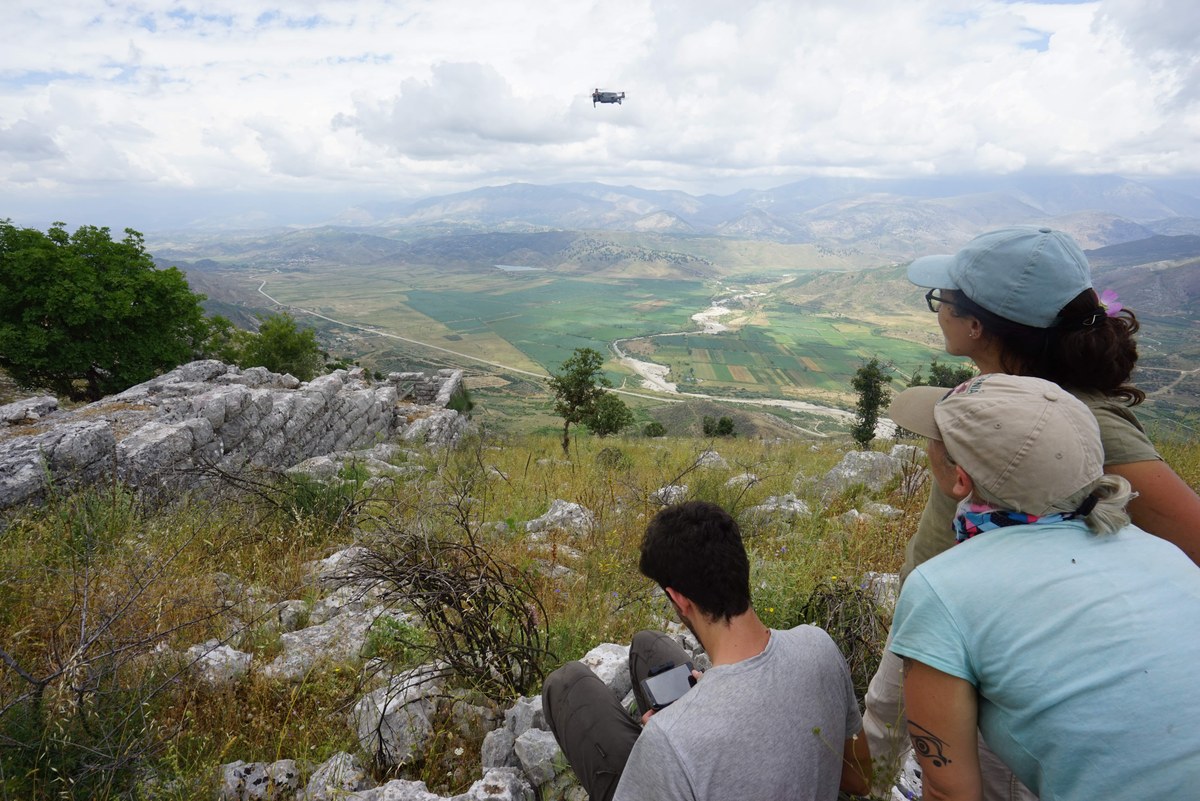
Figure 3. Drone survey during fieldwork in Vagalati (Finiqi)
[1] E. Giorgi, J. Bogdani, Il territorio di Phoinike in Caonia. Archeologia del paesaggio in Albania
meridionale, Bologna, 2012.
[2] Giorgi 2022, p. 461 (E. Giorgi, Another Greece. The population of northern Epirus and the genesis
of Butrint in the Archaic period in R. Brancato, L.M. Caliò, M. Figuera, G.M. Gerogiannis, E.
Pappalardo, S. Todaro (a cura di), Schemata. La città oltre la forma. Per una nuova definizione dei
paesaggi urbani e delle loro funzioni: urbanizzazione e società nel Mediterraneo pre-classico, Roma,
2022, pp. 461-485).
[3] Angelucci, Anesin 2012, p. 12. (D.E. Angelucci, D. Anesin, Sedimenti e suoli, natura e cultura.
Considerazioni geoarcheologiche sulla genesi delle stratificazioni archeologiche in ambiente
montano, in G.P. Brogiolo, A. Colecchia, D.E. Angelucci, F. Remondino (a cura di), APSAT 1. Teoria
e metodi della ricerca sui paesaggi d'altura, Mantova, 2012, pp. 11-25).
[4] Angelucci, Anesin 2012, pp. 18-21.
[5] Müth, Sokolicek, Jansen, Laufer 2016, p. 5 e pp. 10-19 (S. Müth, A. Sokolicek, B. Jansen, E.
Laufer, Methods of Interpretation, in S. Müth, P.I. Schneider, M. Schnelle, P.D. De Staebler (eds.),
Fokus Fortifikation Studies: Volume 1. Ancient Fortifications. A Compendium of Theory and Practice,
Oxford-Philadephia, 2016, pp. 1-23).