WATERSCAPE
As in many other semi-arid regions of the world, the existence and persistence of the Samarkand oasis have always depended on the control and distribution of water. Since antiquity, local communities have engineered and maintained complex irrigation systems to transform the arid landscape into a fertile zone of settlement and cultivation.
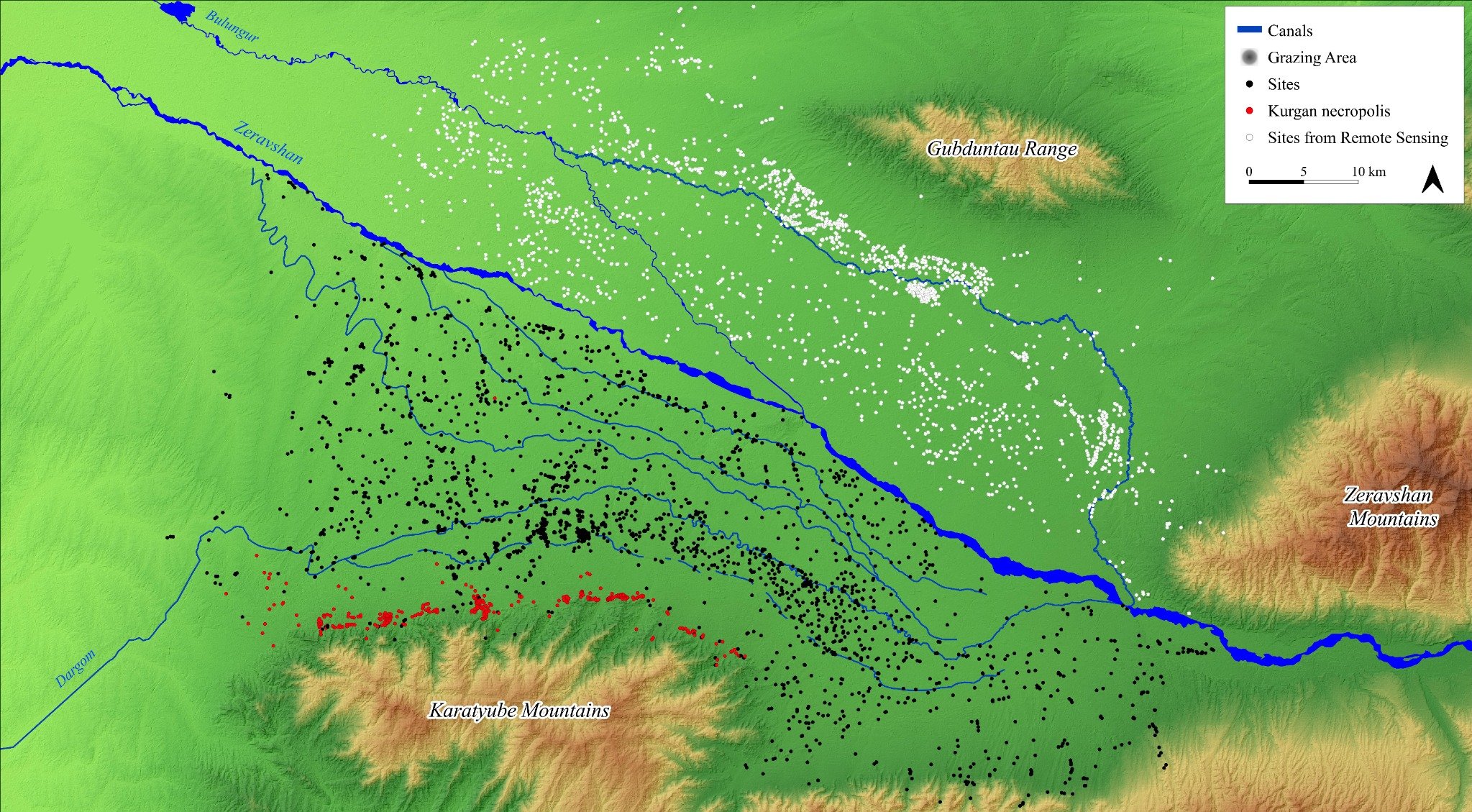
Two of the most significant artificial canals—the Dargom to the south and the Bulungur to the north—are diverted from the Zeravshan River. Together, they form a vast hydrological network that channels water across cities, rural settlements, and agricultural lands (© UIAP, basemap LANDSAT TM satellite image 1991).
This engineered waterscape is the result of centuries of collective effort and adaptation. It not only supported intensive farming and urban life, but also shaped patterns of movement, territorial organization, and political control across the region.
Uzbek version
Suv manzarasi
Dunyoning boshqa yarim-qurg‘oqchil hududlarida bo‘lgani kabi, Samarqand vohasining mavjudligi ham qadim zamonlardan beri suv resurslarini boshqarishga to’liq bog‘liq bo‘lgan. Janubda Darg‘om va shimolda Bulung‘ur kabi sun’iy kanallar Zarafshon daryosidan yo‘naltirilgan bo‘lib, ular shaharlar, qishloqlar va aholi manzillarini suv bilan ta’minlovchi murakkab sug‘orish tizimini hosil qiladi.
(© UIAP, negiz xarita: LANDSAT TM sun’iy yo‘ldosh tasviri, 1991)
Russian version
Водный ландшафт
Как и во многих других полузасушливых регионах мира, существование Самаркандского оазиса с древнейших времён было неразрывно связано с управлением водными ресурсами. Искусственные каналы, такие как Даргом на юге и Булунгур на севере, отводятся от Зеравшана и формируют сложную ирригационную сеть, снабжающую водой города, сёла и поселения.
(© UIAP, базовая карта: спутниковый снимок LANDSAT TM, 1991)
Waterscape