ARCHAELOGICAL MAP
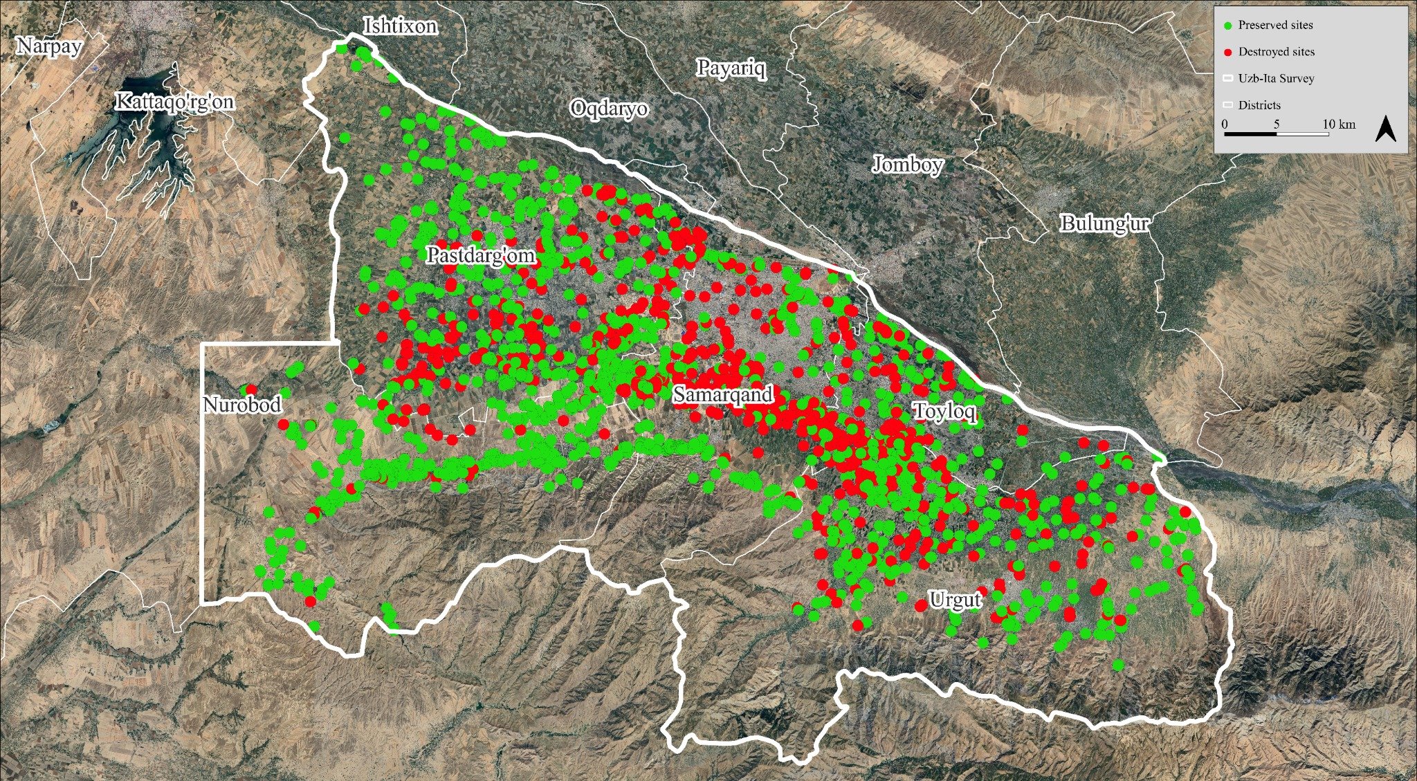
The Samarkand oasis is one of Central Asia’s most archaeologically rich regions. Thousands of traces—settlements, tombs, irrigation canals—have been recorded through historical satellite images, aerial photos, and Soviet-era topographic maps.
These tools, combined with intensive fieldwork, reveal not only the depth of past human activity, but also the scale of its loss. It is estimated that up to 40% of the known archaeological record has been destroyed, mainly due to urban expansion, agricultural intensification, and landscape modifications since the Soviet period.
This evolving map of presence and erasure highlights the urgency of documentation and preservation, as each surviving trace contributes to our understanding of the region’s complex past.
Uzbek version
Arxeologik xarita
Tarixiy sun’iy yo‘ldosh tasvirlari, havo suratlari va tarixiy topografik xaritalar Samarqand vohasida minglab arxeologik yodgorliklarni qayd etgan. So‘nggi yillarda olib borilgan intensiv dala tadqiqotlari shuni ko‘rsatadiki, arxeologik merosning taxminan 40 foizi shaharsozlik va qishloq xo‘jaligi hududlarining kengayishi natijasida yo‘qolgan.
Russian version
Археологическая карта
Исторические спутниковые снимки, аэрофотосъёмки и топографические карты зафиксировали тысячи археологических объектов на территории Самаркандского оазиса. Согласно результатам интенсивных полевых исследований, предполагается, что до 40% археологического наследия было утрачено в результате урбанизации и расширения сельскохозяйственных площадей.
Archaeological map