Fourth Activity
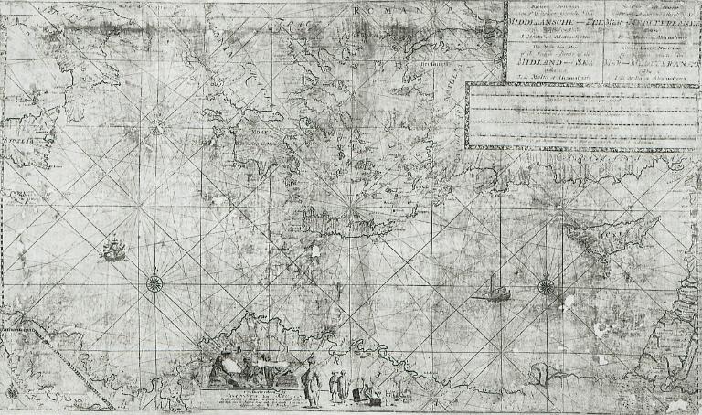
This reflection is inspired by a map from the cartographic collection at the Palazzo Poggi Museum in Bologna. Specifically, we will start from the maps of the Flemish school, which, around the 1600s to 1700s, represent the first attempts to map the known globe through cartographic and nautical projection techniques. The discussion focuses on the Mediterranean Sea as a crossroads between two continents that have historically maintained close diplomatic, commercial, and cultural relations – relationships that underwent radical changes during this period, coinciding with the dawn of European colonialism in Africa and the peak of the transatlantic slave trade. Starting from how the so-called "cartographic reason" (Farinelli, 2009) transforms our way of relating to the Other, the reflection aims to unfold up to the contemporary era, characterized by new connections and flows that continue to be conditioned by cartographic imaginaries and frameworks that originated in the modern era.
Together we will discover the Nautical Chart of the Mediterranean Part Two: Eastern. Amsterdam, early 18th century (cm 70 x 111.5) Authors: Joannes Van Keulen – Gerard Van Keulen (17th-18th centuries)
Who it’s for (or Intended for):
The journey is designed preferably for high school students, but can also be tailored for primary or lower secondary school students, adjusting the themes and discussions accordingly. The museum space allows for the visit of one class at a time.
Lecturers:
Professor Karin Pallaver
Professor Timothy Raeymaeker