Fifth Activity
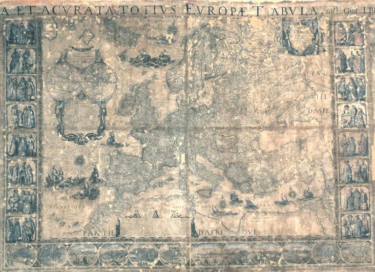
The reflection begins with some maps from the cartographic collection of the Palazzo Poggi Museum, specifically considering the geographical map Nova et acurata totius Europae tabula by W.J. Blaeu, Amsterdam 1562 (engraving Bologna, 1677-80).
Through this map, the aim is to show the persistence and power of toponymy in conveying a specific cultural dimension and in determining the geography and belonging of the lands represented. Contrary to common belief, in many cases, Latin/Italian toponymy was used at the time even where there was no significant presence of Italian speakers.
Later, with the national movements of the second half of the 19th century, toponymy – like all naming – becomes increasingly a manifestation of the prevalence of this or that Nation, as well as of national claims towards those border territories that for centuries had represented points of contact between different cultures and languages, now in contrast with the idea – typical of the nation-state – of linear borders between internally homogeneous regions. The Adriatic space is a significant example of this process.
Who It's For (or Intended for):
Given the themes addressed, the journey is designed for high school students. The limited space of the museum is suitable for the visit of a single class of students.
Lecturers:
Matteo Proto: Associate Professor of Geography
Mattia Vitelli Casella: RTD-A Roman History
