2026
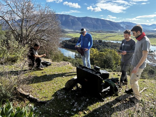
Between 08 and 11 February 2026 and in collaboration with the Landscape Archaeology and Remote Sensing Lab (LAP&T) of the University of Siena, the team of the Butrint Project completed the UAV LiDAR survey in the area of the archaeological park of Butrint and on the southern end of the Ksamil peninsula.
The following areas were interested by the UAV LiDAR survey:
- Archaeological Park of Butrint.
- Isthmus connecting the Archaeological Park of Butrint to the Ksamil peninsula.
- Slopes and shores of Mount Sotira and Mount Kepin.
- Alinura bay.
- Vrina plain, in correspondence with the area interested by the Butrint Foundation excavation and the remains of the possible amphitheatre.
- Archaeological site of Kalivo.
- Archaeological site of Pallavraq (Ksamil peninsula).
The preliminary post-processing of the datasets has already highlighted the significant potential that this survey methodology can offer for the archaeological park and enabled the production of a very high-resolution digital elevation model (DEM), free from forest canopy, thus allowing a precise analysis of the positioning of ancient structures and park facilities. This also made it possible to carry out an initial ground verification of some anomalies identified in the DEM, which will be completed in the following months and during the annual September campaign.