2022

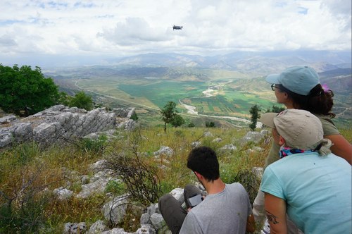
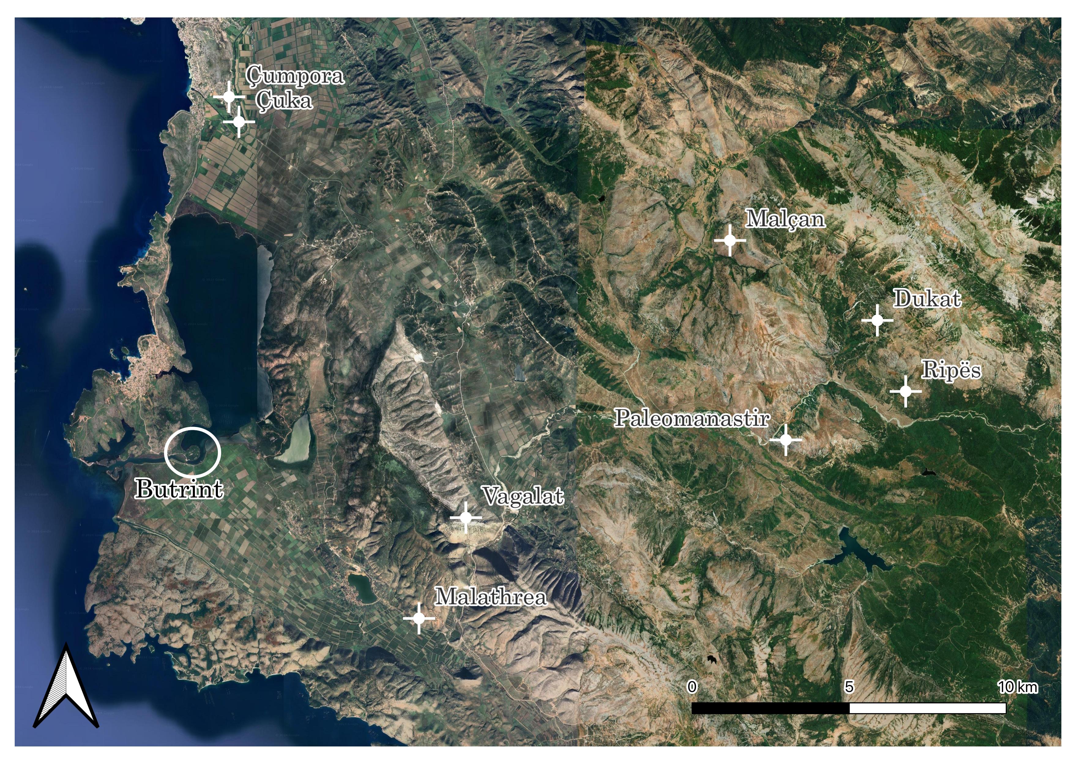
From 3/06 to 15/06/2022 the team of the Butrint Project was involved in the first new survey campaign exploring some of the mains sites of the Pavla River Valley after ten years from the publication of the last big archaeological survey of Southern Albania by E. Giorgi and J. Bogdani. The site surveyed are the following:
Malathrea: fortified farmhouse located on the road going from Konispol to Butrint, and first excavated by Luigi Maria Ugolini and Pirro Marconi. It is formed by a central structure with four angular towers and a series of rooms built around the central body, probably used as storage rooms. Its chronology goes from the second half of the 3rd century BC up to the Diocletian age. Malathrea and its surroundings were systematically surveyed by the Butrint Project team, both by intensive fieldwalking survey and by drone.
Çuka: fortified farmhouse inside the modern residential area of Çuka, near Saranda. Due to the expansion of the modern settlement, the building is badly preserved: just three of the four sides of the building with the central tower are still visible. It can probably be dated to the Hellenistic age. The team surveyed the site by drone.
Çumpora: another fortified farmhouse, located north of Çuka, first built during the second half of the 3rd century BC and occupied until the Roman age. It was excavated for the first time by Dh. Budina. The main building is almost completely preserved: a stone stair and two passages covered with lintels are still in place. Around this, the structure that could have enclosed the complex on the south-west and south-east sides disappeared, while only the foundations of the later rooms on the north-west and north-east sides are still visible. The site was involved both in the drone survey and in the topographic survey using the laser scanning methodology.
Malçani: fortified settlement located south-west of the modern village of Malçani. Its most prominent features are the two wall circuits encircling the hill along the east and south side. The outer Hellenistic wall circuit is characterised by 15 rectangular, equally spaced towers. The inner circuit, probably built during Late Antiquity, encloses the summit of the hill. Malçani is one of the biggest sites in the Pavla and Leshnica Rivers Valleys, which makes it particularly interesting for the survey project. The drone survey was able to locate several buildings on the hill, part of which had already been identified during the last survey here conducted by E. Giorgi and J. Bogdani. The site was analysed by drone survey and fieldwalking survey, the latter, however, limited to the summit of the hill and the terraced areas along its side.
Vagalati: several structure are visible on this site, located on the mountain at the right of the Pavla river, on the Bogazi gorge. During the survey, the team was able to locate the rubble wall structure with an entrance on the northern side on the top of the mountain, which is usually referred to a Bronze Age fortified settlement. To the north of it, the Hellenistic watchtower with a double curtain wall on its south-west side climbing the slope of the mountain. Given the difficulty of accessing the site, the team focused on the drone survey only.
Ripës: located near the village of Zëmnec, on the Greek border, this settlement is naturally fortified on three sides, while on the fourth (the south-west one) a long emplekton wall can be seen. What seems to be a later terrace wall is also visible on the eastern side of the wall circuit, partly built outside it. Its chronology is still debated, probably going from the 4th-3rd century BC to the 2nd-1st century BC. The Butrint Project team surveyed the site by drone.
Dukat: located near the village of Zëmnec and the site of Paleomanastiri, this site is characterised by one wall defending the only accessible side of the hill and one stronghold. The site is badly preserved, being nowadays mostly a heap of rubble. The drone survey was considered to be the best option to understand the extent of the site.
Paleomanastiri: a settled fortification located near the village of Karroq, just behind the end fo the Bogazi gorge, on the left of the Pavla river. The morphology of the site has deeply influenced the construction of the wall circuit: on the northern side, it is founded directly on the bedrock plummeting on the Bogazi gorge, while the other parts of the wall circuit just follow the natural slopes of the hill with a sawtooth pattern. The southern side, on the other hand, follows a curved line. Two gates are still visible, the main one on the south-east and a second one on the north. Several structures are visible on the inside of the wall circuit. The fieldwalking survey was limited to part of the terraces created by the wall circuit near the main access gate. The whole site was interested by drone survey.
At the end of the campaign, the team visited some interesting archaeological sites in Greek Epirus, such as the Nekromanteion, Ephyra, Nikopolis, as well as the Archaeological Museums of Ioannina and Nikopolis.
Team: Enrico Giorgi, Federica Carbotti, Francesca D'Ambola, Giacomo Sigismondo, Matteo Rivoli, Francesca Bindelli, Danjela Dodaj, Taip Kaca.
Photogallery
Album

Sites surveyed in 2022