Roman Bridge and Aqueduct
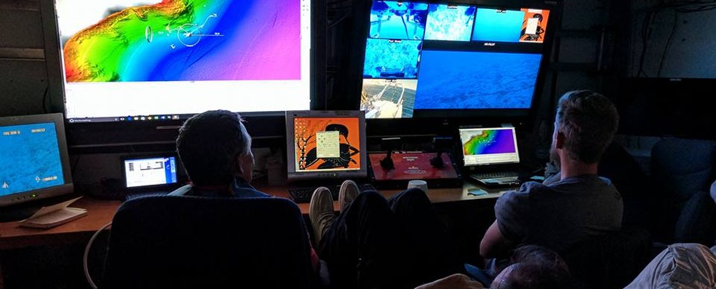
The remains of the Roman Bridge of Butrint are located on the southern bank of the city, connecting it to the settlement on the Vrina Plain. L. M. Ugolini already had theorised that Butrint could have had a bridge, given the discovery of an Augustan coin depicting three arches of a large structure. It is not known whether Ugolini had actually found the bridge or the aqueduct. An underwater survey project of the University of Texas in the southern part of the Butrint channel in 2002 had noted large masonry remains at the bottom of the Vivari Channel, possibly interpreted as piers and a part of the bridge. However, it was only in 2007 that a long section of the bridge and the top of the first arch were fully uncovered by the team of the RPM Nautical Foundation, lead by Peter Campbell, Howard Phoenix, Derek Smith and Auron Tare. In 2013, a team of Albanian and American underwater archaeologists and heritage specialists from the RPM Nautical Foundation and the Albanian Archaeological Institute identified massive granite piles and bricks arches thanks to remote sensing and underwater surveys in the Butrint channel, offering insight into how the city linked to the surrounding region during the roman colonization.
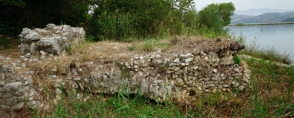
The state of conservation of the bridge and the pillars was not good: there was not much left beyond the core of the structure. However, as S. Leppard report, a short extent of the road was recovered and a small part of the northern face was still intact, which were useful for reconstructing its original shape. The structure was built using a limestone rubble core bonded with a yellow and white mortar. The arch was quite similar. It had similar slim rectangular limestone wedges bonded with mortar. The face of the arch, as visibile on the north face of the bridge, was characterised by long rectangular limestone wedges. The spandrel was built using shorter rectangular limestone blocks. Probably, the flat limestone slabs visible on the top of the core were part of the road.
S. Leppard also proposes a reconstruction of the bridge. The scholar assumes that the arch was semi-circular, with a 1/2 rise/span ratio, like the majority of Roman bridges, and also the ratio of the rib thickness to span width. This means that the arches would have been 5.8 m wide, which matches the thickness of 0.58 m measured on site. Assuming that the Butrint bridge was built between the 1st century BC and the 1st century AD, this means that pier widths were already evolving to a narrower ratio of 1/2 or 1/3, similar to the bridge crossing Marecchia at Rimini. There is no flood-relieving arch on the visible spandrel, so Leppard proposes that this arch could have been inserted lower down. The calculated length is of 400 m, with probably 45 or 46 piers, and wide enough to let small fishing vessels through. It has also been taken into consideration that part of the bridge was made of wood in order to be drawn up, or that the central part of the bridge was wider than the rest to allow bigger vessels to sail through the Vivari Channel.
It seems also that the bridge had a connection with the aqueduct. The orientation of the remains of the bridge highlights that it was probably built as a straight line across the Channel, passing around 75 m to the southwest of the aqueduct header tank on the gravel bank in the channel. This would mean that the water main and the bridge were two separate structure. However, the remains of the bridge on the Vrina Plain have not been found, so this reconstruction is purely hypothetical.
It is difficult to date when the bridge was abandoned. Nevertheless, it must be noted that between the end of the 10th century and the beginning of the 11th century AD, the around around the remains of the bridge in the city had changed and an orthostat boundary wall was constructed across the road surface fo the bridge. This would mean that by that time the bridge was no longer used as access to the city.
First from Leppard S., "The Roman Bridge of Butrint" in Hansen, Hodges, Butrint 4. The archaeology and history of a Ionian town, Oxbow Books for the Butrint Foundation, 2013, pp. 97-104
Second image courtesy of Auron Tare, whom we kindly thank for the first-hand valuable information about the discovery of the Roman bridge of Butrint.
Bibliography on the subject
- Campbell P., "A Roman Type IVB Wooden Anchor Found in the Corfu Channel Albania", in International Journal of Nautical Archaeology, 2012, pp. 411-416
- Campbell P., Smith D., Tare A., Begley C., Irwin D., Zdravković P., Phoenix H., "Albanian Center for Marine Research. Underwater Sciences Field School" in Submerged Heritage. Potopljena baština. Yearbook of the International Centre for Underwater Archaeology in Zadar, n. 3, 2013, pp. 60-63
- Ceka N., "Recent excavations in Butrint (2004-5): Notes on the growth of the ancient city centre" in Bejko l., Hodges R., New direction sin Albanian archaeology. Studies presented to Muzafer Korkuti, Tirana, 2006, pp. 177-185
- Greenslade S. et al., Butrint 6: excavations on the Vrina Plain, Vol. 1 - The lost Roman and Byzantine suburbs, Oxbow Books, 2019
- Leppard S., "The Roman Bridge of Butrint" in Hansen, Hodges, Butrint 4. The archaeology and history of a Ionian town, Oxbow Books for the Butrint Foundation, 2013, pp. 97-104
- Ugolini L. M., Butrinto. Il mito di Enea. Gli scavi, Istituto grafico tiberino, 1937, pp. 85

