

IRAQ - QADISIYAH
As part of ‘Recording of damages and threats on archaeological landscapes’ (Task 2.a), between February 22nd and April 06th 2022 a LMU team mainly consisting of archaeological personnel led by prof. Adelheid Otto concentrated its work on three different sectors in Qadisiyah region performing a preliminary evaluation of the local landscape and sites under threat. For instance, the area around Ishan al-Bahriyat (ancient Isin) experienced serious and widespread damages. The site itself, once the early Old Babylonian capital of the kingdom of the Isin Dynasty and therefore one of most important cities in southern Mesopotamia, is mainly known because its exposure to excessive destructions and pillaging following the 2003 Invasion of Iraq. Thousands of looting pits, up to 5 meters deep and partly connected by horizontal underground tunnels, led to the destruction of most of the main archaeological mound. In extreme contrast to this evidence, the nearby sites west of Isin with evidence of later occupation (from the Parthian-Sasanian to the late Islamic periods) show limited or almost no looting activities. It appears that looters have somehow acquired a basic knowledge on the different archaeological materials and their dating, selection the artefacts to be sold at higher prices on the antiquities black market. The scheme of the looting operations has also been clarified: if the pillagers are not sure about the date of the site, they first cut a sounding to see if it is eligible for further excavations. An exemplar case is a squared Ottoman fortress with well-preserved outer walls (K.26): because several stamped bricks from Isin (dating to the early 2nd millennium BC) were used to build the more recent military structure, the looters performed a test hole in the south-western wall, leaving behind a cluster of stamped bricks. This predilection for sites of the 3rd and 2nd millennia BC is clearly visible on the site named Ishan Handhalah (K.25), around 2 km north-east of Isin. This small settlement, mainly dating to the Old Babylonian and Kassite periods, experienced intensive looting which destroyed a large building on the top of the mound (parts of which are still visible from drone photos) while agricultural activities had a heavy impact on the preservation of the area corresponding to the ancient lower town.
Operations in the region have been resumed between February 26th and March 26th 2023, with the survey of 24 sites ranging chronologically from the Late Ubaid period to Medieval times. All the surveyed sites have been exposed to illicit digging at different times, with some among them featuring recent looting pits. The Medieval/Islamic sites are the least at risk in terms of illegal digging, but they are more endangered by agriculture as they are usually quite flat. The sites with evidence of earlier occupation (5th-1st millennia BCE) are systematically exposed to illegal digging, especially those located in remote areas at a distance from modern settlements. Finally, action on the heavily-damaged site of Ishan al-Bahriyat (ancient Isin) has been resumed, with additional geophysical prospection (magnetometry) to understand the ancient topography of the site and related it to the plan of looting pits.
During 2024 fieldwork season (February 16th-March 20th), a total of 51 sites, whose dating ranged from the Late Ubaid period (5th millennium BCE) to the Ottoman period (19th century CE), were identified and surveyed. The activities further confirmed that building activities, especially the digging of canals through heavy machinery (bulldozers), mechanized, intensive agriculture (especially the flat sites near villages), and looting (especially those in remote areas) represent the main threats to the archaeological sites of the region. Ottoman sites, mostly military forts and watchtowers built with mudbricks, are the only structures still standing, but they are left to slowly decay. The support offered by Remote Sensing analysis provided further information on the changes occurred to the sites and landscape of the region (such as in the case of the Sasanian site KA.149), in the recent decades and throughout the millennia (for instance, the modifications of local waterways and the connected settlement patterns).
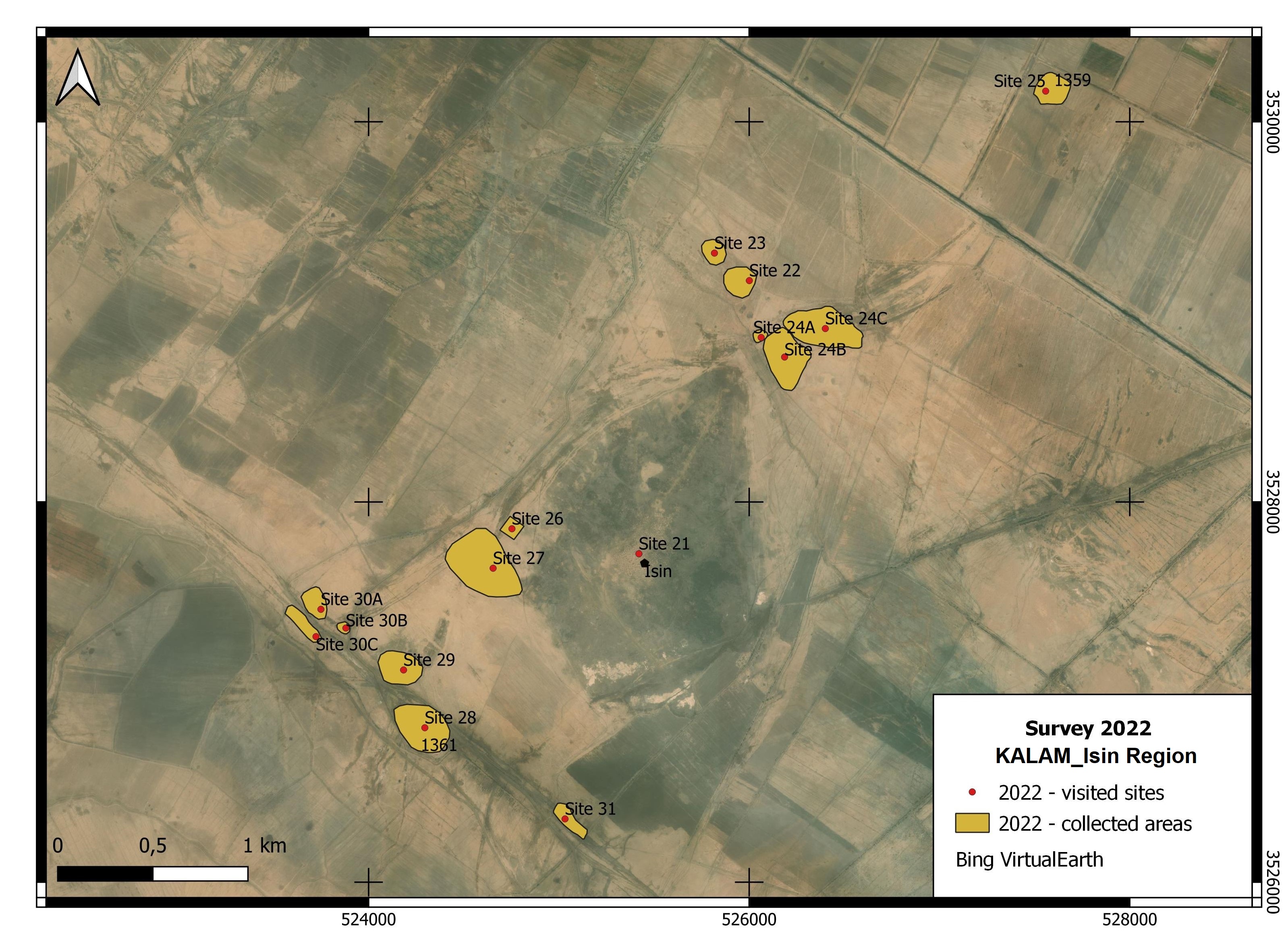
Fig. 1. The area around the main site of Ishan al-Bahriyat/Isin represented an ideal area to study the impact of looting on Iraqi archaeological sites, given the severe impact of this illegal activity in this specific region.
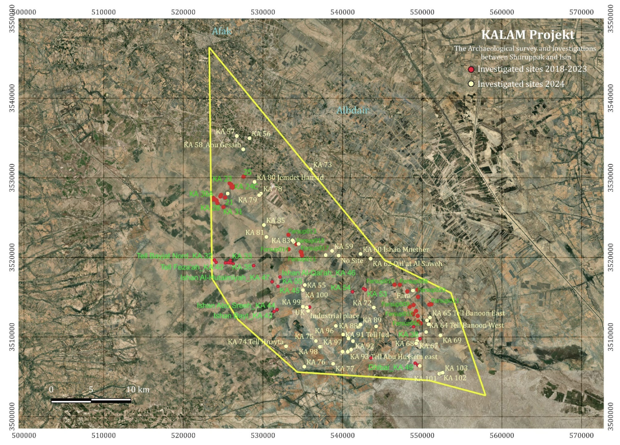
Fig. 2. The region around Ishan al-Bahriyat/Isin and Fara/Šhuruppak featured a large variety of sites alternatively occupied over a timeframe spanning from the 5th millennium BCE to modern times.
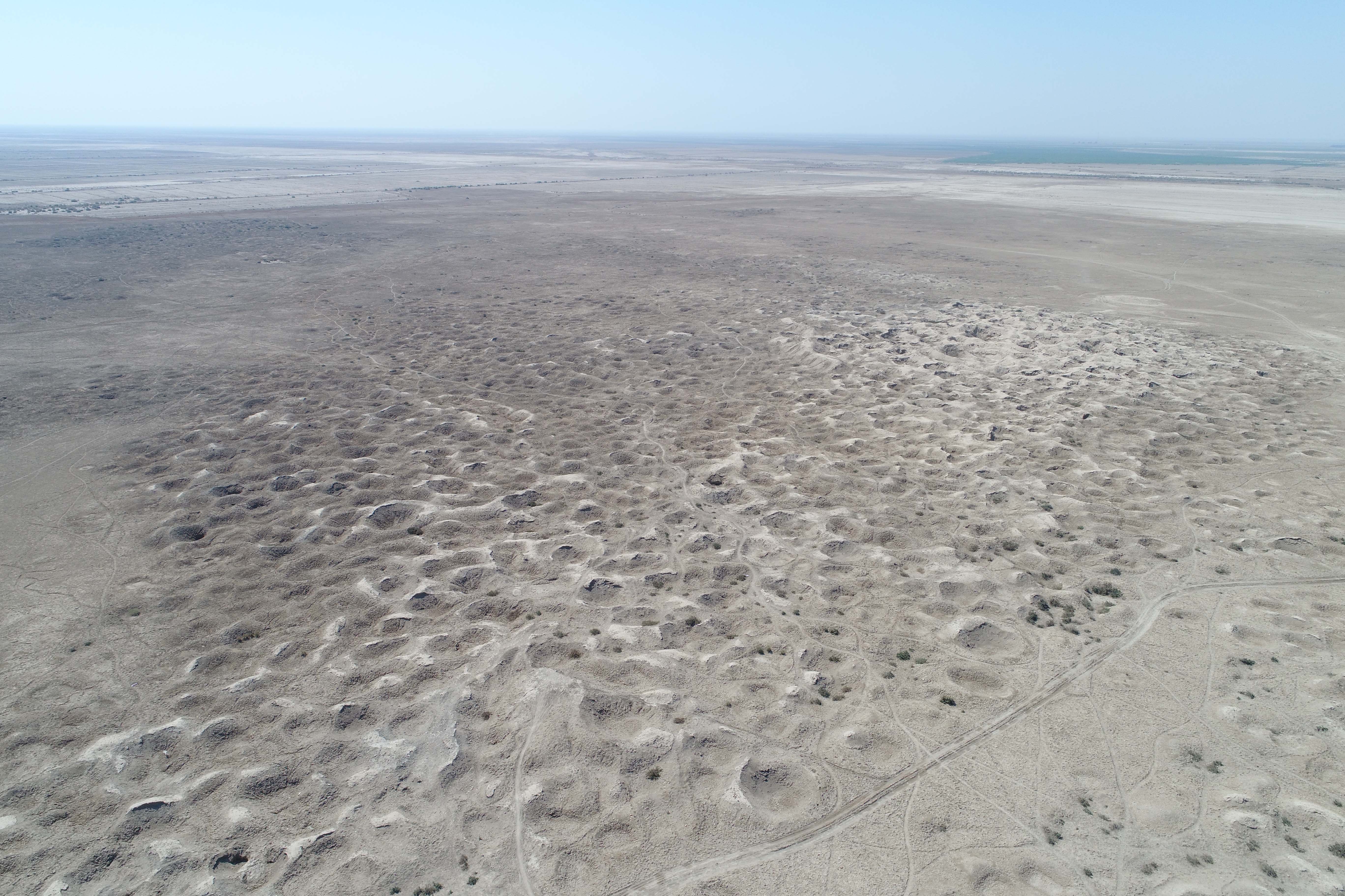
Fig. 3. The use of drones and aerial photography is instrumental to sistematically record the damages occuring to ancient sites, such as in the case of Ishan al-Bahriyat/Isin.
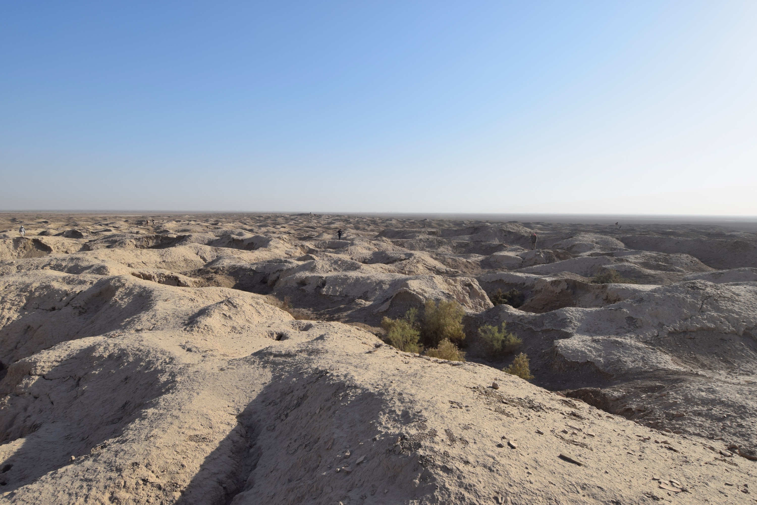
Fig. 4. The aerial documentation is integrated with the recording on ground level of the looting evidence and resulting materials.
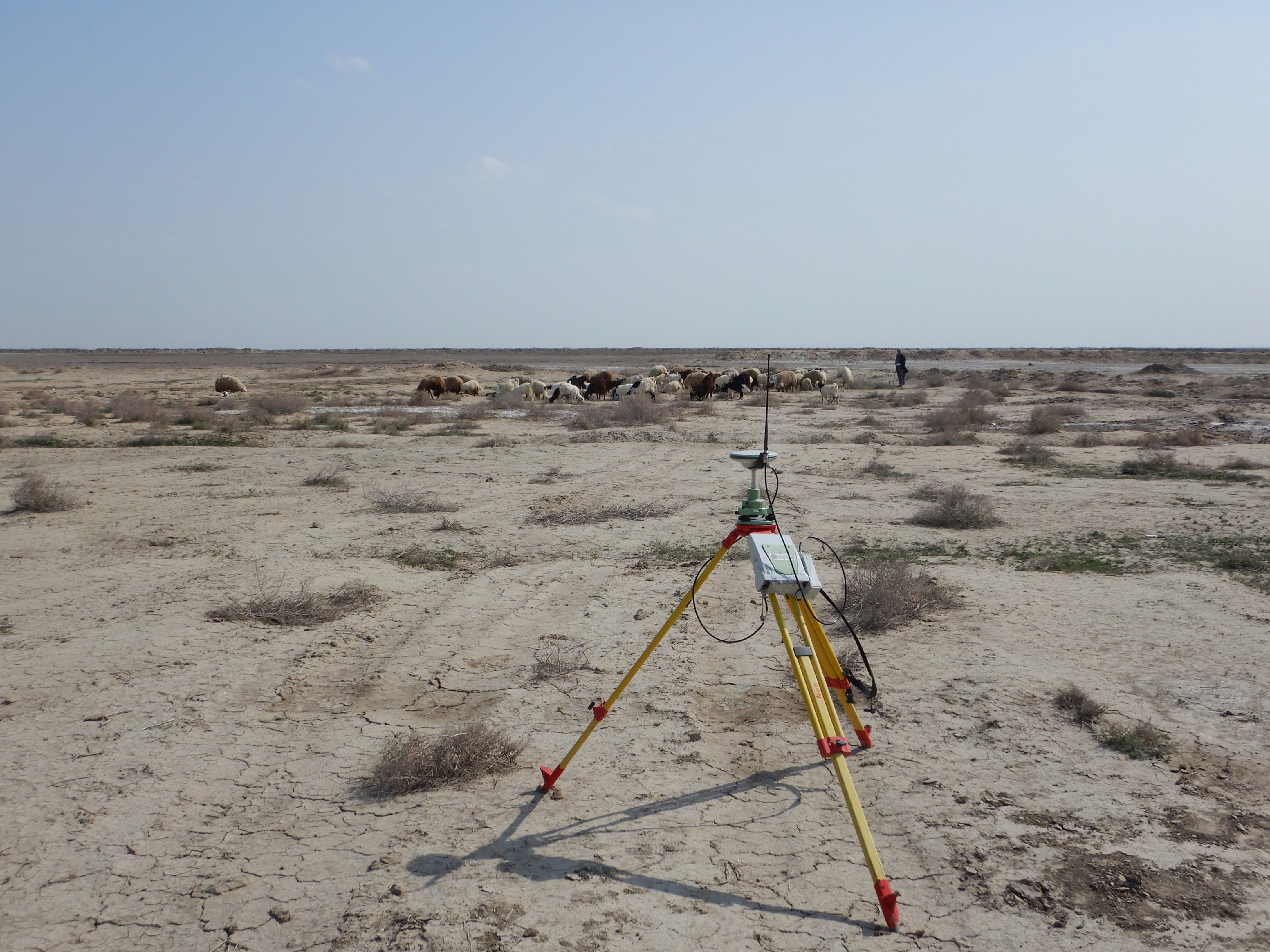
Fig. 5. On the ground, sites are surveyed not only to record the archaeological material and the presence of damages, but also to reconstruct their evolution through the different periods of occupation.
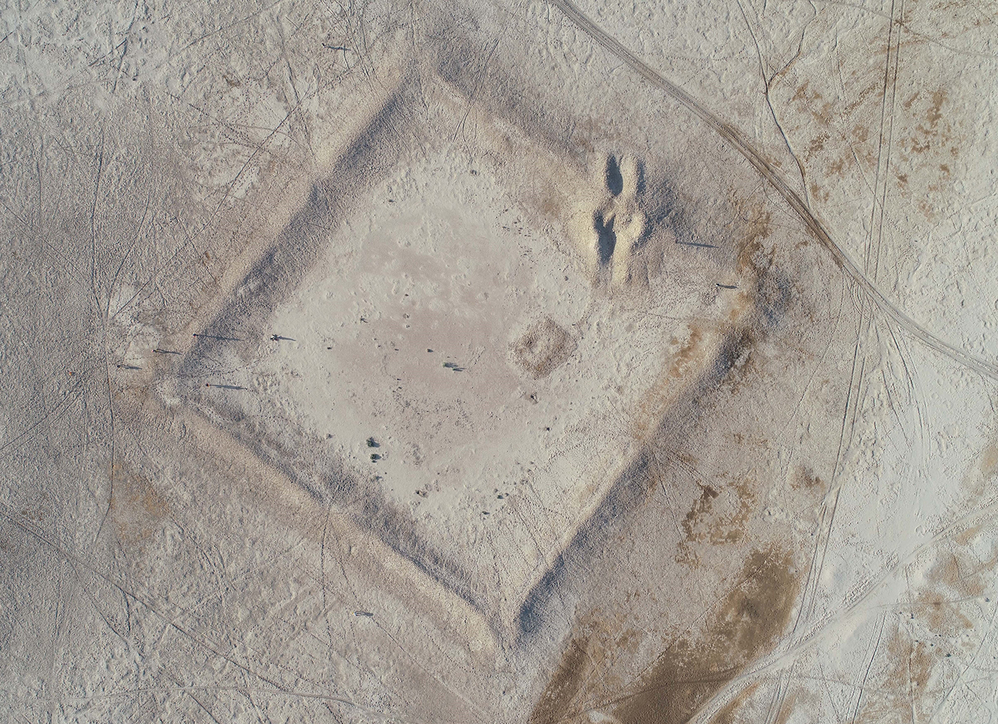
Fig. 6. The Iraqi archaeological landscape includes sites dating to different periods and also features evidence of the recent history of the country, as demonstrated by the well-preserved shape of rhe Ottoman fortress located north of Ishan al-Bahriyat/Isin.
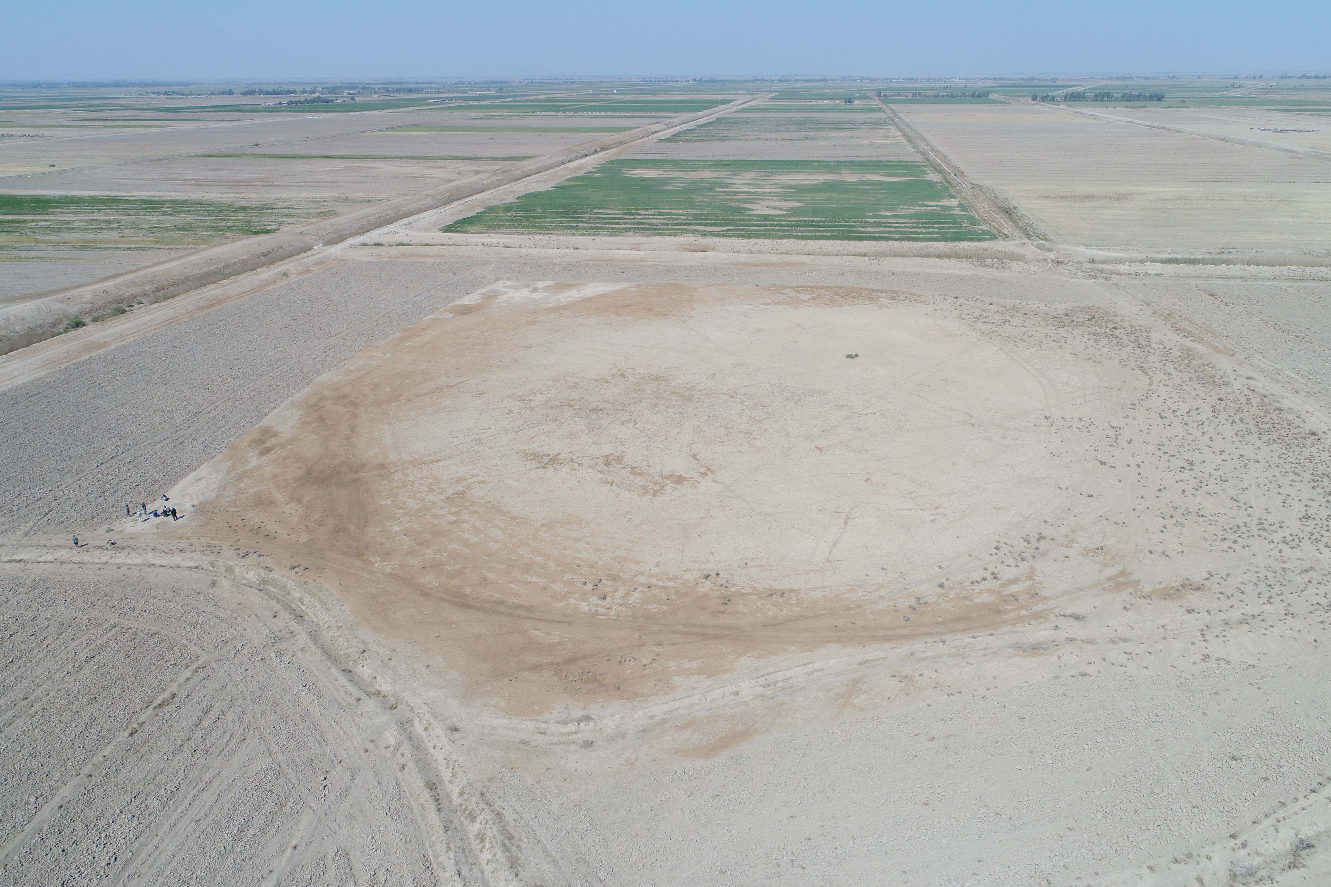
Fig. 7. Several sectors of the site of Ishan Handhalah suffered widespread damages not only connected to looting activities but also from the agricultural exploitation by local farmers.
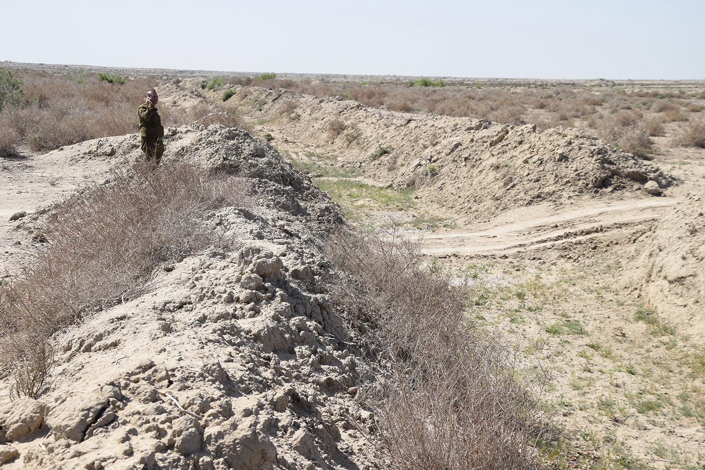
Fig. 8. The collaboration with the SBAH is fundamental: the protection and management of archaeological sites and landscapes in Iraq have to rely on heritage personnel aware of current issues and their solution.
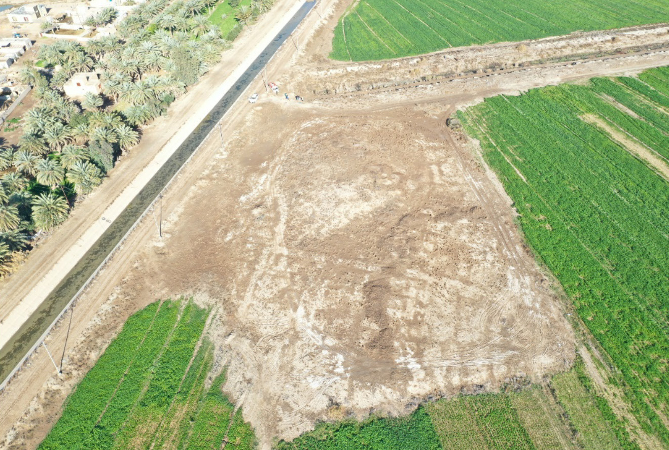
Fig. 9. Agricultural activities have become an increasing threat to the preservation of the archaeological landscape, leading to the levelling or encroachment of ancient mounds.
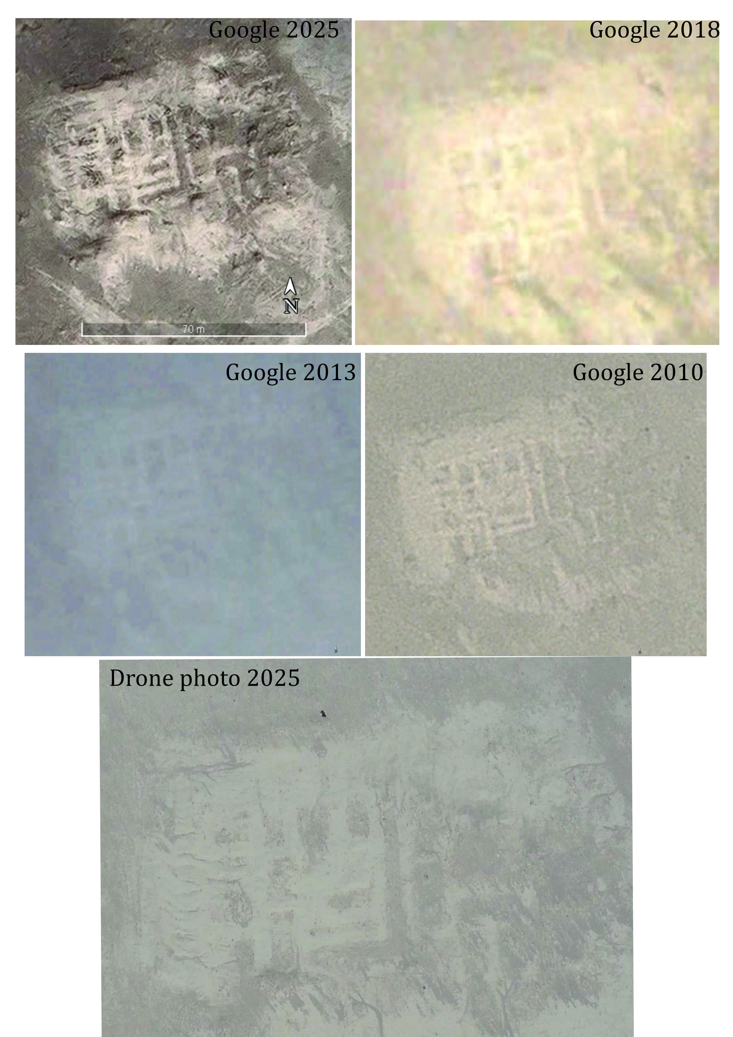
Fig. 10. The monitoring of the conservation conditions of the archaeological site KA.149 has been performed through different methods and activities, starting from Remote Sensing.
IRAQ - AQAR QUF and ABU GHRAIB
In 2023 (from January 11th to January 23rd) and 2024 (from January 14th to January 23rd), an intensive survey has been conducted on the archaeological site of Aqar Quf and in the Abu Ghraib district, in the western hinterland of Baghdad by a team of 9 archaeologists from UNIBO supported by 2 heritage operators from Iraqi SBAH. In detail, the field intensive survey, organised on longitudinal routes aimed at covering the entirety of sites and areas of interest and supported by drone flights for an above-ground view, has been anticipated by a remote sensing analysis conducted in a GIS environment on different types of basemaps (current and historical satellite imagery, topographic and geomorphological maps) in order to identify archaeological features and record visible threats.
The survey of the archaeological area of Aqar Quf primarily focused on the sector within the enclosure surrounding the ziqqurat and the temple and has then expanded across the 425 hectares of the site, underling the recurrence of damages in different sectors due to the creation of new houses, canals and agricultural fields. Simultaneously, the team in the Abu Ghraib district surveyed a total of 86 sites (45 in 2023, 41 in 2024): the fieldwork has highlighted that agricultural and building activities, occurring since the 1960s, represent the main reason behind the damaging or destruction of sites, in particular through the use of heavy machinery for the digging of water canals and cultivation trenches, while looting is generally an absent variable.
As a result, the investigation of Aqar Quf has resulted in clarifying the original urban shape and size of the ancient city, thus allowing a full and proper protection of the archaeological area, while the assessment of the Abu Ghraib landscape has provided consistent data for drafting a high-precision archaeological map for its protection.
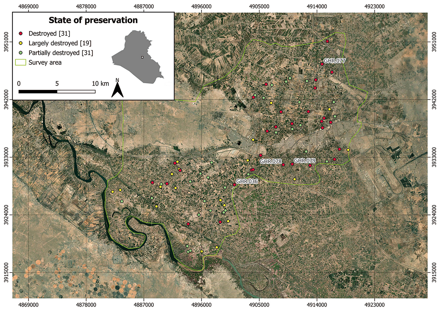
Fig. 1. The archaeological landscape of Aqar Quf and the surrounding region of Abu Ghraib have been mainly affected by agricultural exploitation and building activities.
IRAQ - MAYSAN
As part of the ‘Archaeological and conservation training activities’ foreseen in the KALAM project (Task 2.b), 15 officials from SBAH coming from 9 inspectorates in southern Iraq (Baghdad, Babil, Dhi Qar, Karbala, Maysan, Muthanna, Najaf, Qadisiyah, Wasit) attended the training course ‘Archaeological surveying techniques - The archaeological landscape of the western Maysan region’, organised with the support of the Investigations and Excavations Directorate of SBAH in Baghdad and thanks to the kind hospitality of SBAH Maysan Inspector, Mr Murtadha Hashem.
The training course took place at the SBAH Inspectorate in Amarah (Maysan Governorate), between January 16th and January 27th 2022 and was organised around a series of seminars on several topics, from archaeological techniques to conservation practices, followed by specific lectures on case-studies from excavation and survey projects in Iraq and beyond. Lecturers included Prof. Nicolò Marchetti, Prof. Abbas Al-Hussainy, Ass.Prof. Simone Mantellini, Dr. Gabriele Giacosa and Mrs. Valentina Orrù.
In detail, seminars included the role of remote sensing analysis on satellite imagery, the application of innovative registration techniques on the field (aerial photography through drones), the best practices to draft reports and scientific articles, supported by practical sessions about graphic documentation of ancient artefacts.
Training fieldwork sessions included pilot survey operations in the western countryside of the Maysan Governorate: the trainees visited 12 archaeological sites, applying the best practices learned during the workshops. Field activities included the collection and sorting of ancient artefacts (pottery, clay and stone tools, shells), the recording of features (structures, paleochannels) and threats/damages (for instance, modern buildings, illegal excavations and – especially – agricultural works). The use of a GIS app for mobiles and tablets, called QField, was instrumental for registering sites on the field by the trainees and allowed them to record and present the critical issues affecting the archaeological landscape.
All the trainees showed a positive mindset and awareness toward the aims and results of the training program, during which they worked hard to acquire and apply the new skills they acquired.
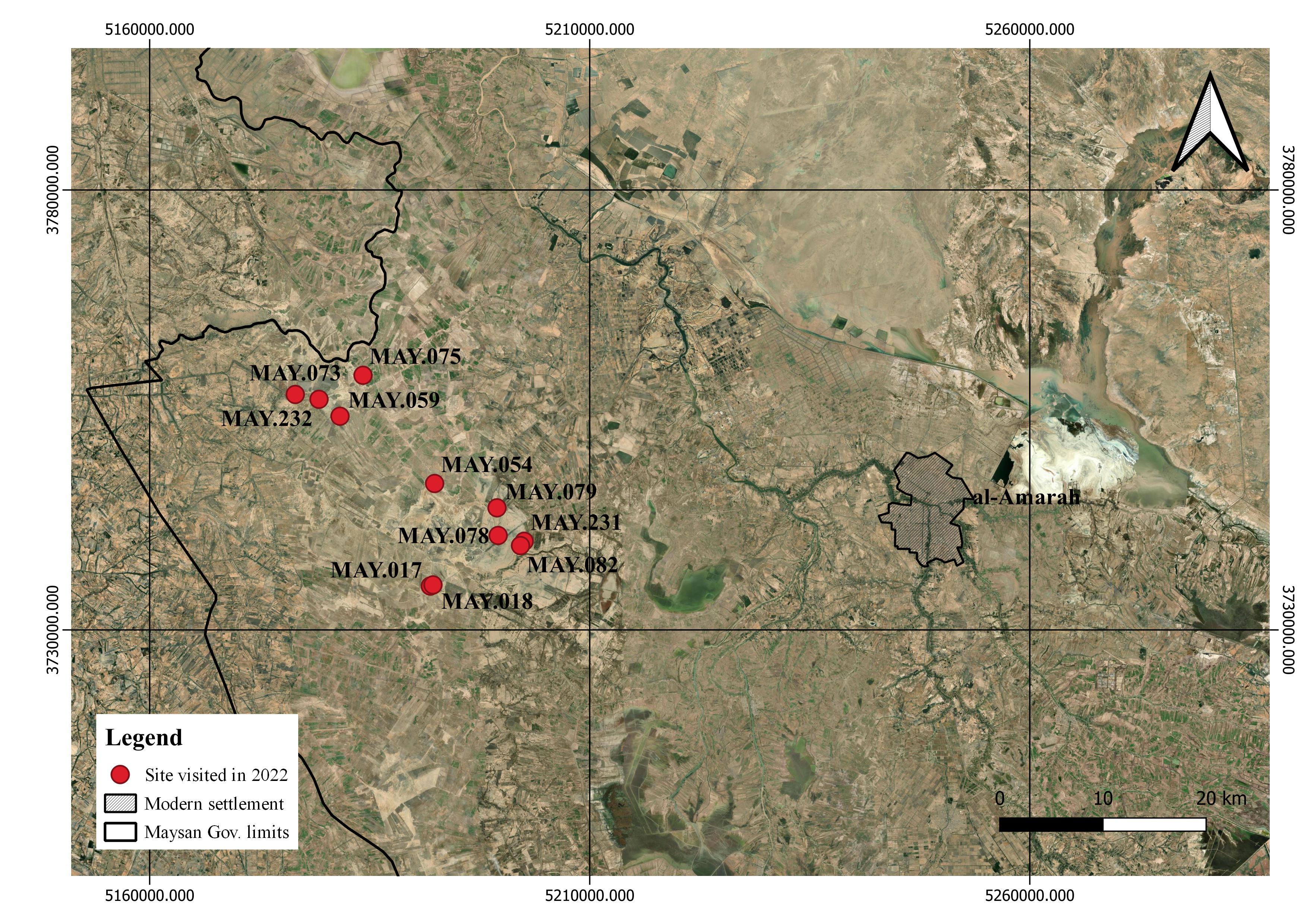
Fig. 1. The training course took place in the SBAH Inspectorate in Amarah, while the pilot survey activities were organized in the western part of Maysan Governorate.
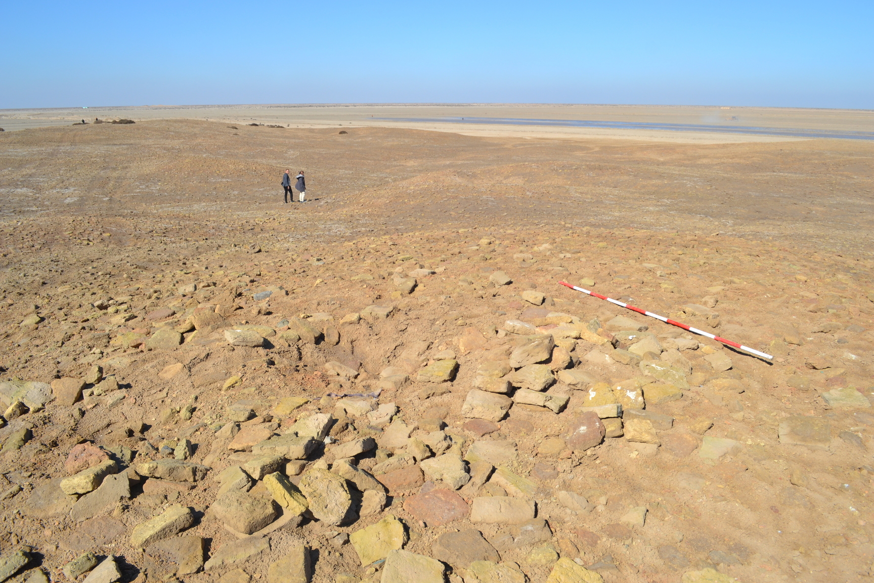
Fig. 2. Documentation of ancient architectural remains visible on one of the mounds surveyed during the pilot field activities.
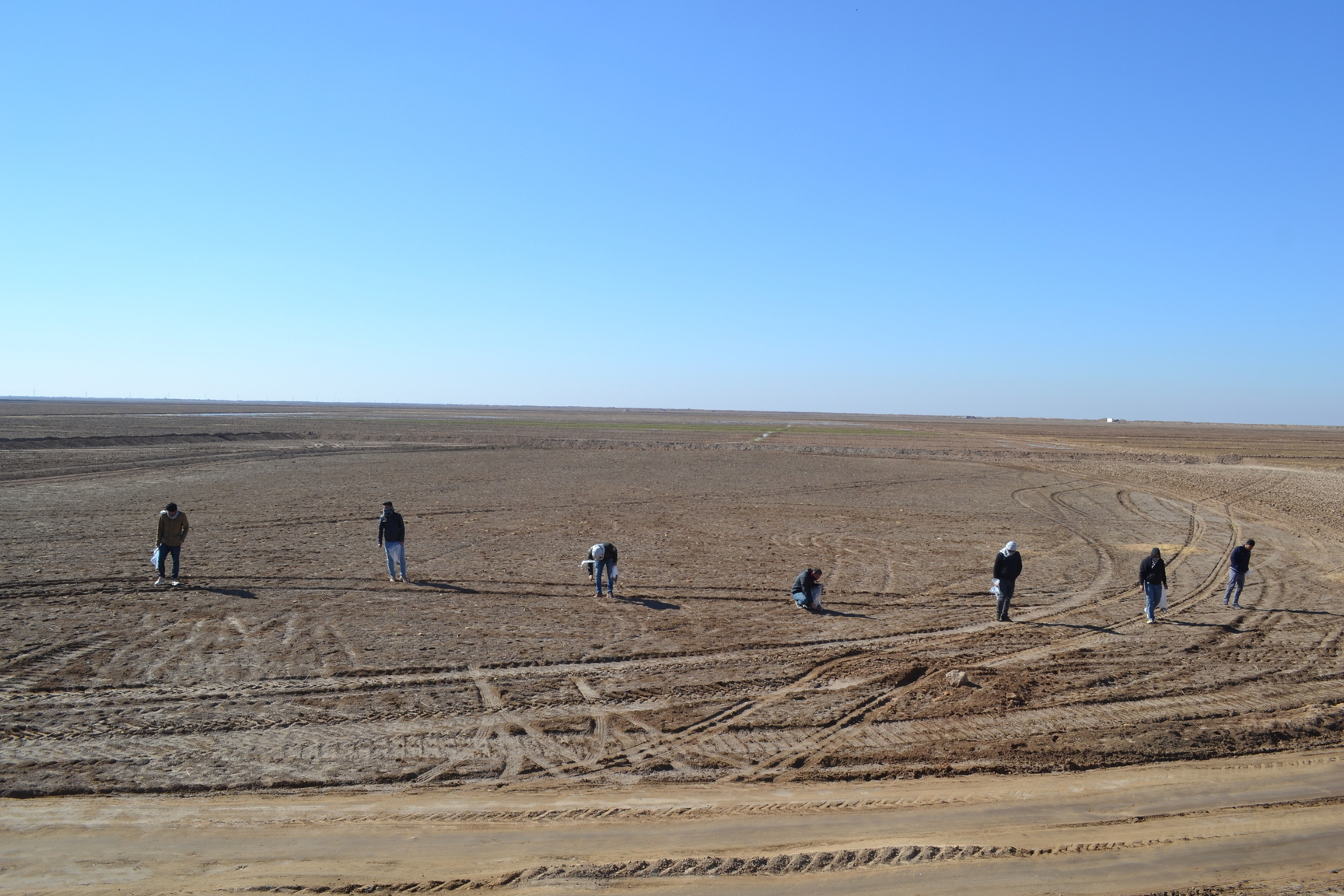
Fig. 3. The collection of ancient materials from the surface of sites visited during the pilot field activities was the first step in documenting ancient settlements.
Fig. 4. Cultivation fields and irrigation canals are recurrent elements within the Maysan landscape.
Fig. 5. The Maysan landscape experiences consistent damages by the digging of trenches and canals for agricultural purposes.
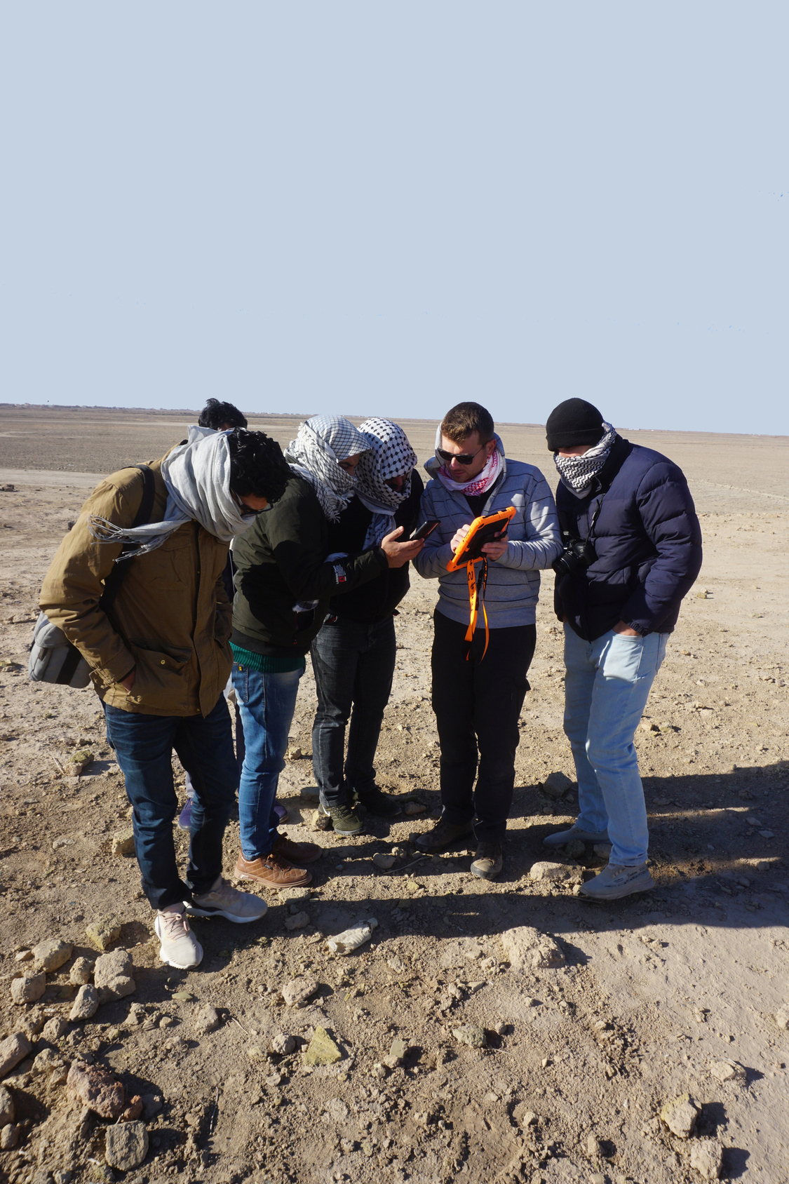
Fig. 6. Through portable devices, the trainees directly tested on the field the methods they had learned during the seminars.
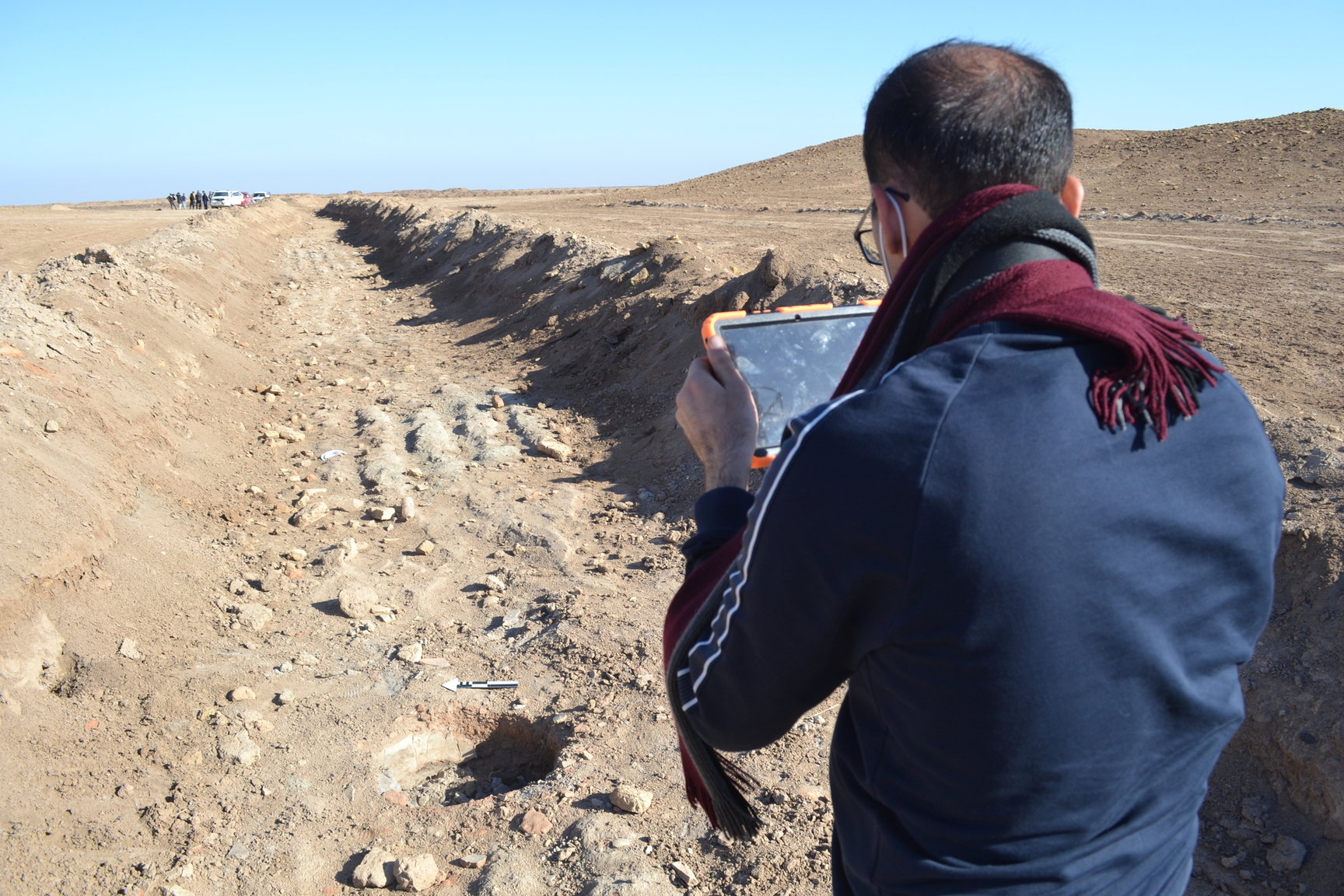
Fig. 7. Digital tools, such as QField app for mobile devices, were used to record archaeological evidence as well as the damages it suffered.
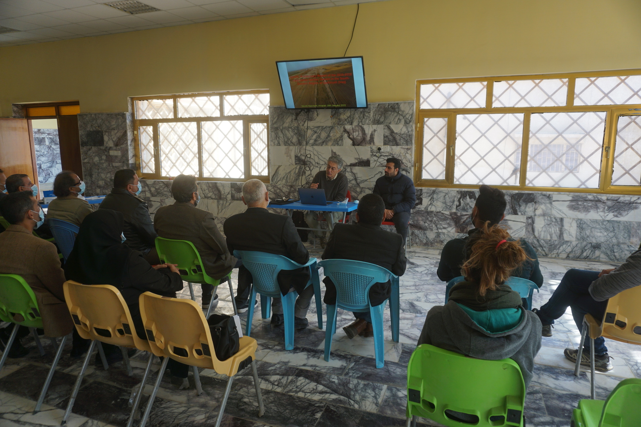
Fig. 8. Seminars and lectures were provided during all the course by the organisers and external experts.
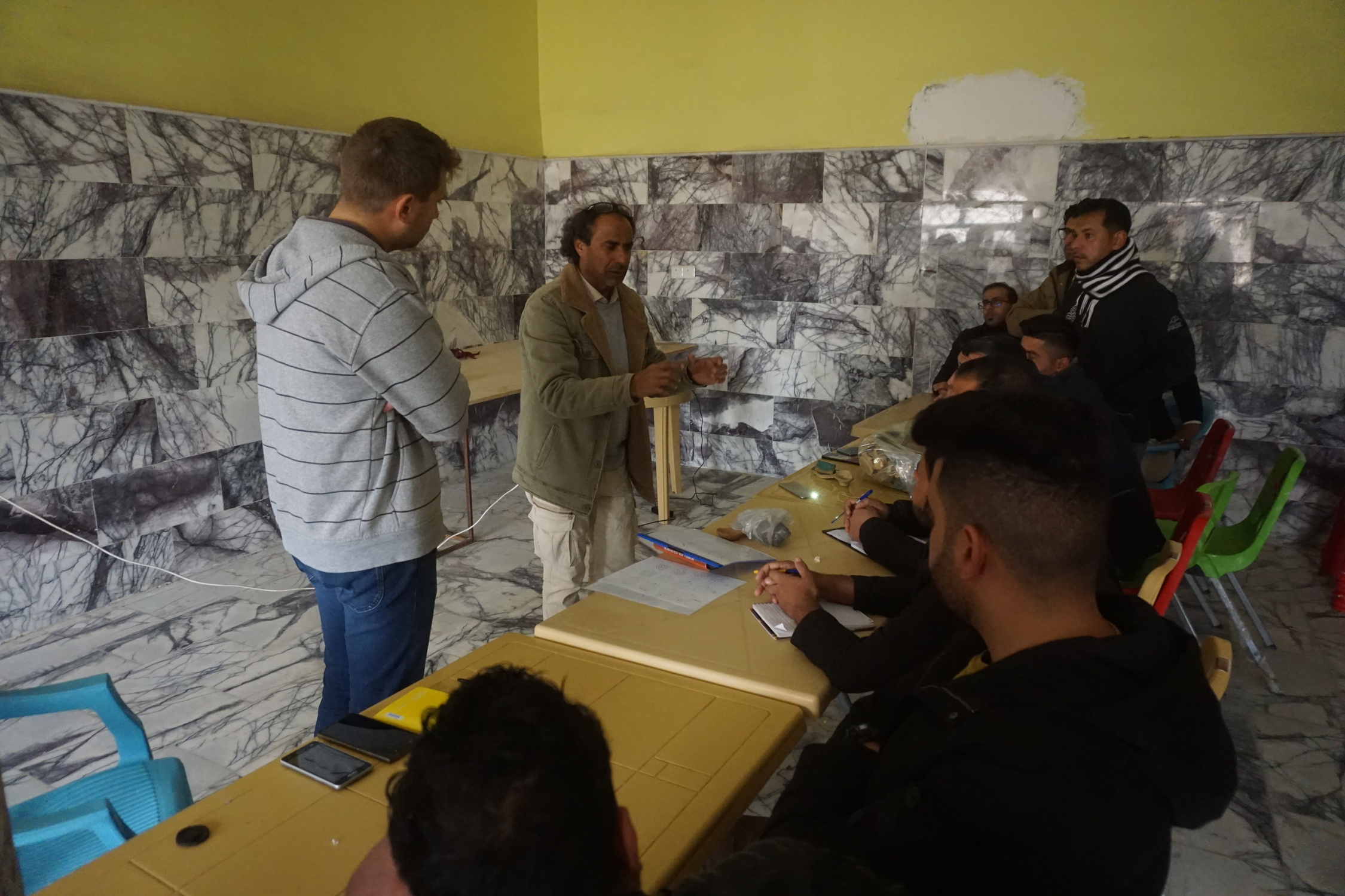
Fig. 9. Practical activities, such as pottery drawing sessions, were part of the daily activities for the trainees.
Fig. 10. Not only archaeology: the Maysan landscape features landmarks of the recent history of Iraq, such as the Martyrs’ Memorial complex, located in the north-western sector of the Governorate.
IRAQ - NINEVEH
As part of the ‘Archaeological and conservation training activities’ (Task 2.b), between May and July and again in October 2022, a KALAM team including archaeologists and conservators from UNIBO (under the coordination of Prof. Nicolò Marchetti) worked in close contact with UOM colleagues and students (supervised by Prof. Khalid Salim Ismael) on the preservation of ancient Nineveh and its remains. The operation has been carried out with the support of the Investigations and Excavations Directorate of SBAH in Baghdad and the SBAH Ninawa Inspectorate. In detail, the UNIBO personnel was part of the Iraqi-Italian Archaeological Expedition, which has been active on the eastern part of the site since 2019.
The activities included extensive conservation works on the structures uncovered by past and recent excavations at Nineveh: preservation activities were carried out in the Adad Gate sector, in the northern part of Nineveh. Conservation of the Gate itself featured the application of mud plaster both on the ancient mudbrick structures as well as over modern reconstructions (made by the Iraqis in the 1970s), together with the completion of the metal roof over the entire area investigated by the Iraqi-Italian expedition. Inside the Gate, recently uncovered, Neo Assyrian structures were targeted as well by conservation activities: the aim is to designate this part of the site as the main entrance of an archaeological park, allowing visitors to understand on the ground and appreciate the archaeological remains.
Further clearing and conservation operations were also carried out on outer section of the city walls: for instance, their north-eastern corner has been cleared from the debris resulting from ISIS destructions, displaying the original stone basement.
In 2023, as part of the conservation activities scheduled at Nineveh, the workshop Preserving a Fragile Heritage: a Workshop on the Conservation of Ancient Artifacts and Monuments at Nineveh, Mosul has been organised on November 29th: it was attended by 26 heritage operators from the Antiquities Directorates of Mosul and Erbil (Iraqi Kurdistan) and from academic personnel of Mosul University.
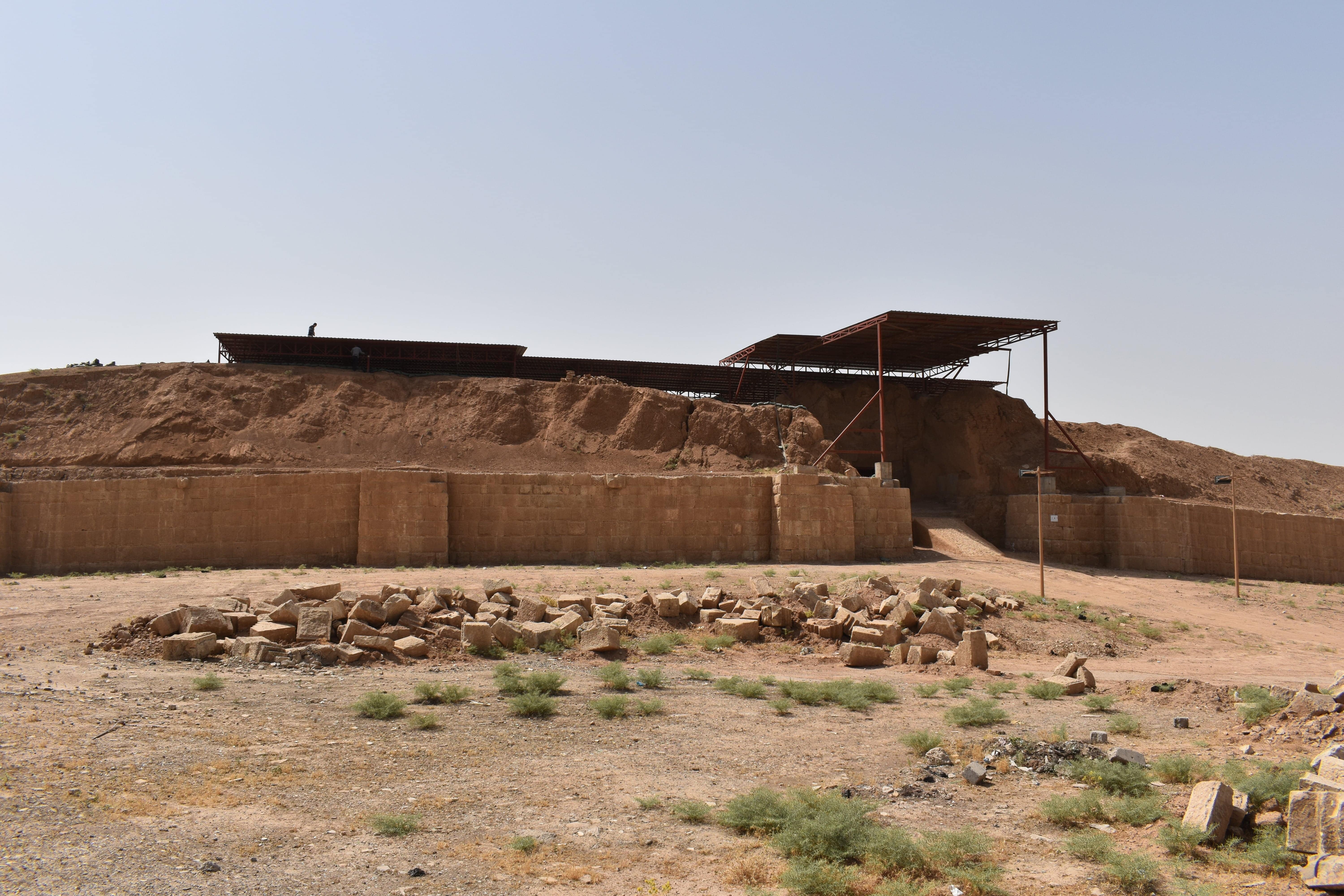
Fig. 1. The city walls of Nineveh, extending for over 12 km with multiple gates, are a prominent landmark and they represent one of the main focus of intervention for KALAM conservation activities.
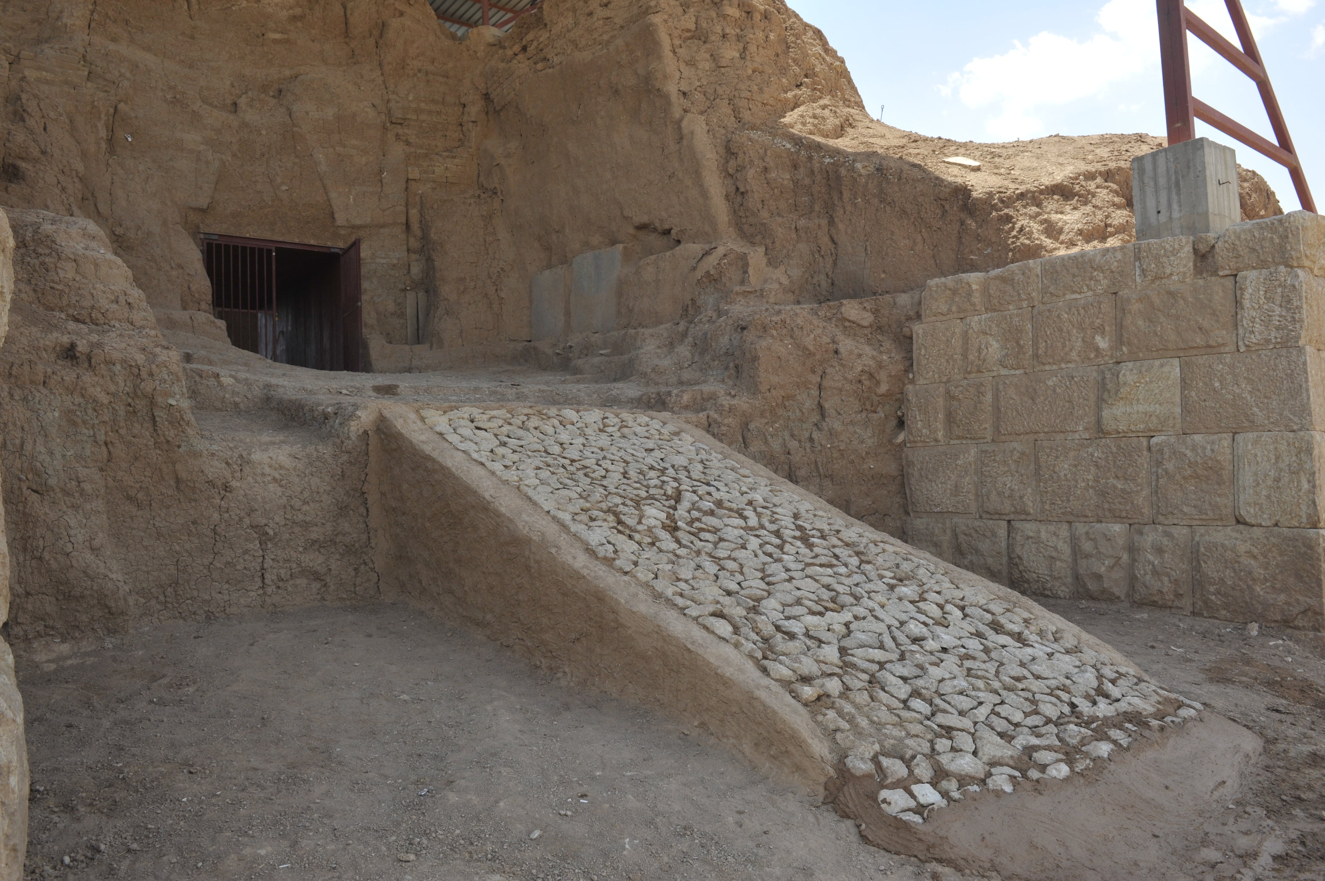
Fig. 2. The conservation activities have the ultimate aim to develop Nineveh to be a main location for Iraqi and international tourism.
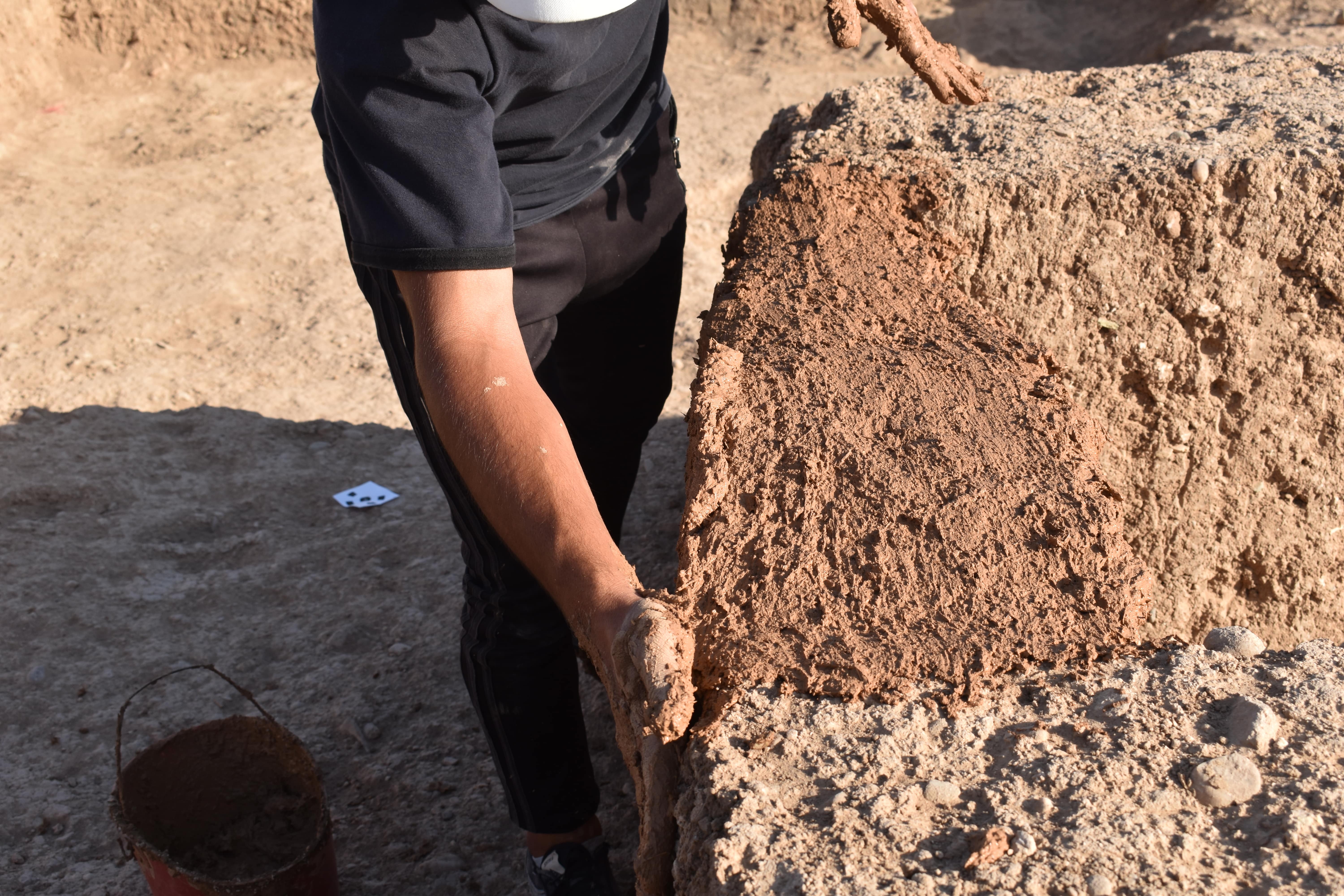
Fig. 3. Conservation activities followed traditional, low-impact methods, employing available materials such as clay or mud, and confronting with the expertise of local Iraqi workers.
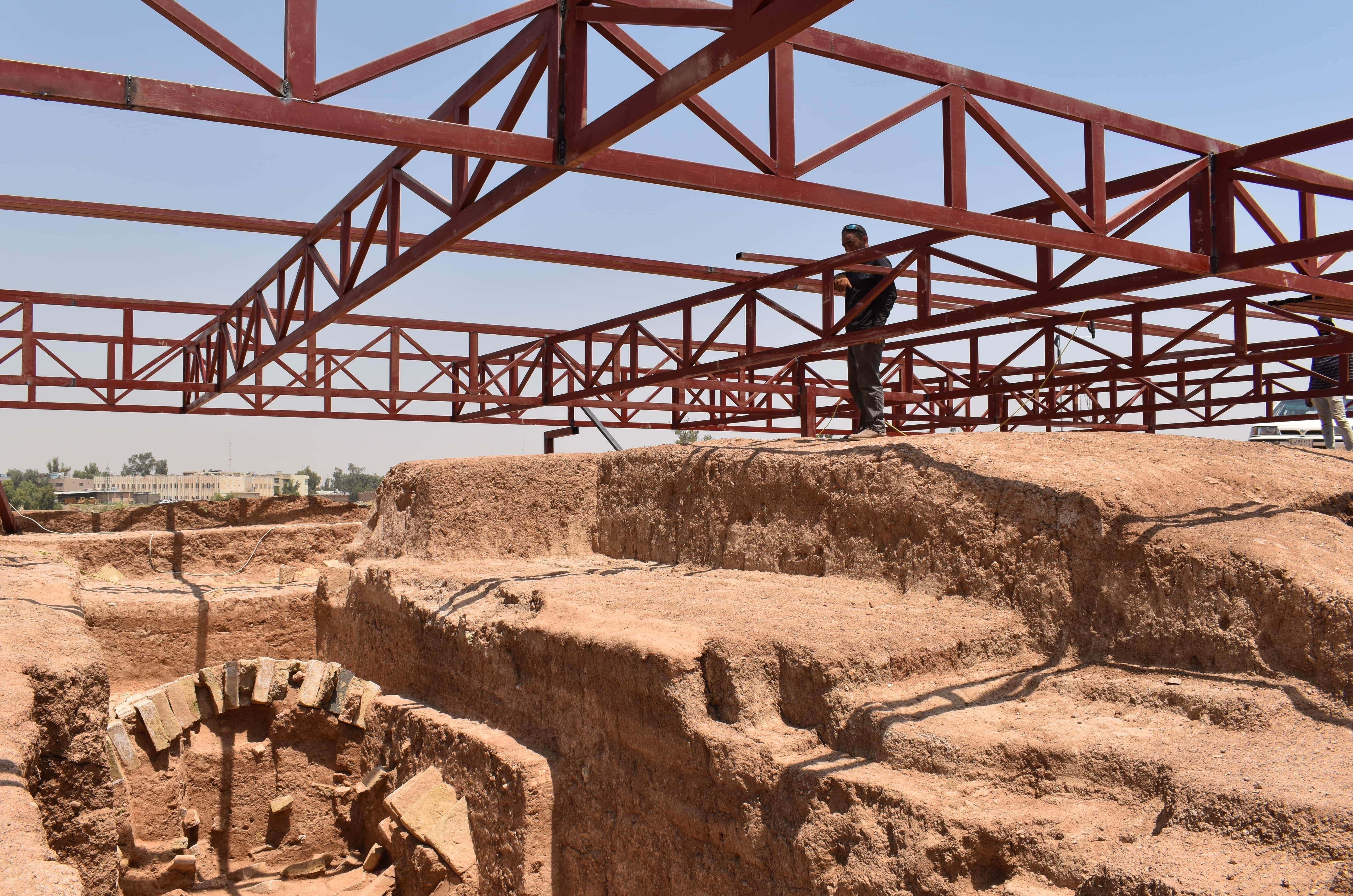
Fig. 4. The construction of a metal cover is required for the preservation and fruition of larger structures such as the city gates or other monumental buildings.
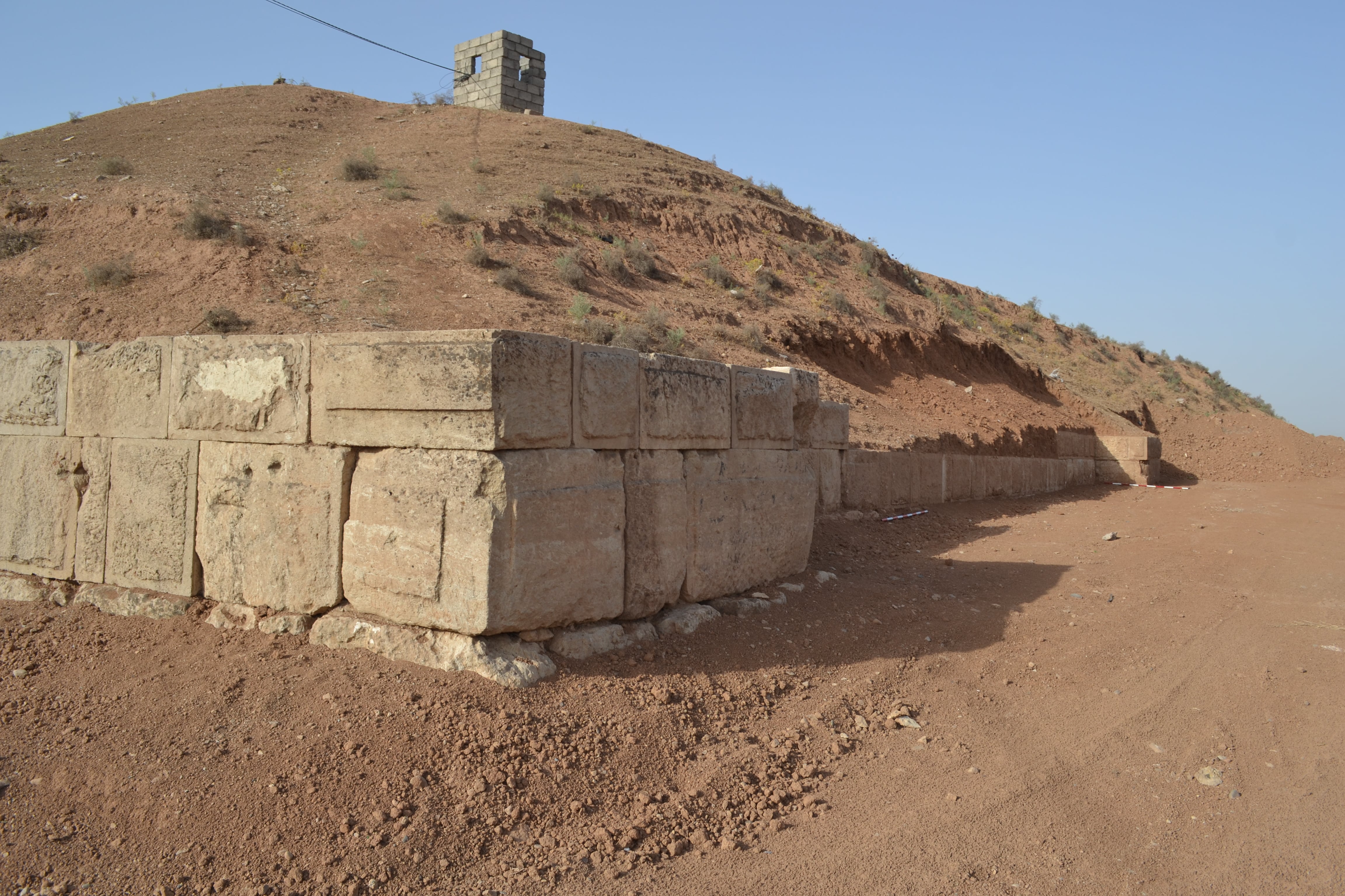
Fig. 5. Large sections of the original city walls of Nineveh are still preserved and their clearing and conservation are an immediate evidence of the KALAM aims and methods.
UZBEKISTAN - KAFIR KALA
As part of the ‘Archaeological and conservation training activities’ (Task 2.b), for 6 weeks between May and June 2022, a KALAM team of archaeologists and conservators from UNIBO undertook field operations (including archaeological and conservation activities) at the site of Kafir Kala. Works were coordinated by Ass. Prof. Simone Mantellini and Dr. Samaretdin Suyunov , as co-Directors Uzbek-Italian Archaeological Project in Samarkand – UIAP, and in collaboration with Eleonora Serrone, Amdriddin Berdimuradov, Sanat Khudjamov, Alisher Sandibaev and Bakhriddin Boliev.
The complex of Kafir Kala is one of the most important monuments in the area of Samarkand. Research on site highlighted an important occupation from the Early Middle Ages (7th century CE) to the Timurid period (15th century CE). Given its importance for the history of the region and its proximity to Samarkand (10 km), together with the steady increase of systematic tourism in Uzbekistan in the last decade, Kafir Kala represents an ideal spot for the creation of an Archaeological Park and Visitors' Center.
The recent activities were therefore aimed at creating the premises of the musealization of the site: for instance, the main effort consisted in the conservation and restoration in the Upper Citadel, where the structures built with the traditional technique combining mud blocks (pakhsa) and bricks are seriously damaged since their exposure after archaeological excavations. The main problem is represented by the run-off of rain water that descends along the walls, causing erosion of the lower section and subsequent collapse. The intervention is therefore urgent to consolidate the structures and prevent further damages.
Operations were supervised by Bakhriddin Boliev, restorer at the Institute of Archaeology in Samarkand, with the support of the KALAM team members and the help of local farmers tasked with the preparation of the mixture of water, soil, and straws, and its transportation on site. Preliminary restoration concerned the most endangered structures, in particular the original entrance to the Citadel on the south side, which might potentially be the visitors' entry from to the site. Works focused on filling of the empty sections of the walls, the consolidation of the base and side walls of the arched gate and of the eroded structures in north-western corner of the Citadel.
Conservation activities on the site continued in both 2023 and 2024, extending across the Citadel and including the southern residential quarter or shahristan: currently under archaeological investigation, it has provided distinctive evidence on the last occupation of the settlement in the late Medieval period (14th-15th centuries CE).
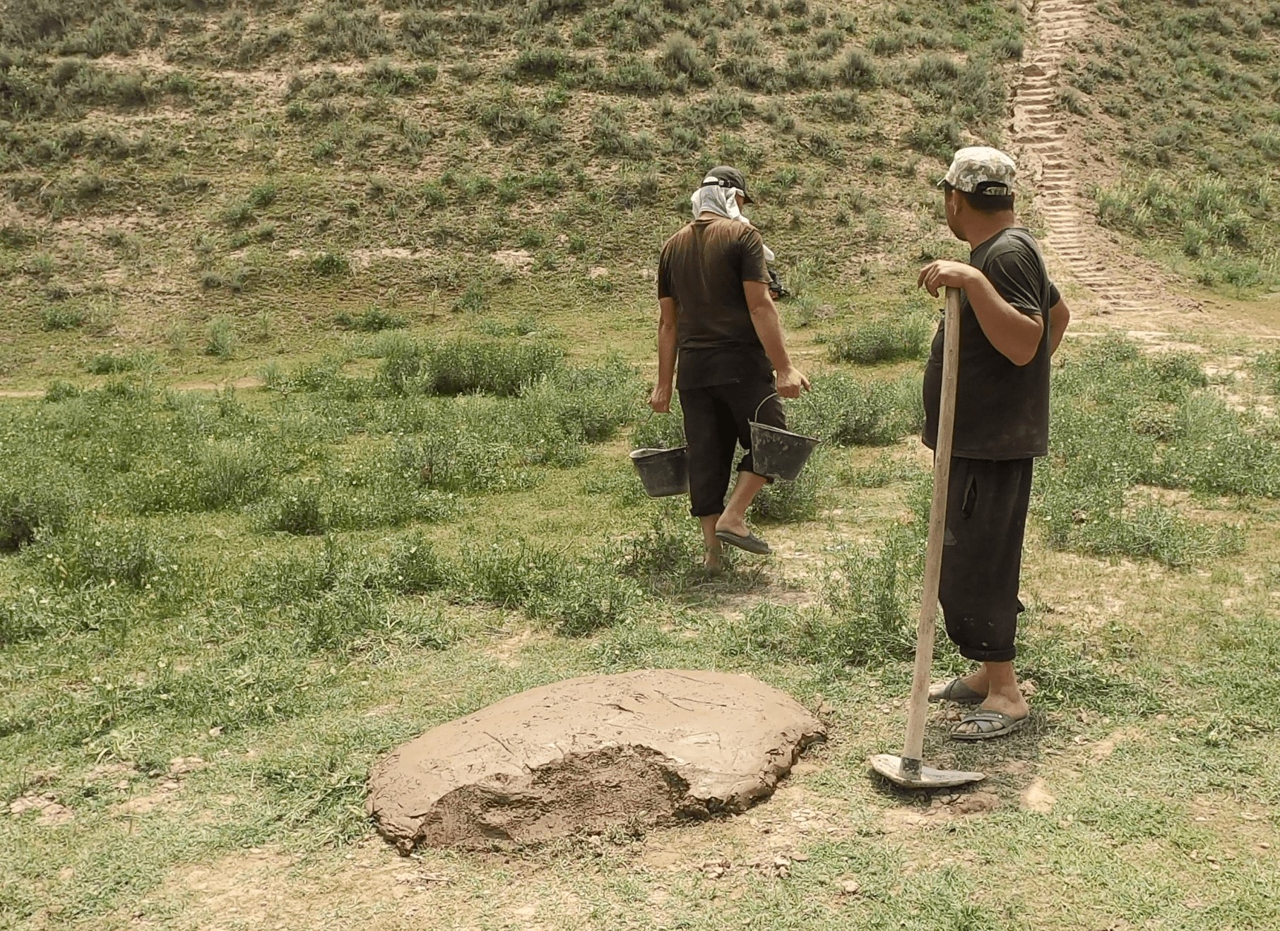
Fig. 1. Conservators prepared with the help of local workers the mixture of mud and straws for the conservation of the mudbrick structures of the citadel of Kafir Kala.
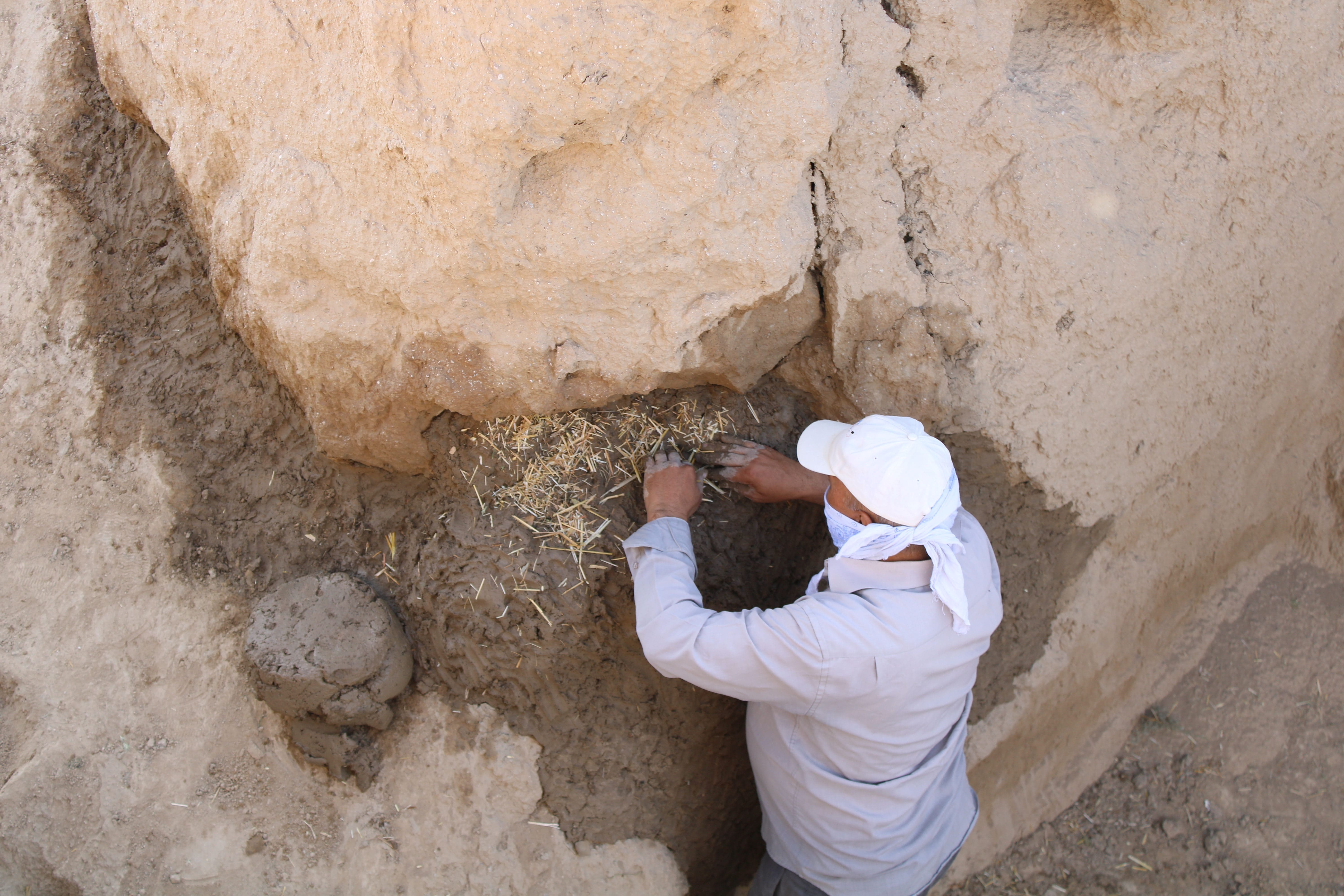
Fig. 2. The conservation activities on the Citadel focused on the most severely damaged sections of the walls displaying a high risk of complete collapse.
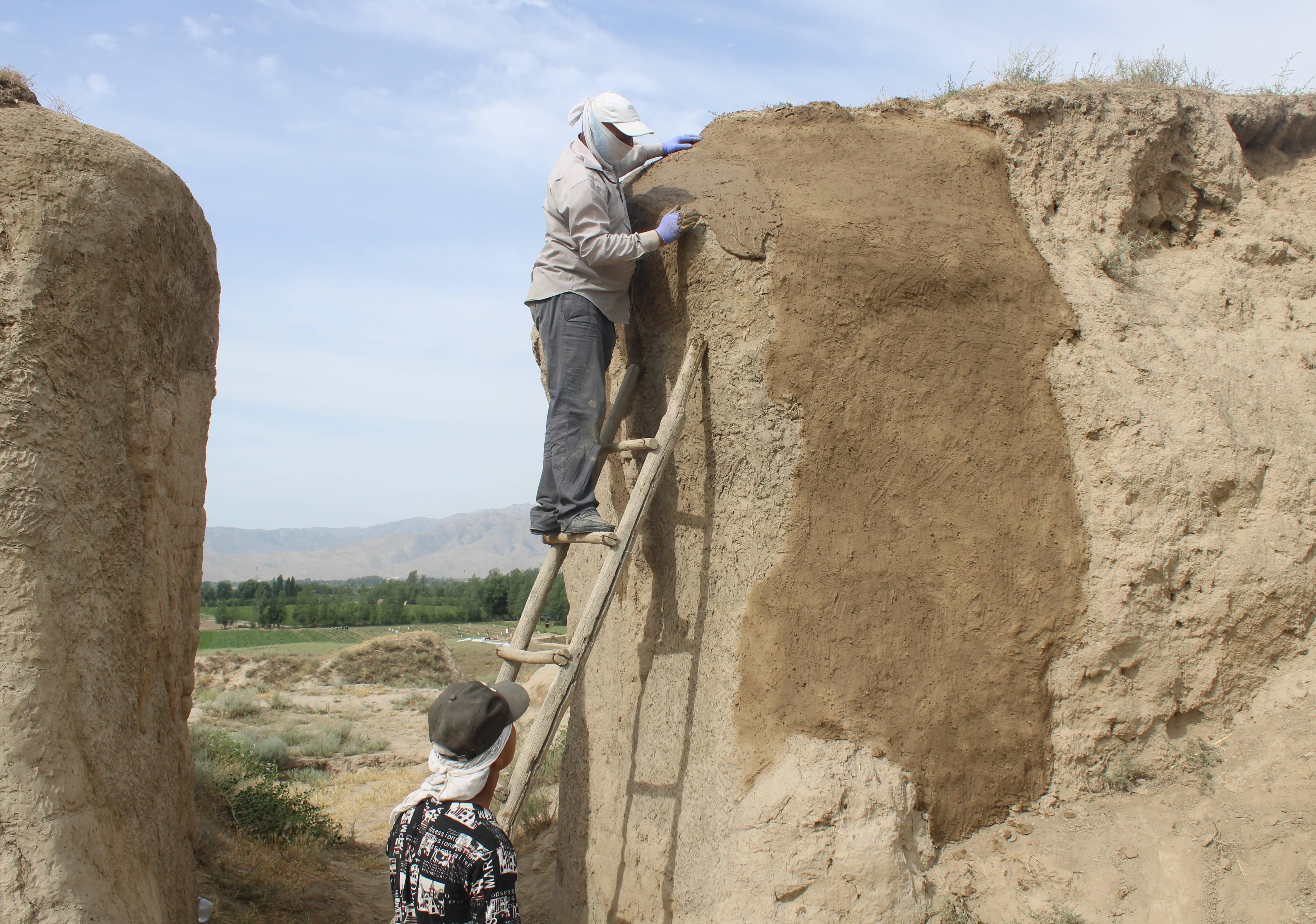
Fig. 3. A critical target of the conservation campaign has been the perimetral southern wall and the arched entrance to the Citadel.
IRAQ - QADISIYAH
Further activities within the Task 2.b "Archaeological and conservation training workshops" included in 2022 a 6 weeks-long (February 23rd-April 05th) archaeological training in Afak/Qadisiyah for 8 SBAH officials and 8 graduate students from the Universities of Qadisiyah and Baghdad. The Iraqi scholars received courses on several subjects: archaeological survey and excavation techniques, sites and damages documentation, site-detection through satellite images, use of GPS/GNSS-instruments, mapping in excavation, practical use of the Total Station and data processing using GIS-software, processing, dating and documenting archaeological artefacts. The training sessions were performed by a team of LMU archaeologists led by prof. Adelheid Otto, while an additional course of archaeological drawing was given by Dr. Manfred Lerchl at the University of Qadisiyah in Diwaniyah.
In 2023, an additional training session involved between February 26th and March 26th 8 archaeologists from the Diwaniyah Governorate: the trainees were involved in activities such as the use of GIS software and satellite imagery to map archaeological sites and their features, and the application of drones and total stations to monitor occurring damages. They participated to a magnetometer prospection and learned the basic principles and practice of pXRF (portable X-Ray Fluorescence) material analysis for archaeological purposes.
The training activities by LMU personnel in practical and theoretical archaeological methods continued in 2024: between February 16th and March 20th additional 8 trainees (both employees from the SBAH and graduate students from the University of Qadisiyah) had the opportunity to learn the use and practical application of devices such as Total Stations and GPS/GNSS for surveying, combined with database programs, remote sensing, and data and image processing in order to create three-dimensional models and topographical maps for application in the field of archaeology.
IRAQ - NINEVEH
Following the training program occurred in May-June 2022 within the framework of the Task 2.b 'Archaeological and conservation training activities’ and performed by UNIBO conservators, personnel by UOM assumed the task of preserving ancient Nineveh. The operations has been coordinated with the Investigations and Excavations Directorate of SBAH in Baghdad and the SBAH Ninawa Inspectorate.
The pilot conservation activities continued the operations undertaken during the trainings: in detail, the Adad Gate and the structures excavated by the Iraqi-Italian expedition in the area nearby since 2019 were targeted.
IRAQ - AQAR QUF
Recent conservation activities (Task 2.b "Archaeological and conservation training workshops") took place from September to November 2024 at Aqar Quf (ancient Dur-Kurigalzu), an archaeological site located north-west of Baghdad: the main target of intervention was the mudbrick ziggurat (temple on a platform) which acts as the monumental hallmark of the area.
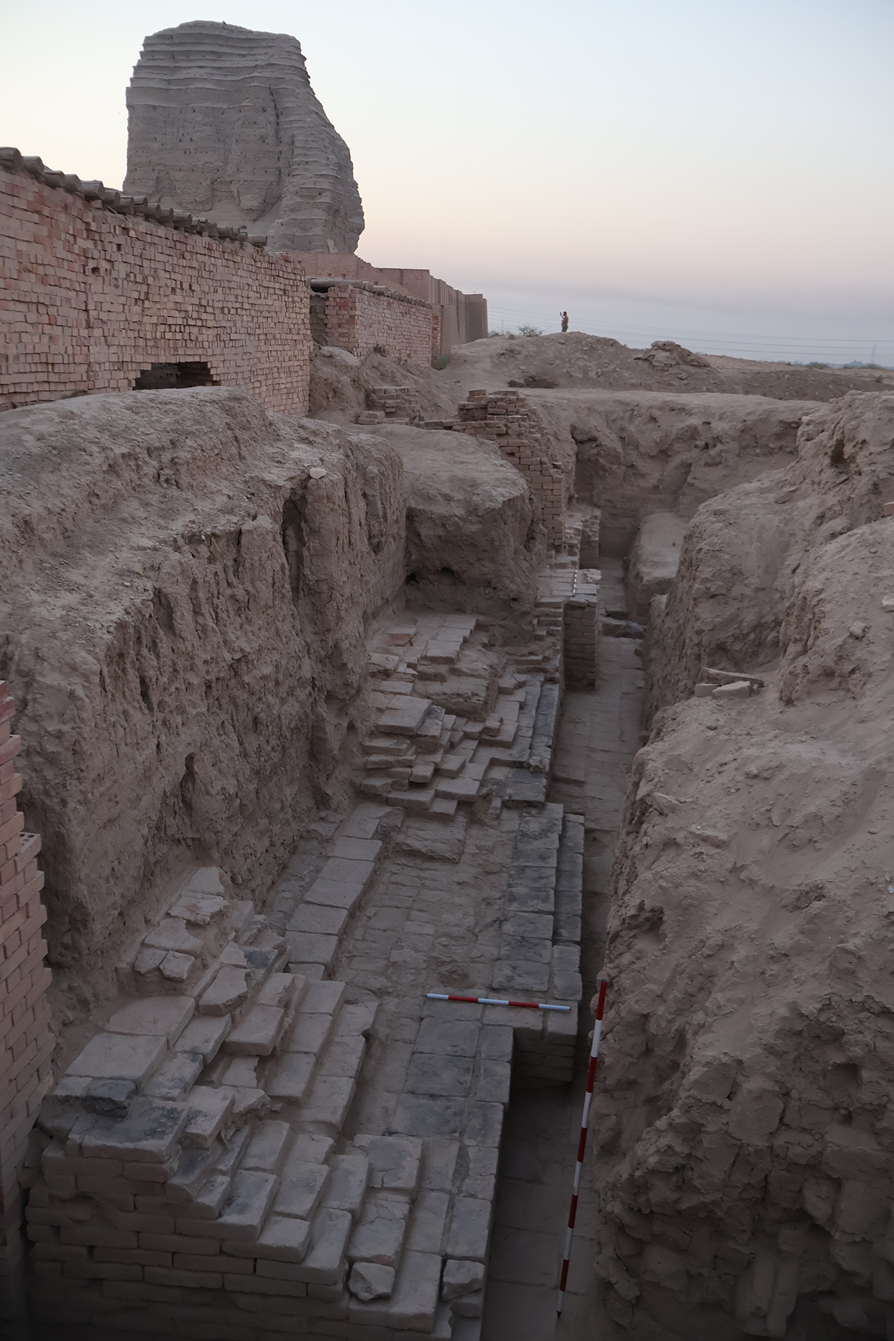
Fig. 1. Removing the debris and cleaning the structures was the first necessary activity to identify the areas where conservation was needed.
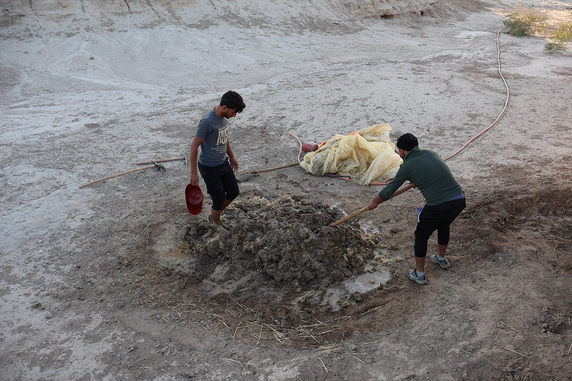
Fig. 2. The creation of mudbricks and plaster with a mixture of local clay, straws and water was firstly managed by workers from Nineveh, where comparable conservation activities were completed.
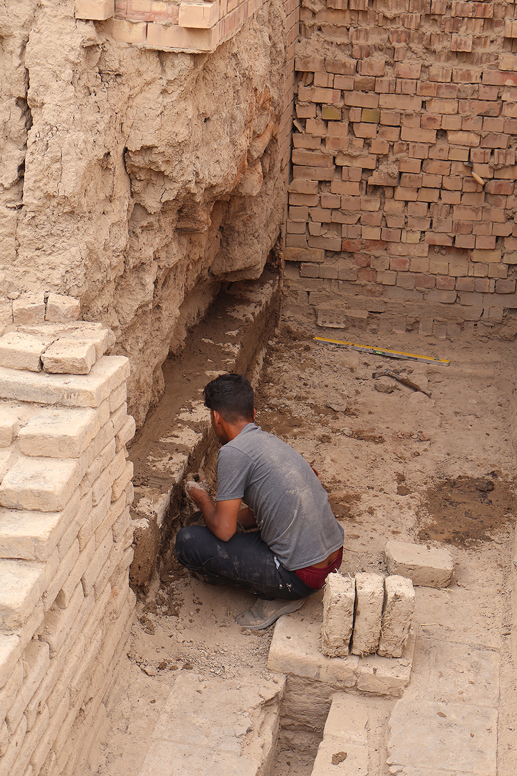
Fig. 3. The conservation action targeted the lower part of the platform, where earlier repairs and consolidation were organised by the Iraqi Antiquities and government in the 1960s-1970s.
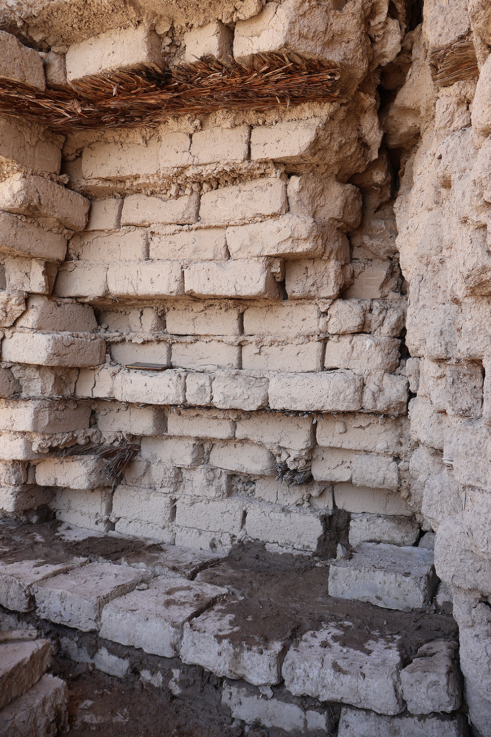
Fig. 4. The lower edges of the mudbrick tower were also strenghtened to avoid the collapse of sections of the original ziggurat.