The Project
BEDFLOW aims to evaluate fluvial dynamics along the mountain portion of the Sillaro River for pursuing sediment management that could improve stream channel quality. BEDFLOW integrates basin-scale (Actions 1 and 2) and reach-scale (Action 3) components.
Actions 1 and 2 entail multi-temporal mapping on remotely-sensed imagery (from 1950's until today), complemented by fieldwork activities. Action 3 includes bedload monitoring in two selected channel reaches.
Action 1 investigates historical channel changes in relation to natural and anthropogenic forcing.
Action 2 focuses on the compilation of a multi-temporal earthflow inventory for estimating sediment fluxes and degree of geomorphic coupling with the drainage network. It looks at how earthflow activity may have affected channel changes in the Sillaro River over the past 70 years.
Action 3 deals with stream flow and bedload monitoring, in conjunction with repeat surveys of the channel bed topography. This action aims to define hydrologic thresholds for particle entrainment at the event-scale and estimate bedload fluxes.
The Sillaro River
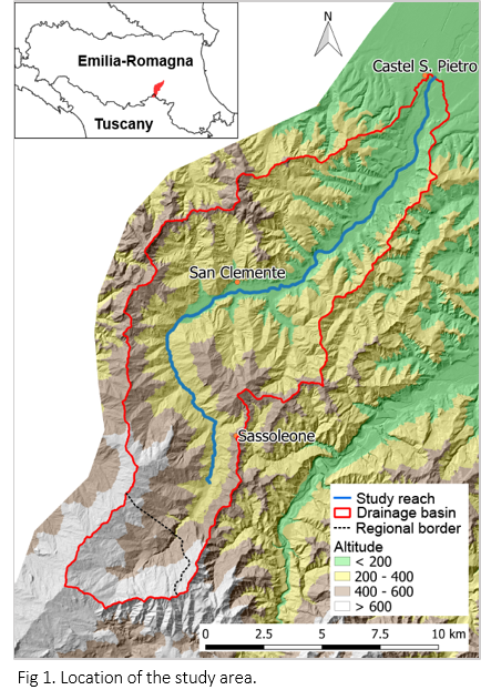
The Sillaro River, a tributary of the Reno River, is located in the Northern Apennines. It originates from Monte Tre Poggioli (966 m a.s.l.), near Piancandoli (Tuscany). The mountain basin extends for an area of 139 km2, with elevation ranging from 991 m at the divide, down to 56 m a.s.l., near Castel San Pietro Terme.
Geology is dominated by siltstones and argillites.
In the historical channel mapping, we considered the portion of the valley comprised between Tomba (394 m a.s.l.) and Castel San Pietro Terme, for a total length of about 27 km (Figure 1).