Action 2: Multi-temporal earthflow inventory
In the Sillaro river basin the predominance of argillites and siltstones of the Ligurian domain originates earthflows, that in this settings are the dominant agents of hillslope sediment transfer.
Through the compilation of a multi-temporal earthflow inventory (1954-2018), we aim to:
(i) characterize earthflow source-to-sink sedimentary pathways, with special reference to sediment delivery to ephemeral and perennial streams;
(ii) explore possible litho-topographic controls on earthflow size, frequency and recurrence;
(iii) examine historical trend of earthflow activity in relation to rainfall variability and land use changes.
Finally, the high and extended temporal resolution of the inventory, will offer the opportunity to test how relevant information could complement the existing inventory of the Emilia-Romagna region, for evaluating earthflow hazard and risk potential.
The Sillaro River Basin inventory
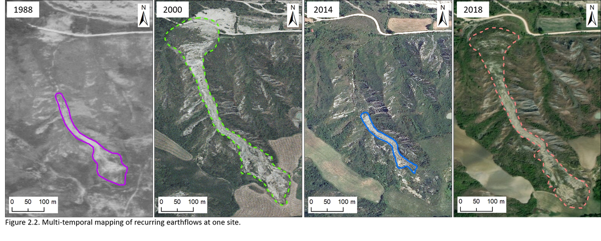
Data collection entails visual inspection of 12 sequential aerial photo sets (i.e., 1954, 1969, 1976, 1988, 1996, 2000, 2006, 2008, 2011, 2014, 2016, and 2018), through which landslides are classified and mapped in GIS environment.
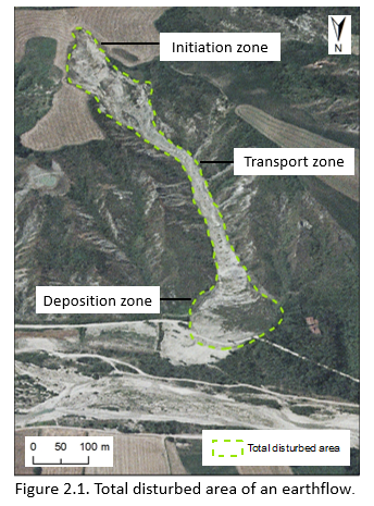
Earthflow mapping involves the delineation of the total disturbed area, which includes initiation, transport and deposition zones (Fig. 2.1).
Multi-temporal aerial photo interpretation and mapping allow depicting: (i) the pace and extent of recurring earthflows at a given site, and (ii) the degree to which the flow lobe travels all the way down to the colluvial fan, or involves only part of the tributary channel (Fig. 2.2).