Action 1: Reconstructing historical channel changes
Reconstruction of historical channel changes has been conducted through multi-temporal mapping of the active channel.
The Sillaro River has been subdivided into morphology-homogeneous channel reaches. Each channel reach has a minimum length equal to 20 times the local active channel width. This subdivision allows minimizing noise within a reach (due to variability in channel units), while maximizing heterogeneity between reaches, hence providing a valuable tool for interpreting and understanding the observed changes. Boundaries between reaches have been delineated based on critical geomorphic attributes and features to sediment supply and conveyance, including degree of lateral confinement, channel pattern, presence of confluences, and presence of anthropogenic hydraulic structures.
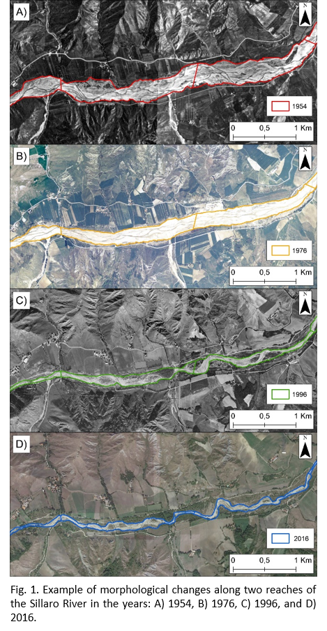
Figure 1 exemplifies some of the historical morphological changes observed in two study reaches in: A) 1954, B) 1976, C) 1996, and D) 2016.
Results show a progressive decrease of the active channel width and an increase in sinuosity. Channel pattern has changed from braided to wandering. In 1954 and 1976, note the high degree of geomorphic activity in the southern tributaries, compared to 1996 and 2016.
Average active channel width for each reach (Wi) has been calculated by dividing reach planform area (Ai) by reach mid-line length (Li).
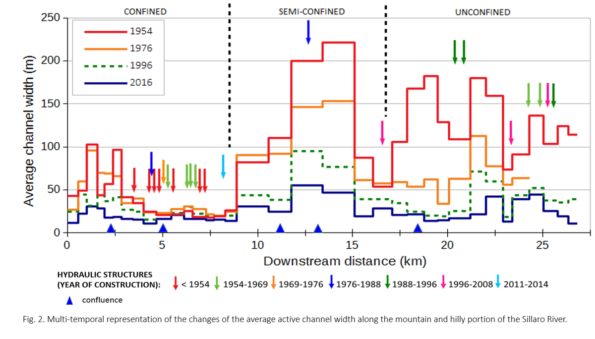
Changes of average active channel width at reach-scale are shown in Figure 2.
Note the magnitude of channel narrowing in the semi-confined zone between 1954 and 1976, and between 1976 and 1996.