

Advancing Underwater Photogrammetry: The Trieste Mission
In October 2024, as part of the MANATEE project, our research team undertook a groundbreaking underwater photogrammetry mission off the coast of Trieste. This mission represents a pivotal step forward in developing precise, non-invasive monitoring techniques for marine habitats, focusing on the Mediterranean Crustose coralline algae species Lithophyllum stictiforme.
Mission Overview
Objective: Our primary goal was to assess the capability of underwater photogrammetry to detect millimeter-scale differences in synthetic Crustose coralline algae models. Achieving this level of precision is vital for monitoring the subtle growth and degradation patterns of marine organisms—critical indicators of ecosystem health.
Setup: We deployed 3D-printed models of Lithophyllum stictiforme, simulating different growth stages, in a controlled underwater environment at a depth of 6 meters. These synthetic models provided a reliable baseline for evaluating the accuracy of our techniques.
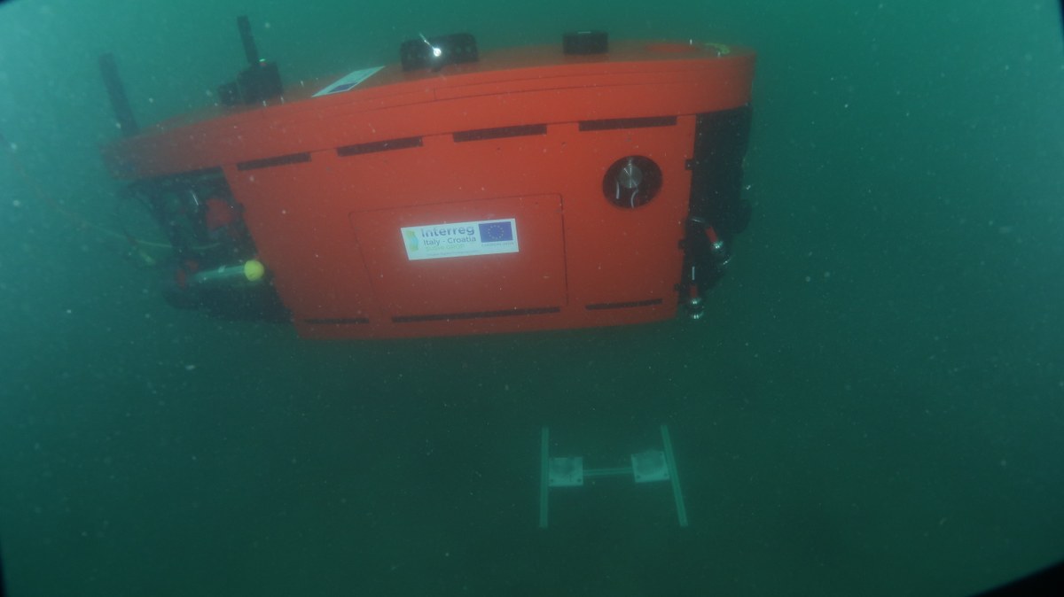
Imaging: Utilizing the Blucy Unmanned Underwater Vehicle (UUV), equipped with a high-resolution Nikon Z6 camera and advanced LED lighting, we captured high-quality imagery under varied conditions. We tested different altitudes (0.5 m and 0.8 m) and lighting scenarios to assess their impact on image quality and model reconstruction.
Processing and Analysis: Post-mission, we processed the collected data using Agisoft Metashape and CloudCompare software to reconstruct 3D models of the synthetic Crustose coralline algaes. These models were then compared to their original digital counterparts to measure discrepancies and validate the precision of our photogrammetric techniques.
Why This Matters
The Mediterranean hosts unique and biodiverse ecosystems that face increasing threats from natural and human-induced stressors. Accurate monitoring of Crustose coralline algae habitats is essential for conservation efforts. The Trieste mission demonstrates how advanced geomatics technologies, such as underwater photogrammetry, can provide high-resolution, reliable data critical for informed decision-making.
What’s Next?
The results from this mission pave the way for further development of our methodologies. Future updates will delve deeper into the tools, techniques, and outcomes, including how the Blucy UUV was optimized for underwater imaging and the results of our 3D model analyses.
Stay tuned as we continue to unveil the exciting progress of the MANATEE project, driving innovations in marine habitat monitoring and restoration.
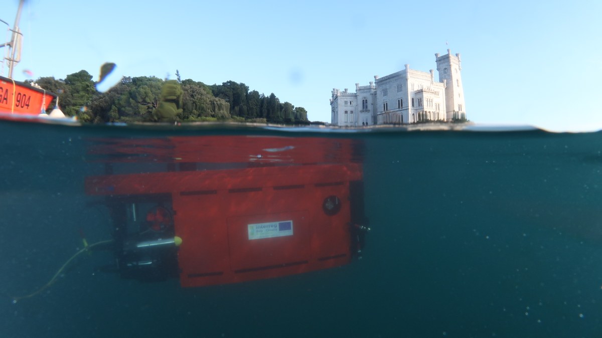
As part of the MANATEE project, the Blucy Unmanned Underwater Vehicle (UUV) played a central role in advancing underwater photogrammetry during our Trieste mission. This hybrid ROV/AUV system was instrumental in capturing high-resolution images of synthetic Crustose coralline algae models, pushing the boundaries of millimeter-scale precision underwater.
Blucy’s Advanced Capabilities
Imaging Procedure Highlights
During the mission, Blucy captured imagery at altitudes of 0.5 m and 0.8 m under two lighting conditions—lights on and lights off. These combinations allowed us to evaluate the impact of altitude and illumination on the accuracy of photogrammetric reconstructions. Scuba divers assisted with the placement of the models and guided Blucy in low-visibility conditions, ensuring precise imaging of each synthetic Crustose coralline algae.
What We Learned
The Blucy UUV proved highly effective in achieving millimeter-scale accuracy, as verified through 3D model reconstructions and comparative analyses. We found that lower altitudes and artificial lighting significantly enhance precision, underscoring the importance of proximity and controlled illumination in underwater photogrammetry.
Broader Implications
Blucy’s successful performance in the Trieste mission highlights its potential for various applications, including:
Looking Ahead
The insights gained from using Blucy during the Trieste mission will inform future deployments in more complex environments, such as Costa Paradiso in Sardinia, scheduled for January 2025. These missions will further test Blucy’s capabilities and refine its integration with geomatics technologies for ecological monitoring.