Blucy UUV (Unmanned Underwater Vehicle)

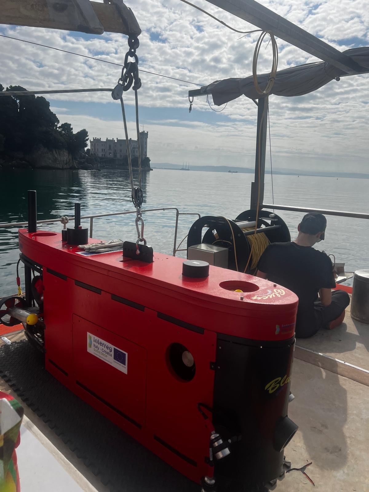
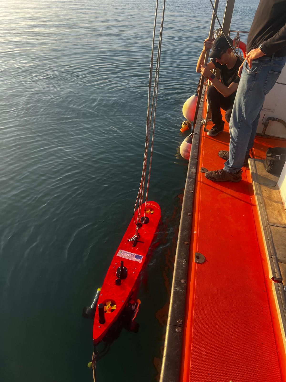
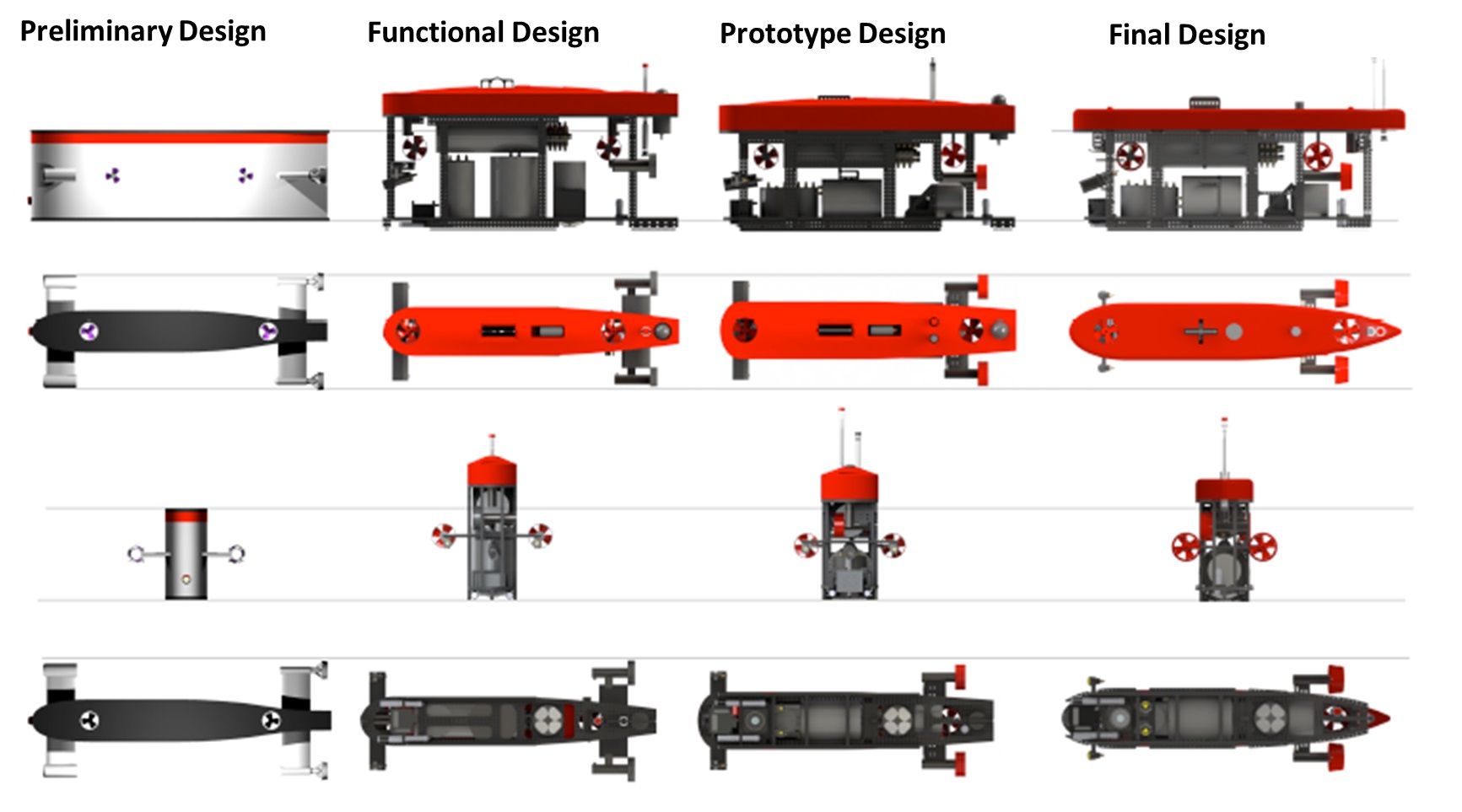
Introducing Blucy: Pioneering Underwater Exploration in the MANATEE Project

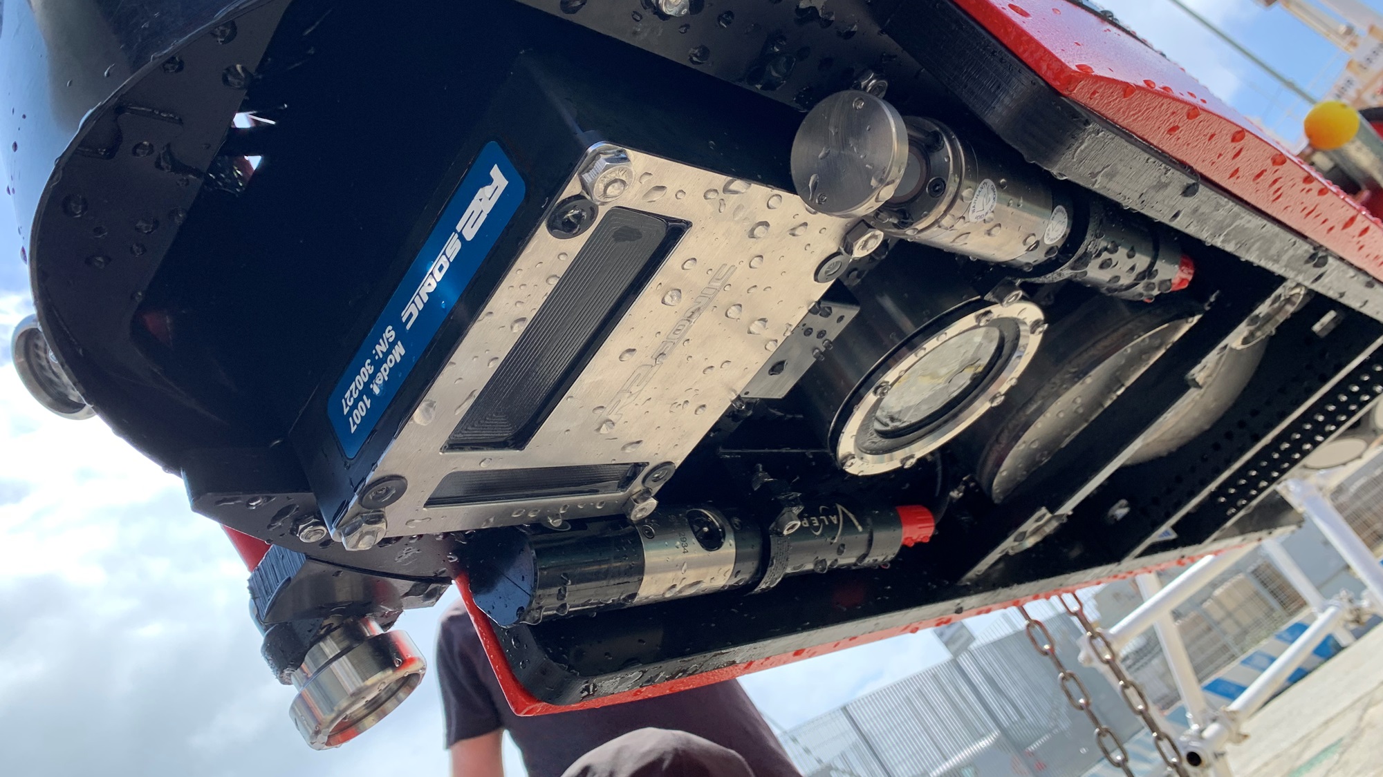
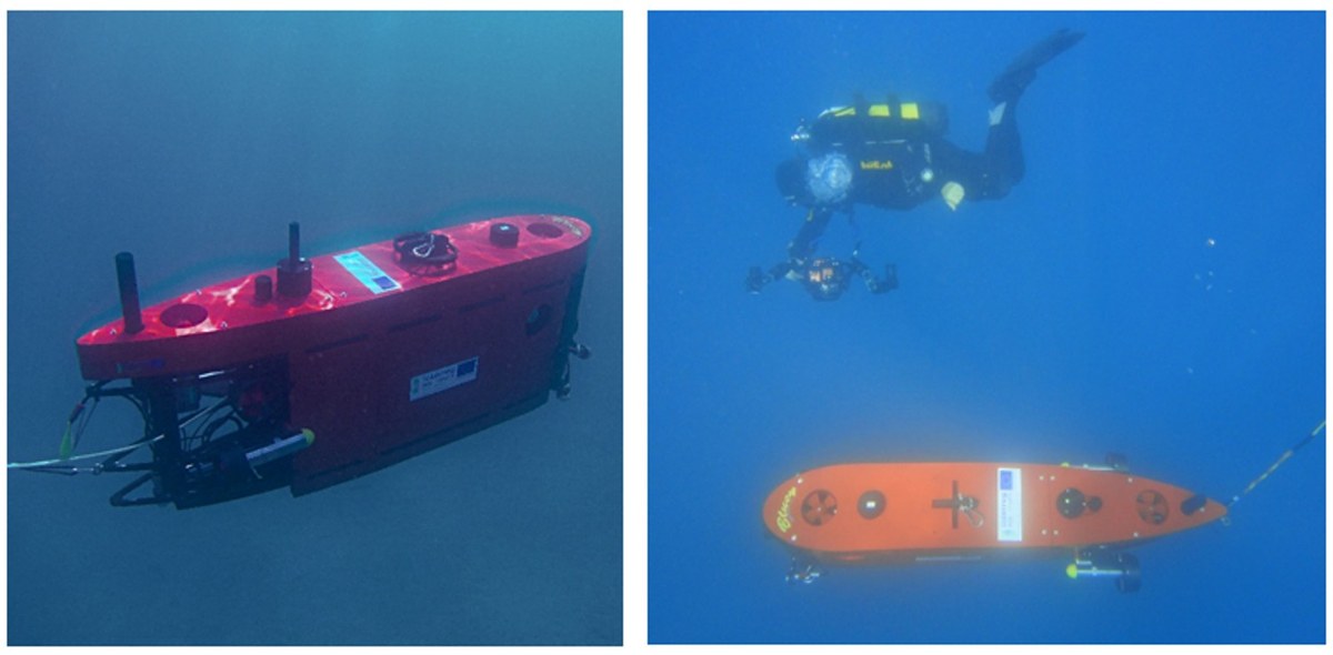
We are thrilled to present Blucy, our state-of-the-art hybrid Unmanned Underwater Vehicle (UUV) that is instrumental in advancing the objectives of the MANATEE project. Blucy embodies the fusion of cutting-edge technology and innovative design, enhancing our capability to monitor and map marine habitats with unprecedented precision.

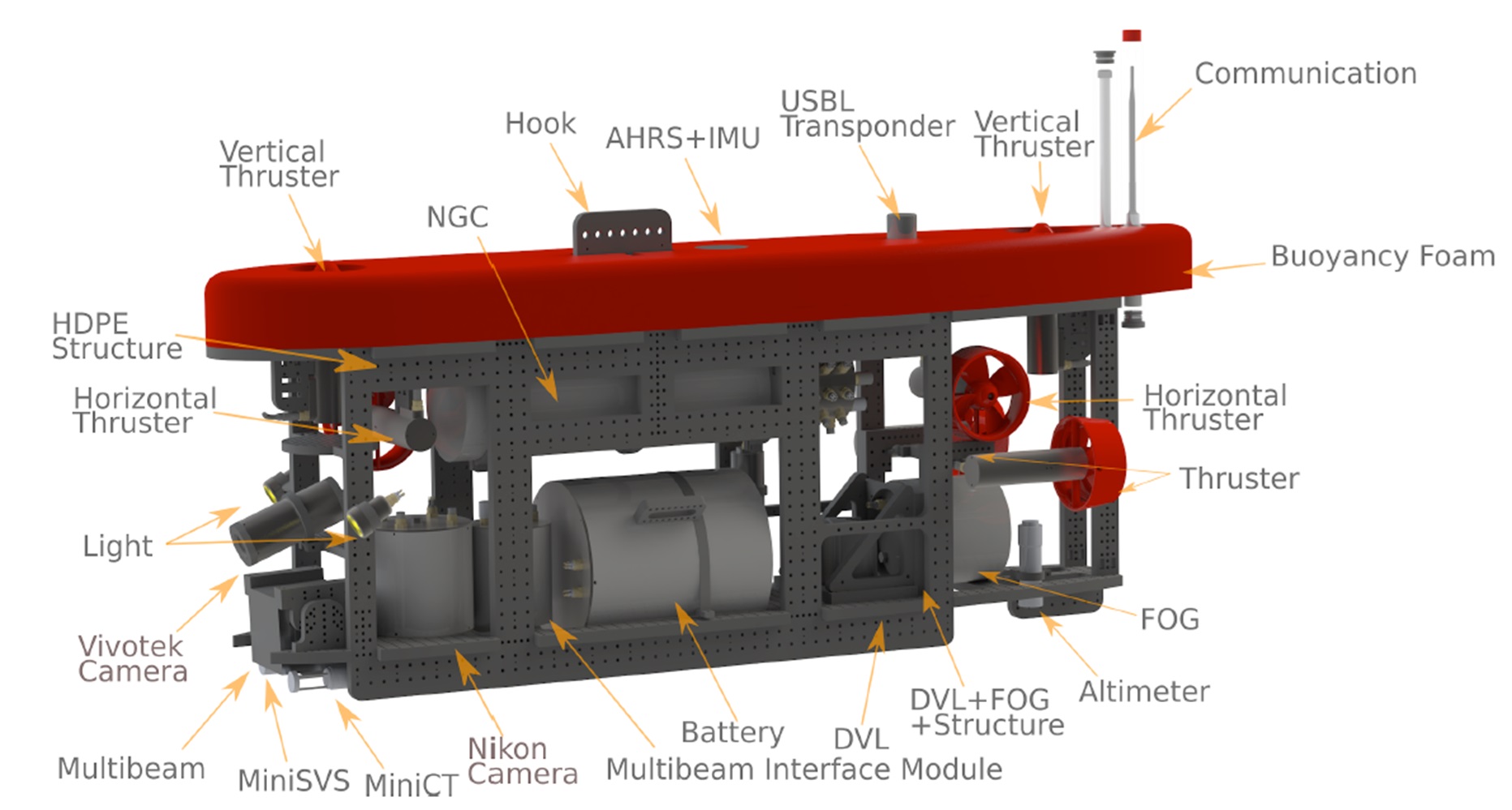
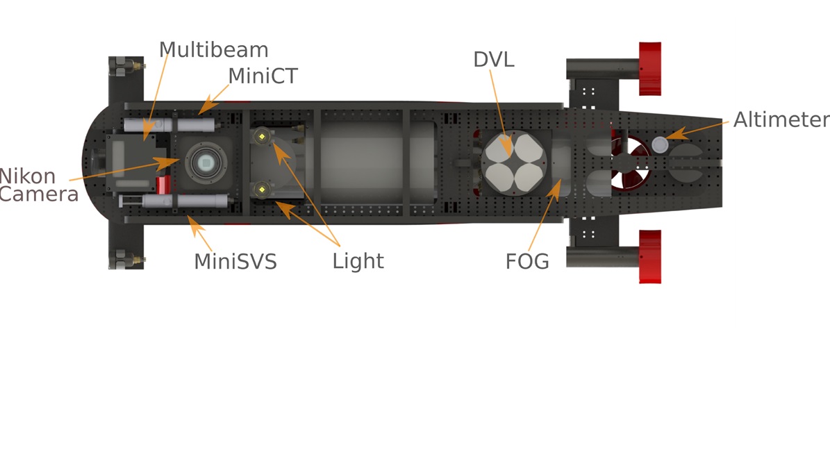
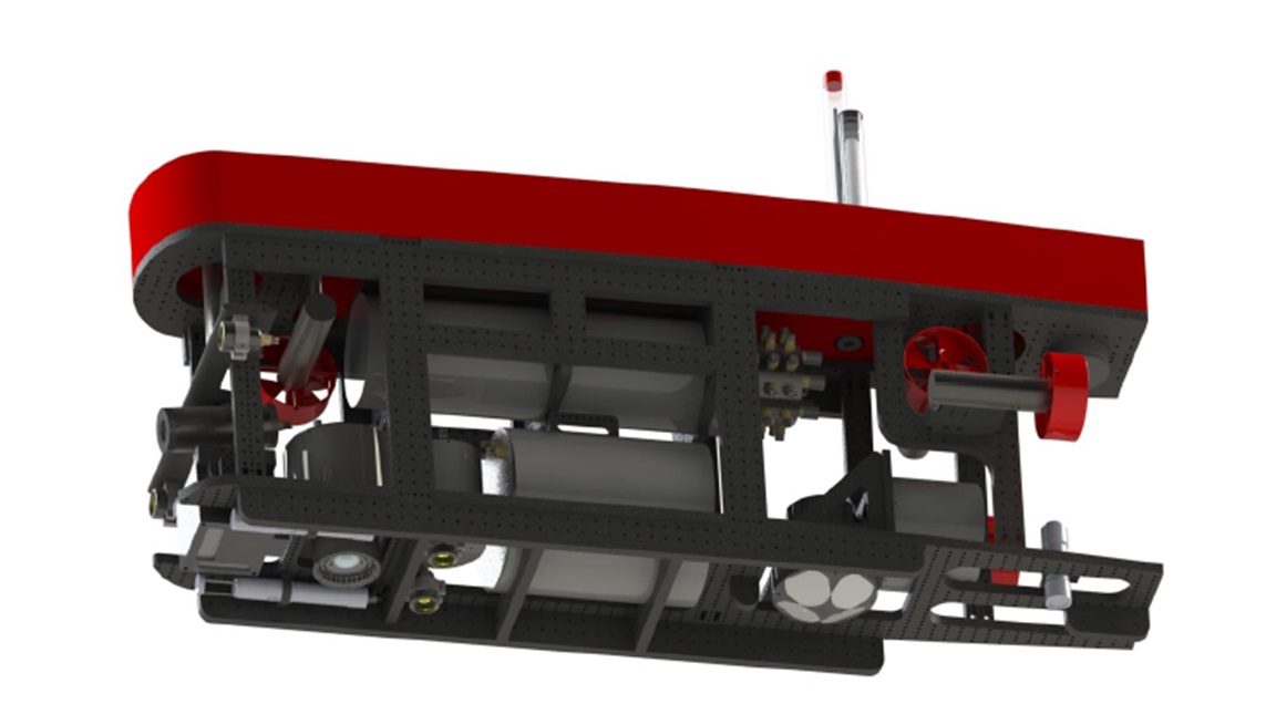
Key Features of Blucy

  • Dual Operational Modes
    • Remotely Operated Vehicle (ROV) Mode: Allows for direct human control, enabling real-time decision-making during missions.
    • Autonomous Underwater Vehicle (AUV) Mode: Executes pre-programmed missions autonomously, ideal for extensive data collection without constant human intervention.
  • Exceptional Performance
    • Depth Capability: Operates efficiently at depths of up to 300 meters, accessing a wide range of underwater environments.
    • Operational Endurance: Offers up to 6 hours of continuous operation, suitable for prolonged missions.
  • Advanced Instrumentation
    • Navigation Systems: Equipped with a Fiber Optic Gyroscope (FOG iXblue) and a Doppler Velocity Log (DVL), ensuring precise navigation and stable positioning even in challenging underwater conditions.
    • Environmental Sensors: Includes a MiniCT sensor for accurate measurement of conductivity and temperature, contributing valuable data for oceanographic studies.
    • Imaging Systems:
      • Pilot Camera: Facilitates real-time navigation and obstacle avoidance.
      • Bottom Camera (Nikon Z6): Captures high-resolution images for detailed 3D seabed mapping and photogrammetry.
  • Data Processing and Management
    • Embedded Computational Platform (ECP): Processes data in real-time, enabling immediate analysis and decision-making.
    • Open-Access GIS Repository: Organizes and stores survey data in a GIS-based system, promoting transparency and collaboration by making data accessible to researchers and the public.

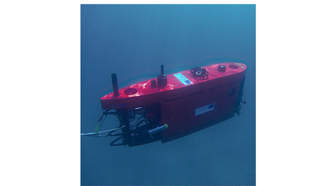
Blucy's Role in the MANATEE Project

Blucy significantly enhances our ability to achieve the MANATEE project's mission of preserving and restoring marine biodiversity:

  • Marine Habitat Mapping: Utilizes high-resolution imaging and precise navigation to create detailed 3D models of marine habitats, essential for monitoring ecological changes and planning restoration efforts.
  • Environmental Monitoring: Collects vital environmental data, aiding in the assessment of water quality and habitat conditions.
  • Technological Innovation: Serves as a platform for developing and testing new methodologies in underwater geomatics, contributing to advancements in marine science and technology.

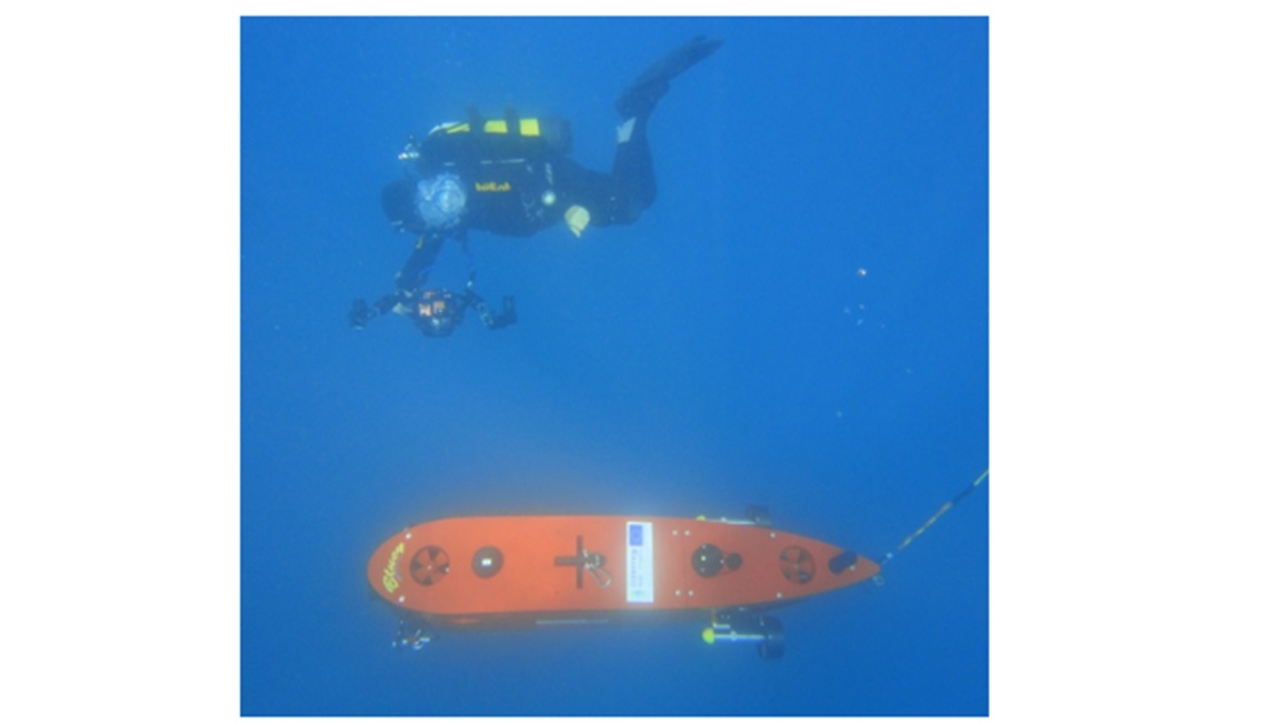
Impact and Future Prospects

The integration of Blucy into our research arsenal opens new horizons:

  • Enhanced Research Capabilities: Provides researchers with high-quality data and imagery, fostering a deeper understanding of marine ecosystems.
  • Conservation Efforts: Supports evidence-based strategies for habitat conservation and restoration, helping to safeguard marine biodiversity.
  • Educational Outreach: Generates engaging content for educational programs, raising awareness about marine environments and the importance of their preservation.


Album

Blucy during the mission
Blucy components
view from the bottom
Blucy design phases
Side view of the Blucy
Blucy during the mission
Blucy view from the bottom