BlueROV2 (Remotely Operated Vehicle)

BlueROV2: A Versatile Platform for Marine Habitat Monitoring

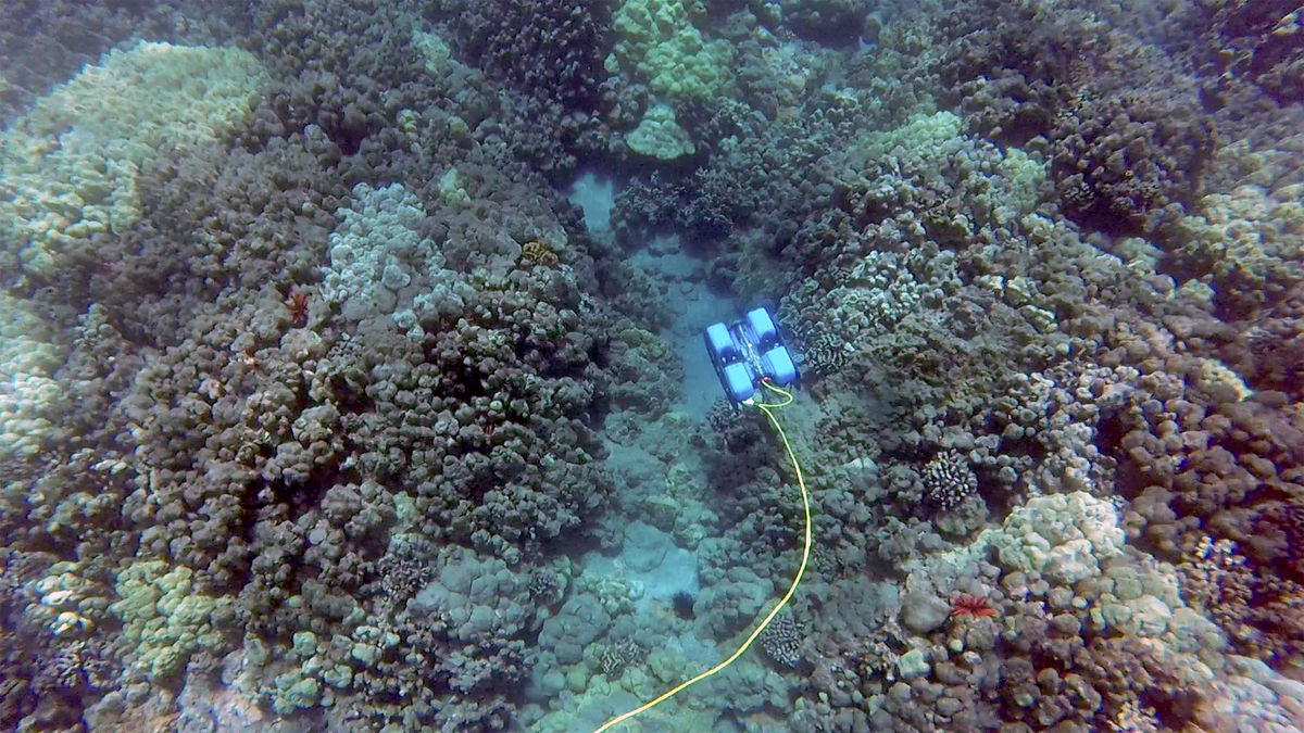
The BlueROV2, a Remotely Operated Vehicle (ROV) developed by Blue Robotics, plays a pivotal role in the MANATEE project's mission to advance marine habitat monitoring technologies. Known for its adaptability, precision, and ease of use, the BlueROV2 is an ideal platform for a wide range of underwater research activities.

Technical Features

  • Depth Rating: Capable of operating at depths up to 100 meters, suitable for a variety of marine environments.
  • High-Resolution Imaging: Equipped with a high-definition camera for capturing detailed underwater imagery, essential for photogrammetry and habitat mapping.
  • Modular Design: The BlueROV2's open-frame structure allows for the integration of additional sensors, such as:
    • Acoustic Sensors for precise navigation and mapping.
    • Lighting Systems for enhanced visibility in low-light conditions.
    • Environmental Sensors for monitoring parameters like temperature and salinity.
  • Thruster System: Features six vectored thrusters for precise maneuvering, enabling stable data collection in dynamic underwater environments.

Applications in the MANATEE Project

As part of the MANATEE project, the BlueROV2 is employed in:

  • Detailed Mapping: Creating high-resolution 3D models of marine habitats using photogrammetry techniques.
  • Marine Habitat Monitoring: Supporting studies on the growth and degradation of key habitats, such as Lithophyllum stictiforme formations.
  • Data Collection: Facilitating multitemporal analysis by revisiting and monitoring specific sites over time.

Customization for the MANATEE Project

To meet the specific needs of the project, the BlueROV2 has been adapted with:

  • Advanced Positioning Systems: Integration of USBL technology for accurate georeferencing of collected data.
  • Enhanced Imaging Capabilities: Addition of stereoscopic cameras for precise 3D reconstructions.
  • Improved Mobility: Modified thruster configurations to ensure stability during delicate surveys.

Why BlueROV2?

The BlueROV2 was chosen for its balance of performance, affordability, and flexibility. Its modularity allows it to adapt to diverse research needs, making it an invaluable tool for the MANATEE project's goal of advancing marine geomatics technologies.