

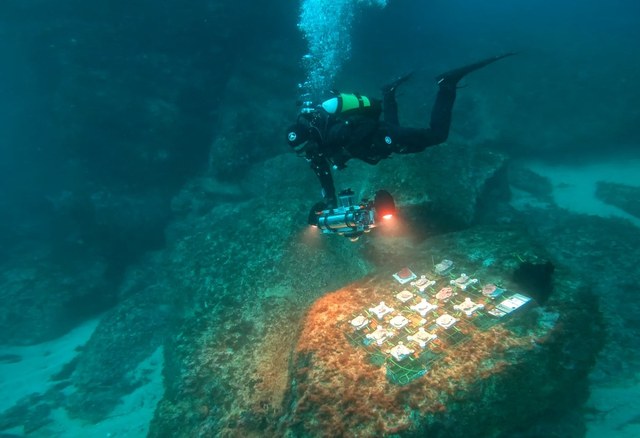
The MANATEE project is pioneering advanced, non-invasive methods to monitor and map marine habitats using integrated geomatics technologies. By combining underwater photogrammetry with precise positioning and navigation systems—including acoustic, pressure, and inertial sensors—we create detailed three-dimensional models of underwater environments.
Utilizing a variety of underwater platforms such as Uncrewed Underwater Vehicles (UUVs), Remotely Operated Vehicles (ROVs), and innovative 3D Survey Devices for Divers, we aim to:
- Map and Monitor Marine Habitats: Provide high-resolution data to understand habitat health and evolution.
- Aid in Habitat Restoration: Offer critical insights for restoring vital marine ecosystems.
- Raise Environmental Awareness: Share our findings with the public and academic institutions to promote marine conservation.
Our focus includes studying key habitat-forming species like the encrusting coralline algae Lithophyllum stictiforme, enhancing our understanding of marine biodiversity.
Dive into the world of marine science and technology with MANATEE. During the European Researchers’ Night 2025 — held in Sassari and Naples — our team brought the sea to life with immersive 3D models, virtual reality experiences, and underwater drones like Blucy and ROV2. Explore the systems that let us map marine habitats with millimeter precision, understand human impacts, and make the invisible visible. Watch the full clip and join us in protecting the oceans through innovation and research.
The European Researchers’ Night is back at the Eugenio Tavolara Pavilion!
The MANATEE project will be at Stand 9 – Department of Humanities and Social Sciences (DUMAS) with an immersive journey into the blue, where science meets technology:
🔹 A dive into the blue, discovering the coralligenous: geomatics and virtual reality in the MANATEE project
📅 When
Thursday, September 25th – 09:30
Friday, September 26th – 11:10
Friday, September 26th – 19:30
📍 Where
Eugenio Tavolara Pavilion, Via Eugenio Tavolara – Sassari
👉 Stand 9 – DUMAS, University of Sassari
🌊 An immersive experience to explore and protect marine ecosystems through research, innovation, and virtual reality.


