Case Studies

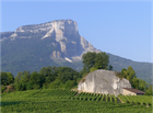
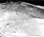
The 1248 Mont Granier Mega landslide
The 1248 Mont Granier (France) gigantic landslide, which buried several settlements and a number of hamlets under 350 million cubic metres of rock debris in the Chambéry-Montmélian valley north of Grenoble, Savoy is possibly the largest historic landslide to have occurred in Europe.The case study examines the landslide-affected river floor at the foot of the Mont Granier around the affected -but not buried and completely destroyed- sites of Les Marches and Myans.

The 1348 Carinthia and Friuli earthquake
The 1348 Carinthia and Friuli earthquake (Italy, Austria, Slovenia) represents the most severe seismic event affecting the eastern Alps in the last two millennia and episodes of environmental degradation (landslide and rockfalls) and structural destruction from the inner Alps (Villach, Arnodlstein and other settlements in norther Friuli, among the others) down the northern Adriatic coast (Aquileia). This case study focuses on the epicentral area of the earthquake, i.e. the bordering Alpine regions of Carnia (Italy), the Gail Valley (Austria) and north-western Slovenia.

The 1421 St Elizabeth’s mega flood (Netherlands)
The 1421 St Elizabeth’s mega flood (Netherlands), which flooded a vast portion of Holland and Brabant, affected a densely populated area after a breach of North Sea levees. Triggering a diversion and avulsion process of the Rheine-Meuse delta, the disaster caused the irreversible inundation of large inland regions, some of which remain under water today. This case study focuses on the region of Dordrecht and the area of the Biesbosch National Park in the Netherlands, a geographical sector which combines reclaimed lands with areas irreversibly inundated by the 1421 flood.