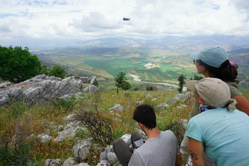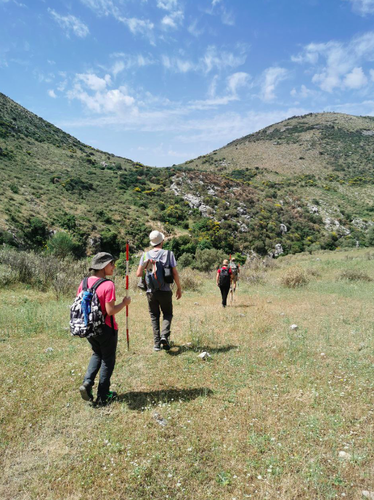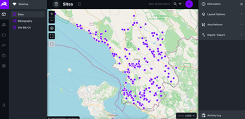
The research project focuses on the use of non-invasive methodologies, combined with the sampling of surface ceramic material, according to the most widespread operational practice in traditional topographical and archaeological surveys. Field campaigns are aimed at obtaining new data about the sites by field-walling and remote sensing surveys, both terrestrial and airborne (drone). The approach to be adopted includes the analysis of historical cartography and archival aerial photographic images (e.g. those available in the historical archive of the Italian Military Geographical Institute); GNSS positioning and the completion of new plano-altimetric topographical surveys at a scale of 1:100 for each site, using imagery obtained from UAVs and photogrammetric models for documenting the elevations of significant portions (by state of conservation and/or construction elements) of the fortifications; acquisition, restitution and interpretation of multispectral images and LiDAR scans by UAVs; high resolution geophysical surveys with fluxgate differential magnetometry and optical pumping, GPR with different frequencies, ERT and electromagnetometry for sites or portions of sites that have sufficiently flat areas and relevant underground levels.

The sites undergoing analytical analysis will also be subjected to intensive archaeological surface survey, with the dual purpose of supporting and completing the photogrammetric survey and collecting a sampling of archaeological material, for a better and more precise chronological definition and, possibly, for a greater qualification of the identified topographic units (domestic spaces, warehouses, production areas, etc.). Considering that, apart from a few exceptions, most of the sites are completely unknown to the international archaeological literature, this quantitative information obtained from sampling the surface archaeological material, although characterised by “low definition” and not strictly linked to stratigraphic sequences, is fundamental for their historical and archaeological contextualisation. For a quicker but highly reliable documentation of the archaeological material collected, the purchase and use of specific optical (laser-based) scanning instruments for the graphic documentation of the profiles is envisaged.
The field survey provides for a phase of documentation and study of the defensive systems, with a precise focus on the constitutive morphological elements and the relationship of the enceintes with geomorphology, materials, and building techniques (extraction and building), in the light of broader comparison with similar studies on a Mediterranean scale. The typology of masonry, even considering the important limits highlighted by scholars, often continues to be the only element available to understand these structures, especially when minor sites are taken into consideration. Such an approach will be essential to set up a new atlas of the ancient building techniques employed in the region.

From its earliest stages, the project will be equipped with a Web-based information system organised on relational databases managed through the BraDypUS software, specifically developed for archaeological needs and continuously maintained and renewed since 2008. Thanks to a research agreement between the LAD, that is the Laboratory of Digital Archeology at Sapienza University (https://lad.saras.uniroma1.it) and the GARR Consortium, a cloud-based infrastructure of very high availability and performance is guaranteed in order to manage research data. The online database will be the main meeting hub between the various teams animating the project and the concrete place where it will be possible to carry out the integrated analysis of data collected by the various units. Part of this infrastructure will be available to the local authorities responsible for the management of cultural heritage, who will be able to use the data collected on the field in a profitable way and in real time, also for protection and of cultural development.