Homepage

Environmental Remote Sensing Platform
The Environmental Remote Sensing Platform aims at collecting projects and papers related to remote sensing environmental studies performed by the Alma Mater Studiorum University of Bologna. This is a inter-departmental and multidisciplinary platform.
People
Go to page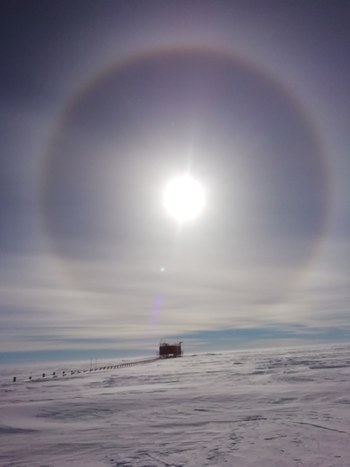
Identify and classify the Antarctic clouds
The Antarctic continent is a key place for the comprehension of climate change in which clouds play a fundamental role by interacting with both solar and terrestrial radiation. A study conducted by the Alma Mater and INO-CNR describes an innovative machine learning cloud identification and classification method exploiting IR remote sensing data.
Go to page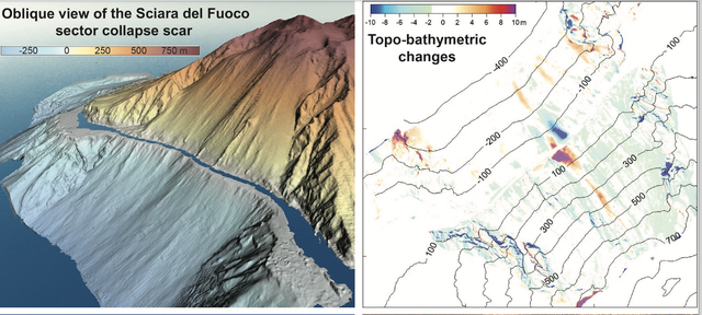
Monitoring of active volcanic areas through integrated remote sensing observations
The integrated analysis of multitemporal, multisensor remote sensing data in volcanic areas experiencing rapid geomorphological changes provides insights on the role of endogenous and exogenous processes in the observed active dynamics. The monitoring of morphologic evolution and volcanic dynamics at Stromboli Island involves researchers from various institutions (INGV, OGS, CNR, Universities of Roma Sapienza, Bologna Alma Mater and Firenze) and has important implications on the understanding of active phenomena and related geohazard.
Go to page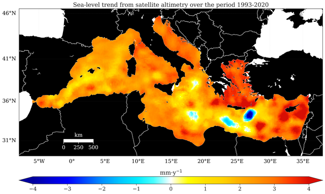
Assessing Sea-Level Change Over Different Spatial and Temporal Scales
The growing concern about sea-level rise due to climate change has led to an increasing need for understanding the complex processes underlying this issue, particularly for coastal communities. To address this, satellite altimetry, in conjunction with in-situ measurements, has provided an unprecedentedly detailed view of sea-level variability across the oceans since the early 1990s. Our goal is to shed light on all the components that influence sea-level variability, from basin scale (such as the Mediterranean Sea), sub-basin scale (e.g., the Adriatic Sea) to the local scale (like the Italian coastlines).
Matteo Meli, Claudia Romagnoli, Beatrice Giambastiani, Federica Costantini, Laura Pezzolesi, Riccardo Bentivogli, Alessandro Piazza, Sonia Silvestri
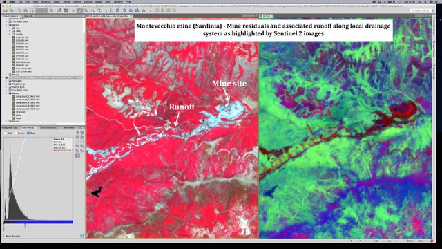
Remote sensing, mineral resources, circular economy
This project involves researchers from ENEA and from the Universities of Bologna and Cagliari, the ASI, and the Italian company Planetek. It aims at identifying secondary mineral resources and monitor the associated environmental risks. To this end, we plan a combined analysis of hyperspectral images and multi-resolution and multi-scale data collected in-situ.
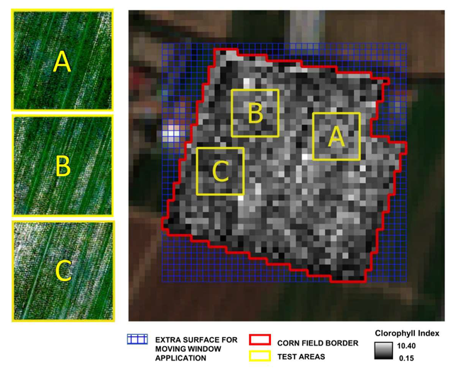
Crops and bare soil monitoring through satellite and proximity data
The growing need for sustainable management of crops and bare soils requires an analysis at multiple time-space scales based on increasingly accurate data. In this context, proximal and satellite remote sensing data integration can be a good practice for the present and future. The study purpose is to develop a protocol based on a statistical comparison between Sentinel-2 data and multispectral data acquired by a sensor mounted on a drone featuring spectral deployment identical to Sentinel-2.
Go to page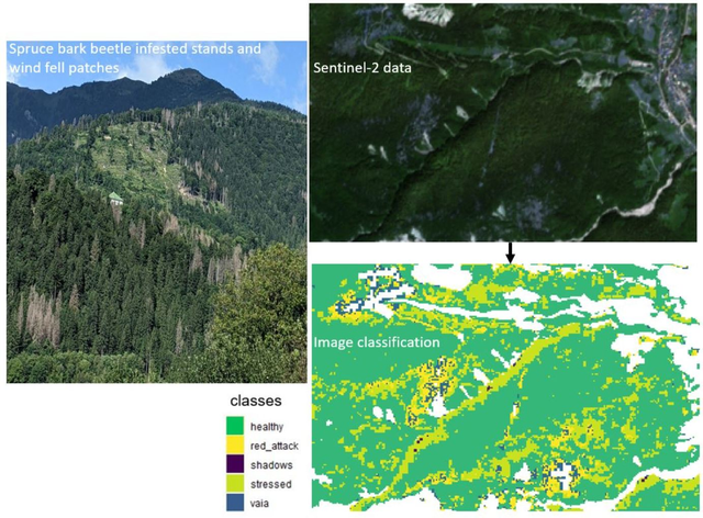
Bark beetle early detection and damage mapping
The occurrence of extreme windstorms and increasing heat and drought events induced by climate change leads to severe damage and stress in coniferous forests, making trees more vulnerable to spruce bark beetle infestations. A study by the Alma Mater and the Free University of Bolzano aims to implement a monitoring framework for the early detection of vulnerable plots and to map the causes of forest damage.
Go to page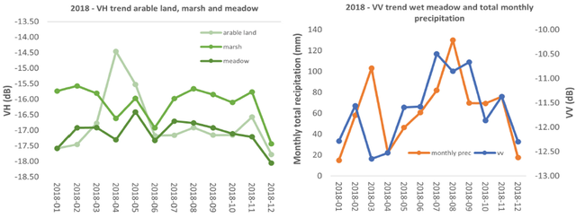
SAR data for wetlands monitoring
Wetlands ecosystems support a significant percentage of the world’s biodiversity and provide many ecological services like carbon sequestration. This Alma Mater study tests satellite instruments and methods for monitoring the health state of these fragile ecosystems. The aim is to better understand their ecological dynamics, their internal transformations, and the impacts of climate change.
Go to page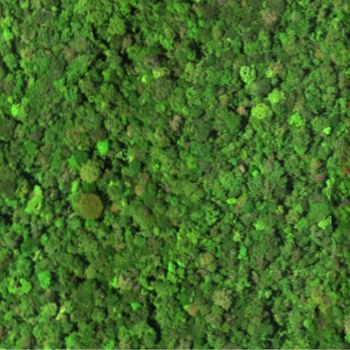
Spectal species from space
Monitoring biodiversity from space can now be faced by the use of spectral species from space, related to the spectral signature of single plants, seen by satellites.
A new study from Alma Mater University of Bologna describes them in detail-
Monitoring tropical forests from space
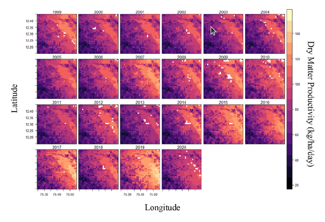
Tropical forest ecosystems are among the most essential habitats on Earth for conserving biological diversity and short-term climate regulation. A study in the Indian Western Ghats demonstrates the power of remote sensing on primary productivity and forest cover
dynamics.
The thrid dimension from space, indeed!
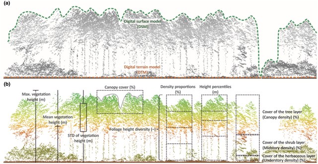
Ecosystem structure, especially vertical vegetation structure, is one of the six essential biodiversity variable classes and is an important aspect of habitat heterogeneity, affecting species distributions and diversity by providing shelter, foraging, and nesting sites. In this study, we propose environmental variables that should be easily accessible
to researchers and stakeholders through remote sensing.
Coastal Wetlands: Importance in Monitoring and Mitigating Greenhouse Gas Emissions
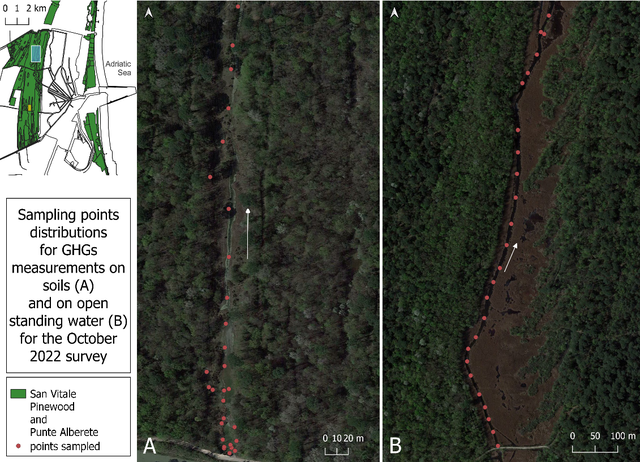
Coastal wetlands have an important role in mitigating climate change, including sequestering carbon and protecting the coast from severe weather events. However, they are also major emitters of greenhouse gases, and their functioning is closely linked to hydroperiods, making them vulnerable to climate change impacts. This study will investigate how climate change factors like salinity, temperature, and hydrological patterns affect greenhouse gas emissions. The research will use field observations and Synthetic Aperture Radar (SAR) data, including Sentinel-1 and COSMO-SkyMed data, to monitor flooding and hydrological patterns.
Go to page