

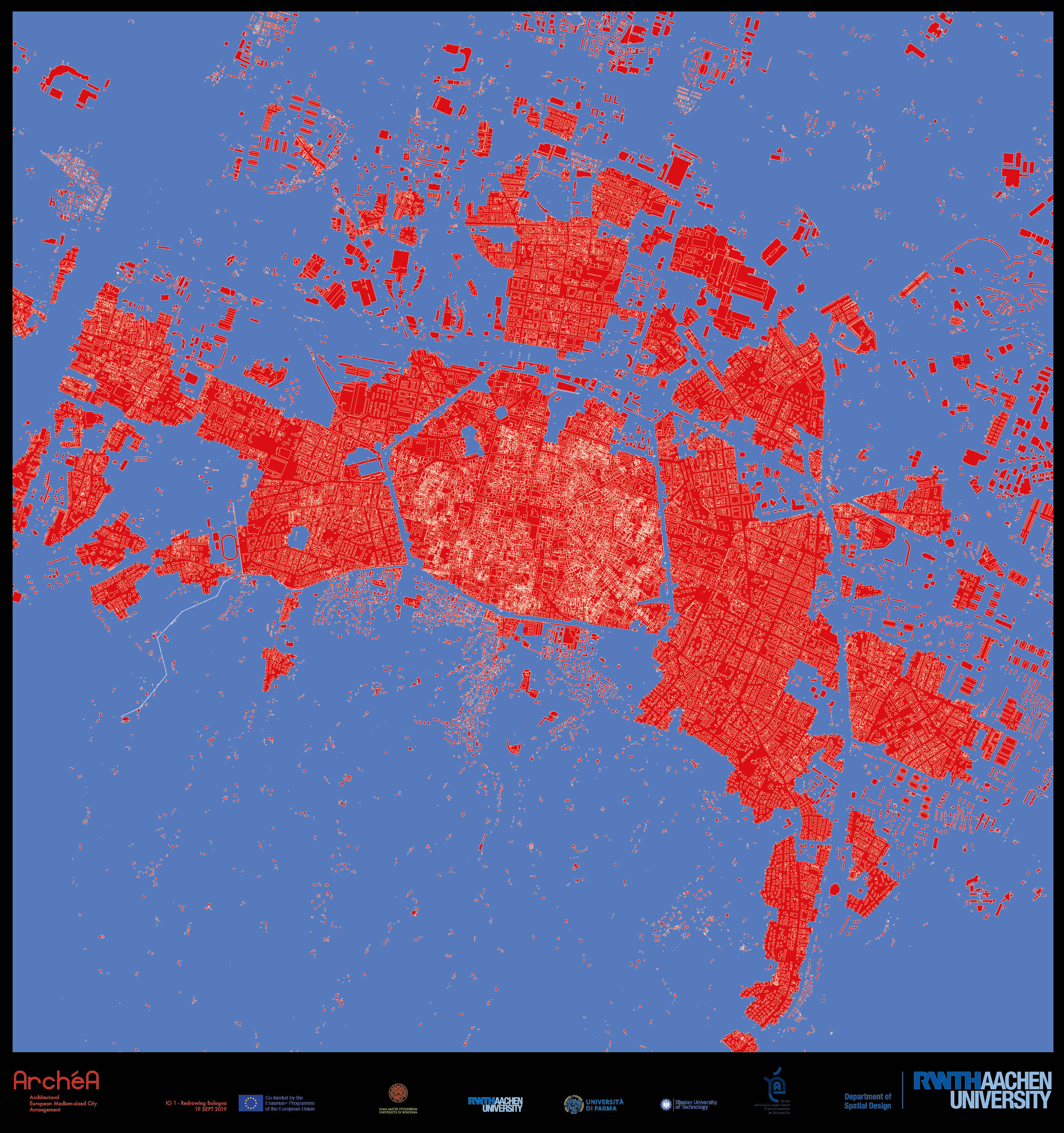
Panel I. City and Landscape
Scale 1 : 10.000
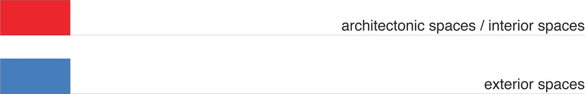
Architectonic spaces, that is to say interior spaces that are derived from the architectural boundaries of walls, and which appear as such by virtue of their proportions are in principle represented in red as ‚warm‘ spaces. Outer spaces, whether linked to landscapes or urban structures, and which by virtue of their breadth, openness and emptiness do not constitute architectonic spatial formations, appear as fields and are in principle represented as ‚cold‘ spaces in blue.
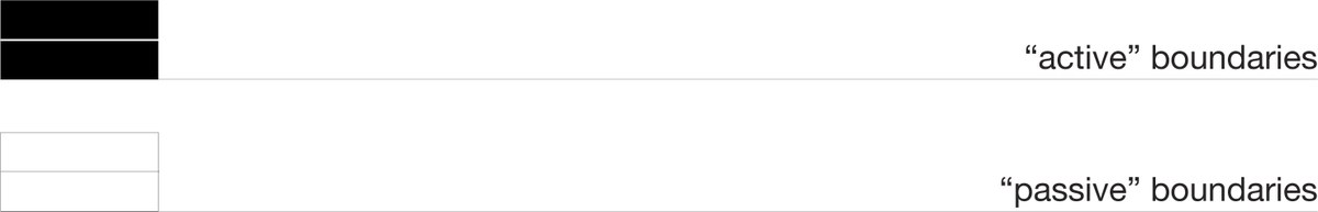
With reference to the architectonic formation of space, „active“ boundaries, i.e. walls, are substantially responsible for the appearance of interior spaces. Passive boundaries, i.e. markings, profiles or parcells, do not participate „actively“ in the formation of architectural space and instead possess structural features.
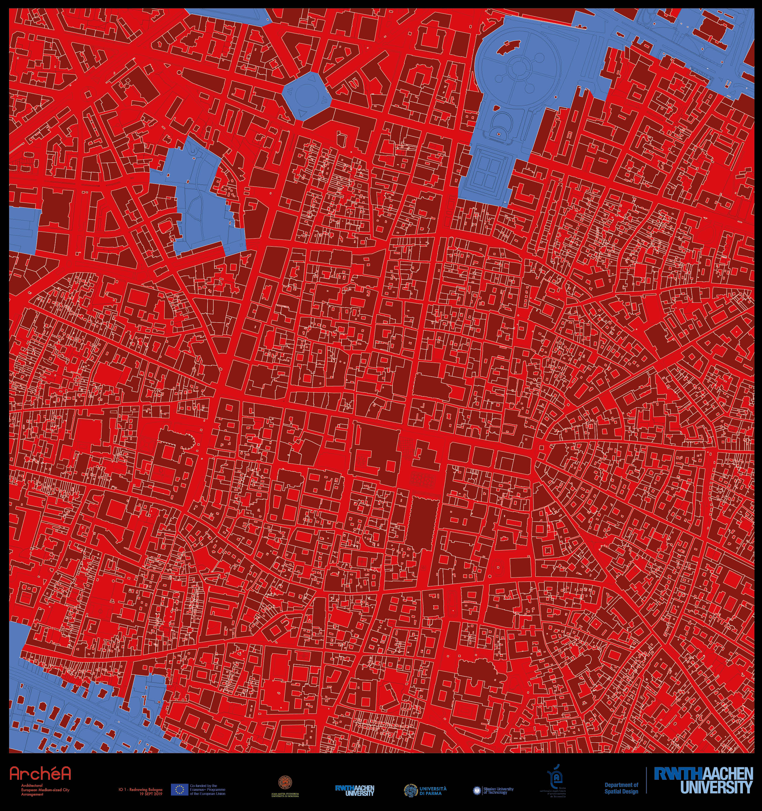
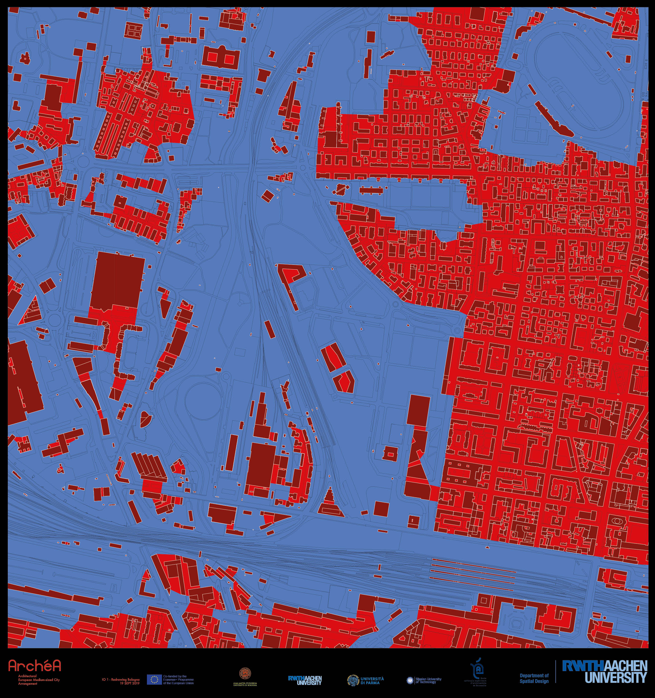
Panel II. Historic City Center / Panel III. Northern Extension
Scale 1 : 10.000
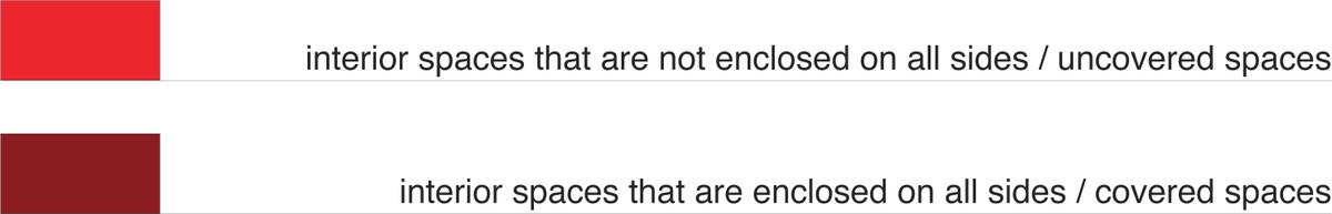
Essentially, red refers to interior spaces. Wherever there is a distinction between dark and light red, this refers to the magnitude of the enclosure of the interior spaces. Dark red interior spaces are enclosed on all sides, i.e. rooms. Interior spaces that are not enclosed on all sides, for example streets, are light red, which in this case refers in particular to the circumstance that they are uncovered.
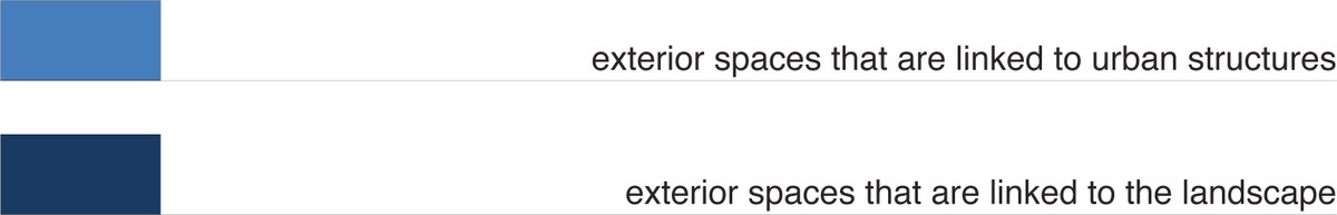
Essentially, blue refers to exterior spaces. Where there is a distinction between dark and light blue, this refers to the linkages of the exterior spaces. Dark blue outer spaces are linked to the landscape, light blue outer spaces instead to urban structures.
The aim of the investigation is to define and to depict the spatial qualities of both architecture and city. Disregarded to begin with are the differentiated atmospheric qualities of individual spaces - those influenced for example by trees in streets and their seasonal forms of appearance - in favor of those effects of interior and exterior spatiality that have an impact on the beholder exclusively through architecture. The proximity and distance of urban blocks, buildings, walls, ceilings, roofs, reveals, thresholds, and lintels form the proportional and scalar fundament of the examination.
With the graduated scale of the mapping, the red-blue plan calls attention to the spatial relationship between architecture and the city. By displaying topological and typological essentials analytically, it also supplies possible preconditions for the design process and for the design.