2019 Survey Season (First campaign)
Field work took place between the 06/19 and the 07/27. The operative base of the mission was hosted in the innher part of the city of S. Foca (the dwelling has allowed us to spare the costs of allocations, that are particularly high during the summer months due to turistic activities) where two groups of 6 students (divided into two shifts) have lived with dott. Spagnolo and myself. Due to the experimental nature of the registration metodologies adopted by the project, dott. Wieke de Neef from Ghent University, specialized in GIS, has followed the work progress in real time interacting directly with the team on the field. To complete the research, regarding to the ethnografic part of the project, my field work has been assisted by an antrhopologist from Tirana, mrs. Arba Bekteshi.
The surveyed areas covered about 980 units with variable dimension, between 20x20 and the dimensions of a whole field (case of manufactures findings). The preliminary work on materials, conducted during the survey, has allowed us to gather, wash and catalogue in a preliminary stati almost 2500 manufactured items of different varieties and different chronologies, from Epigravettian period to the first half of the past century.
Thanks to the Photogrammetric survey have been identified and revealed both the rest of a small cave system used in medieval/post medieval times and a probable rock-out chamber tomb attributed to the Bronze Age (closely connected to one of the megalithic monuments in Melendugno’s territory).
It’s also noteworthy the discovery of a quite large site attributed to medieval times, and the tempering of a prehistorical site previously unknown, findings that are going to be the object of research of the next campaigns.
Beyond the specific findings, field work has allowed us to deepen the knowledge of the territory by increasing the capacity of predicament for the areas mostly subjected to erosion and the areas in which the extensive use of mechanical agricultural practices has deeply impacted the archeological record, leaving almost no remains. Such a loss has on the other end has benefitted the general rhythm of the work, allowing us to cover a much larger area. Overall the land-strip close to the Tamari basin resulted to be the most densely occupied whilst the inner plateau for the moment seems to be hardly occupied or hardly damaged by erosion.
Landscape Archaeology:
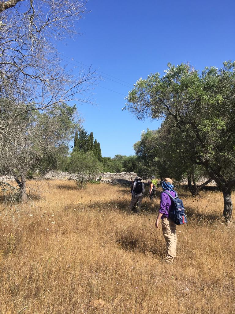
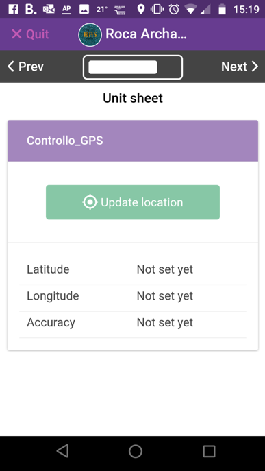
In the initial phase of the project surely the survey has been the aspect of research that has taken the most amount of time workwise. The workflow on the field was greatly facilitated using technical digital supports for the registration of data, relatively to both visibility of field and the quantification of the founded artifacts. The work has been divided into two teams, one led by myself and the other led by my partner, dott. Spagnolo. The data-collection phase has been handled through a cloud synchronized database so that every member of the expedition could reach the data using their cellphone. The spatial cartographical data were inserted directly on the field through a topographical application by the two team’s supervisors.
During the planning stage thre areas were identified, from the Bronze Age site of Rocavecchia to the inner part of the land, specifically the first one was delimited by the Protostoric lagoon, the second area was near the mostly noticeable drop of height and the last area over the most recognizable limestone plains.
As initially planned, the tree investigated areas were championed differently based on their distance from the main site, with a 60% coverage for the first site (nearest to the coast), and a 20% coverage for the inner zones. Lower samplings (scouts being distance more than 10m from one another) have been set aside for now, due to immediate comparability of the quantity of materials founded. A considerable amount of surveyor's units, located as distant as possible from each other, have been investigated in order to obtain a first comprehensive overview of the landscape.
GIS support first campaign
Wieke De Neef, Vincenzo Spagnolo
Ethnography
Arba Bekteshi
Team and collaborators for first campaign
Francesca Barchiesi, Lorenzo Bonazzi, Zoe Ceccato, Simone Favaron, Panagiotis Kaplanis, Camilla Marraccini, Lavinia Mascialino, Virginia Pati, Manuela Pileri, Giovanna Pisciottano, Guido Romano, Alessandra Salvin
